
October 11, 2023
Minneapolis is known as the “City of Lakes,” thirteen of which are at least five acres in size, with the largest, Bde Maka Ska, being 421 acres. Some of you may remember this lake as Lake Calhoun, which was the name given it in the early 1800s, but the original name was reinstated in 2018. If you are in the neighborhood, and love to read, pay a visit to Birchbark Books. This neighborhood book store is owned by Minnesota author Louise Erdrich. Pick up an autographed book, maybe “The Sentence,” set mostly in a bookstore that looks a lot like this one.


This area was originally occupied by the Dakota Sioux. French explorers arrived in 1680, followed by more European-Americans. After the Louisiana Purchase, the US Army built Fort Snelling, located at the confluence of the Mississippi and Minnesota Rivers. More settlers followed, displacing most of the original peoples. In 1852, the name Minneapolis was proposed for the city, combining the Dakota word for water (mni) with the Greek word for city (polis.) The city was incorporated in 1867.
Minneapolis’ location on the Mississippi made it a good home for milling operations, which harnessed the river’s energy to power their mills. At one time, Minneapolis produced over 20% of the nation’s flour. There were more than twenty flour mills at one time, the largest of which were the Washburn-Crosby Company (part of the future General Mills), the Pillsbury Company, and the Northwestern Consolidated Milling Company. In 1880, Washburn-Crosby’s flour won a gold medal at the first Millers International Exhibit in Cincinnati, Ohio. Their Superlative Flour brand was renamed Gold Medal. Remains of some of the old mills can still be seen on the river banks in downtown Minneapolis, near the Mill Ruins Park.
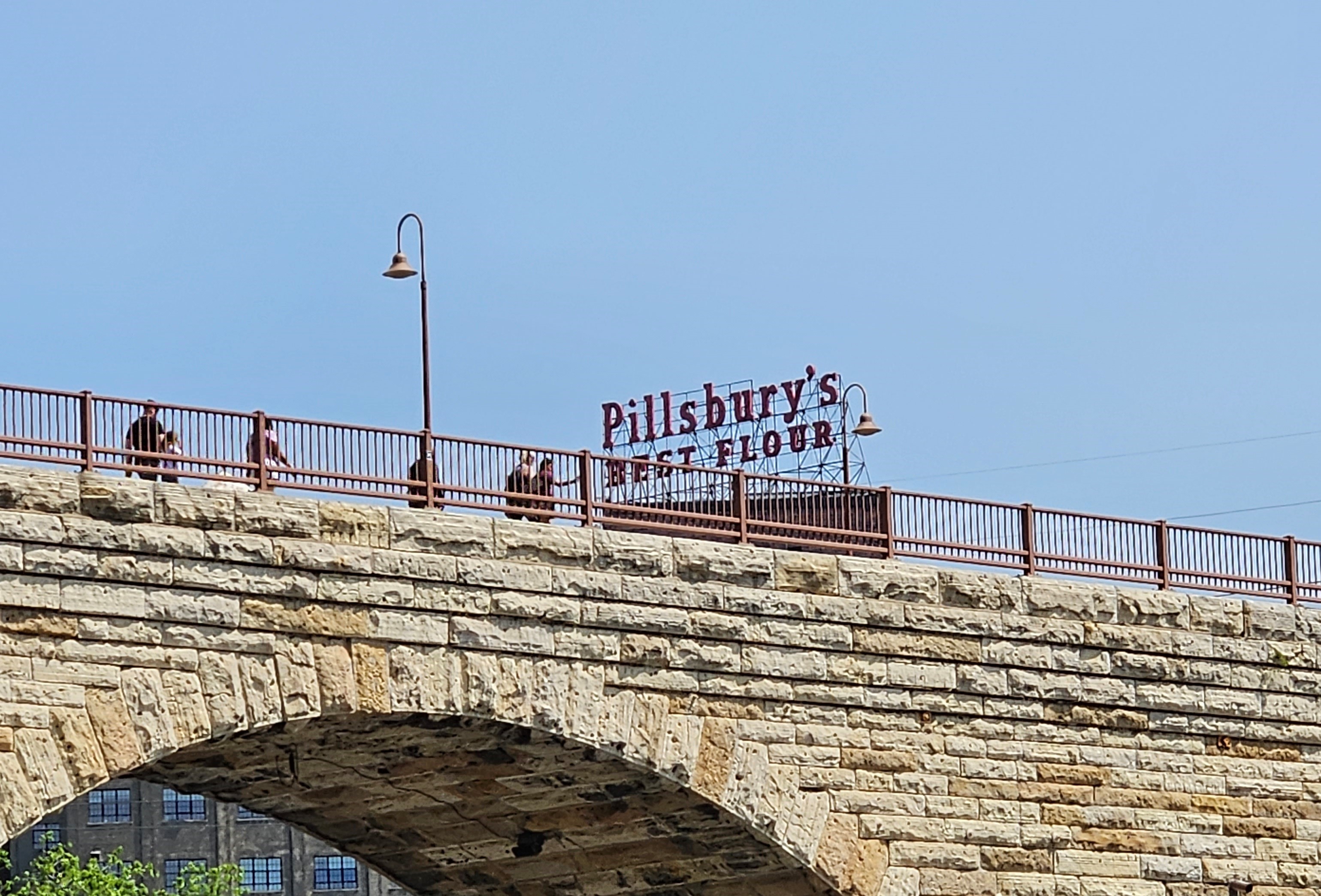


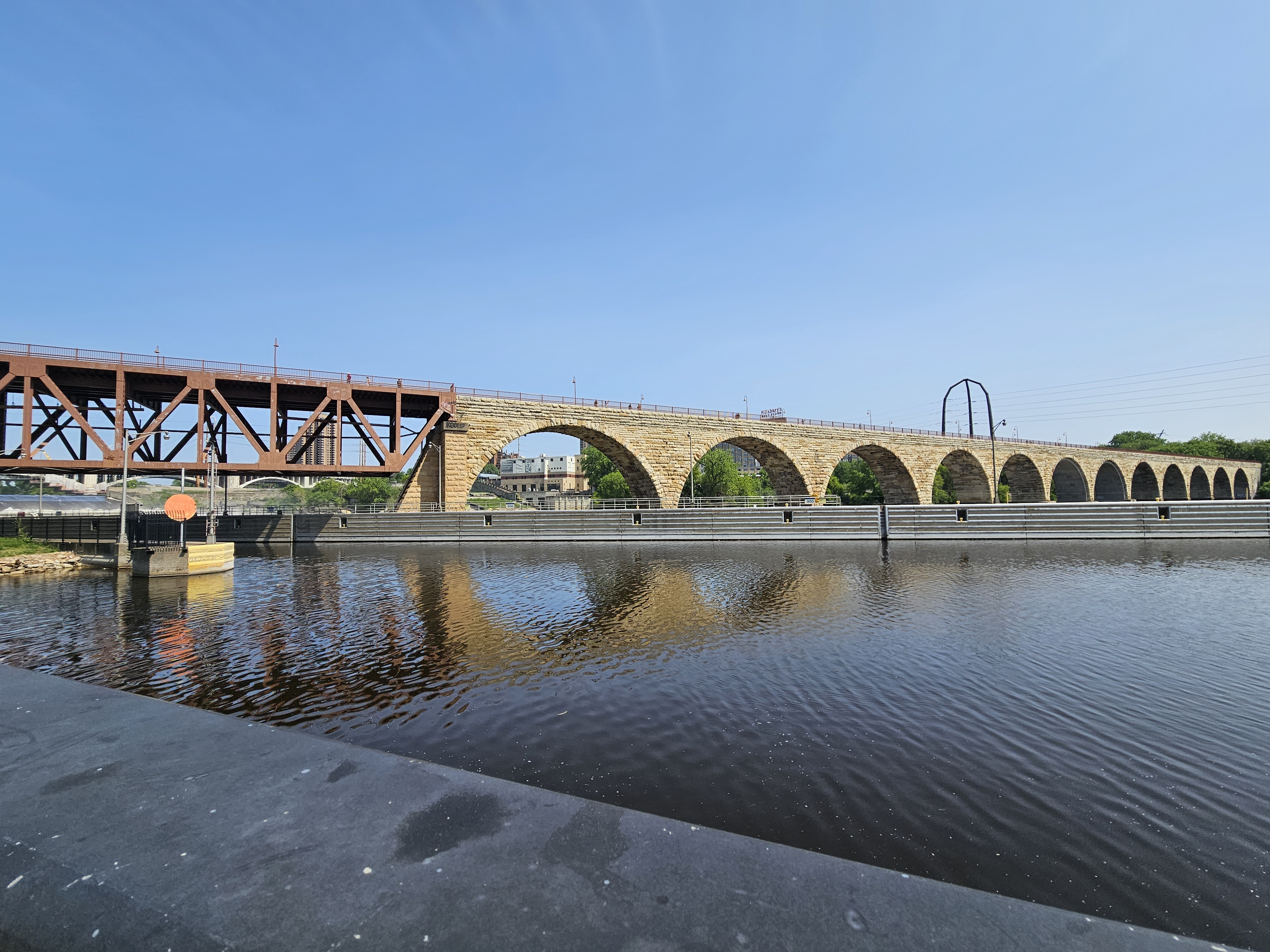
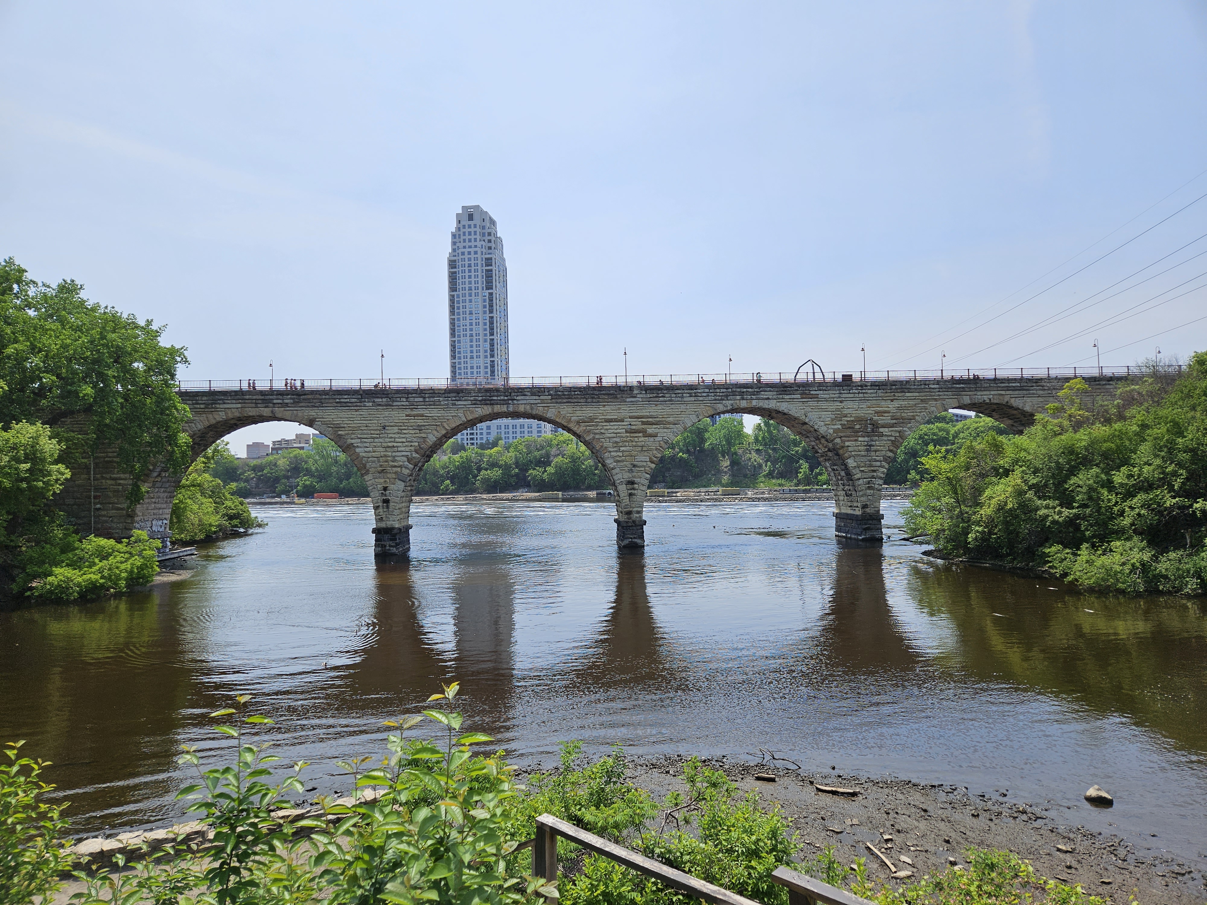
Cross the Stone Arch Bridge to St. Anthony Falls, and you quickly escape the urban landscape of downtown Minneapolis. The James J. Hill Stone Arch Bridge was built between 1881 and 1883, as a railway bridge. It served that function for almost a century, when it was converted to pedestrian use on the St. Anthony Falls Historic District. It was designated a National Historic Engineering Landmark.

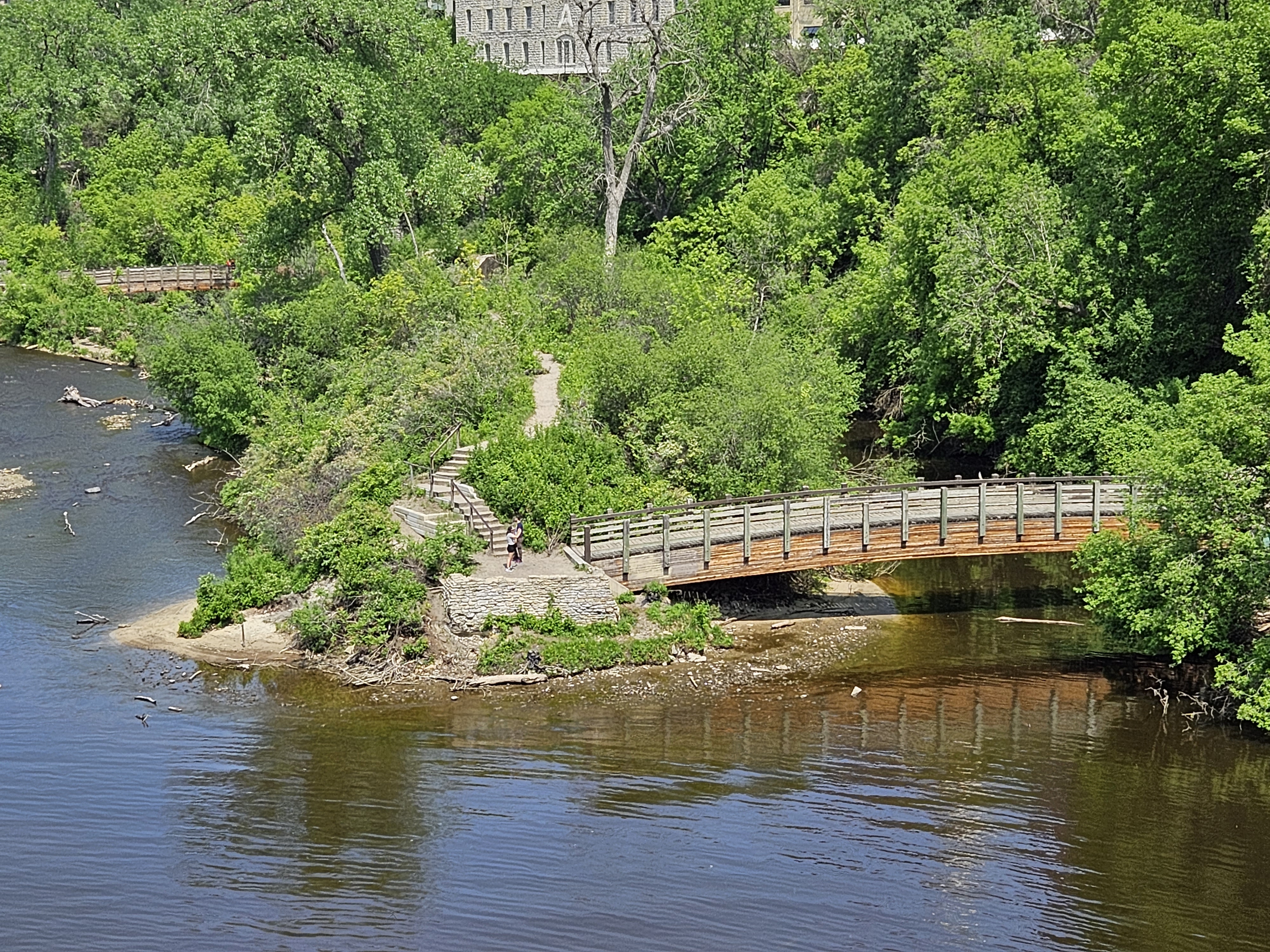
On the St. Anthony Falls site, you can take a trail down to the water, and get a good views of the falls and Minneapolis. We returned to the top, and continued to Nicollet Island, home of the Nicolet Island Inn and DeLaSalle High School.


The northermost lock in the Mississippi Lock and Dam system is located at Upper Saint Anthony Falls. It is currently closed to prevent the spread of Asian Carp. There is another one at the Lower Falls, with a drop of 49 feet. Built in 1917, Lock and Dam Number One is located just north of Fort Snelling, and drops about 25 feet. Also known as the Ford Dam, there is a powerhouse that was once owned by Ford Motor Company, which fed electricity to its assembly plant that operated from 1925 to 2011.
St. Paul was named the capital of the Minnesota Territory, which was formed in 1849. When the territory applied for statehood, there was a push to move the capital to St. Peter, about 75 miles southwest. The territorial legislature had actually voted to move the capital to St. Peter, but one of the legislators, Joe Rolette, stole the text of the bill, thus preventing the move. I guess politics has always been dirty.
In 1819, the US Army built a fort at the confluence of the St. Croix and Mississippi rivers – Fort Snelling. Less than 20 years later, the 1837 Treaty with the Sioux ceded all tribal lands east of the Mississippi to the US government. With the added security, settlers moved into the area, establishing a community known as Pig’s Eye, named for a bootlegger, “Pig’s Eye” Parrant. Missionaries followed the settlers, and built a chapel on a bluff downriver from the fort. This chapel was named for St. Paul. Before long, Pig’s Eye became known as St. Paul.
St. Paul’s location at the confluence of two rivers was prime for riverboat traffic, especially steamboats. It was the last good point to land when coming upriver. With all of this river traffic, lighthouses were important for navigation. In 1885, at the age of 23, Jane Muckle Robinson, living in St. Paul with her husband and family, was in need of work. She was hired by the Department of Commerce and Labor as a light keeper. She kept lights going on four river channels from Dayton’s Bluff to the St. Paul stockyards. If a light went out, boat pilots would blow their whistles, and she would wake up, row out to the lamp, and relight the flame. She worked this job for 36 years, retiring in 1821.
Today, there is only one working lighthouse on the Mississippi, located in Lake City, Minnesota, about 60 mile southeast of St. Paul. We should pass by after we board our ship in Red Wing tomorrow.
