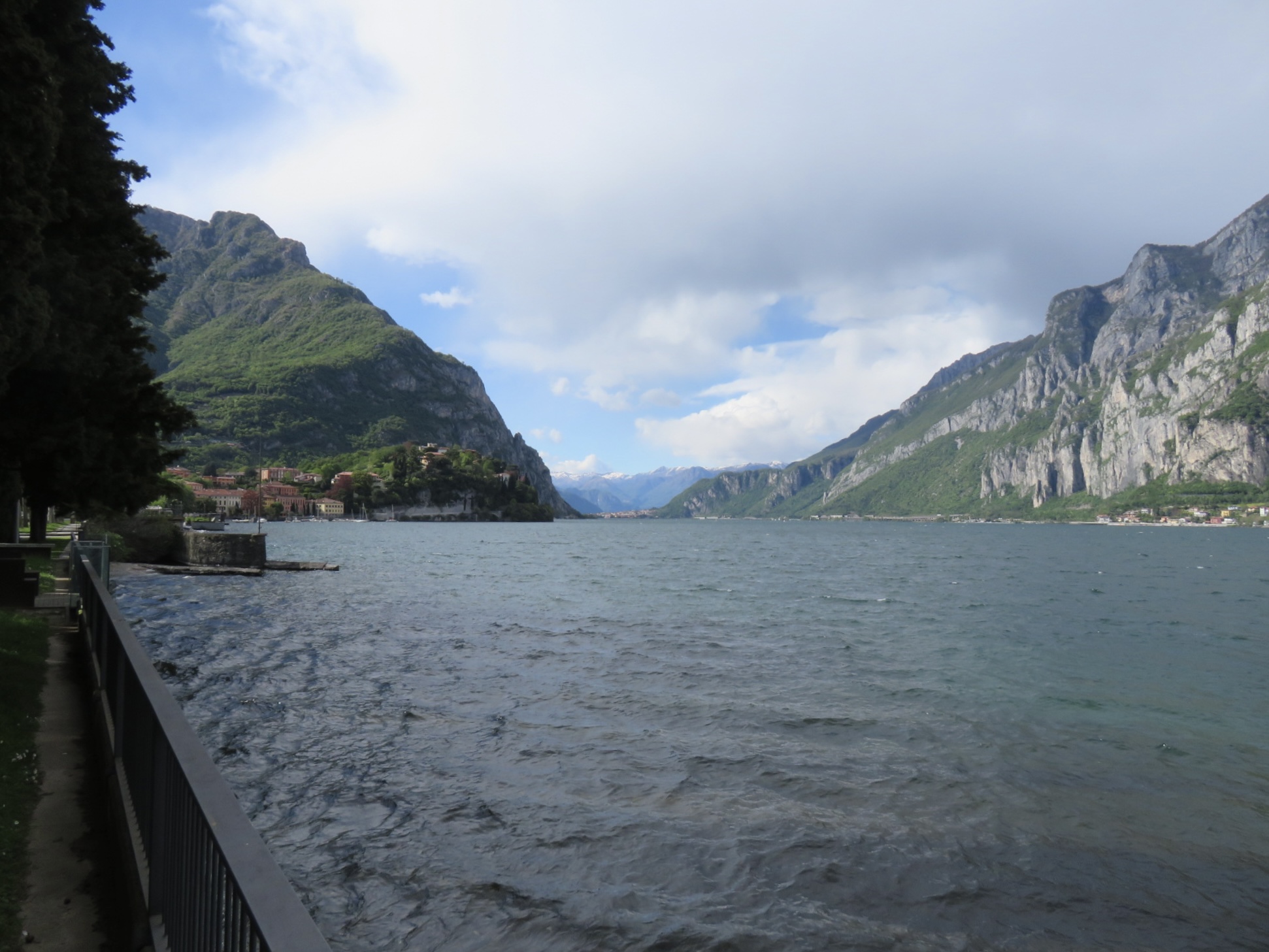
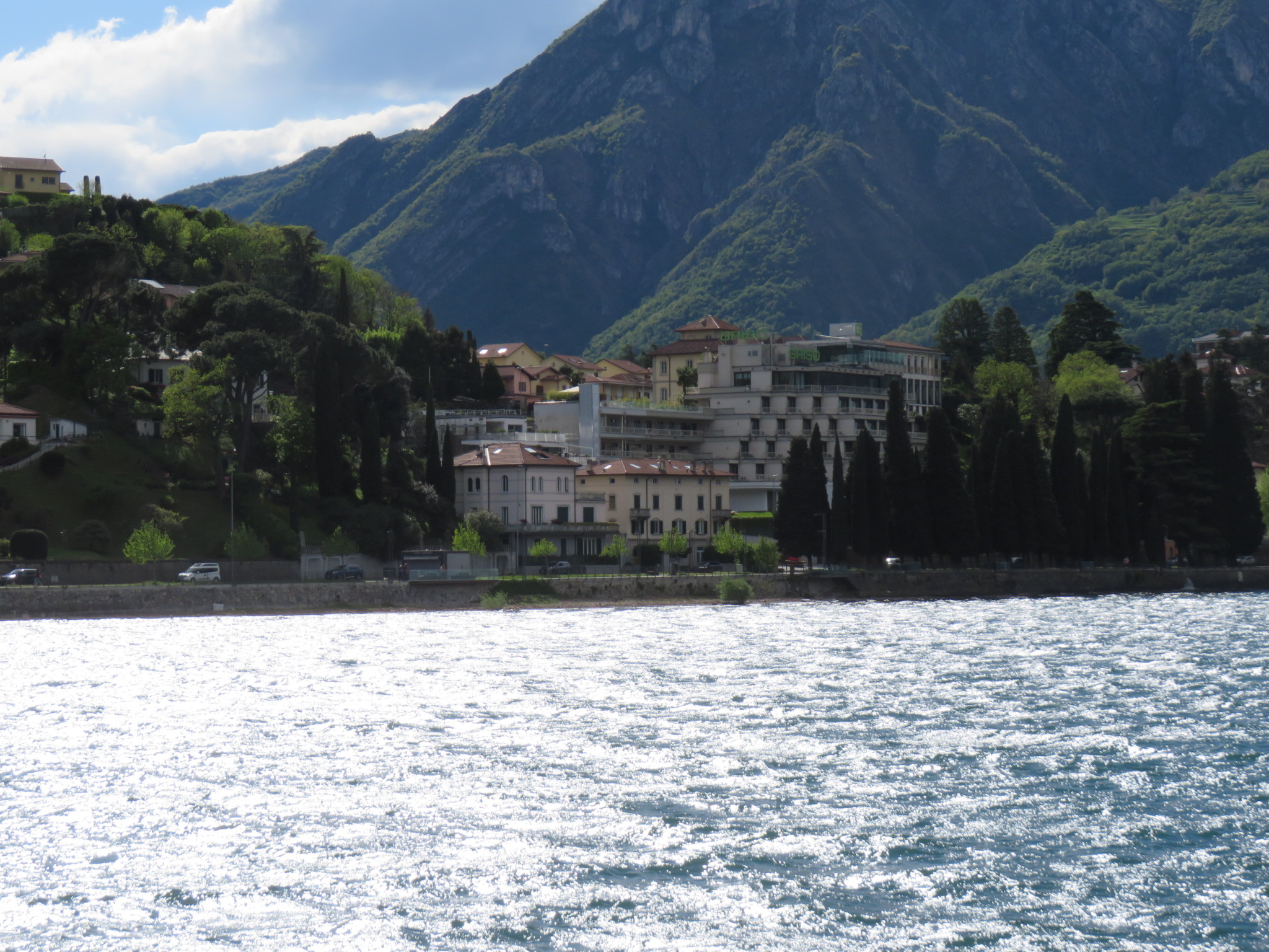
We left Minneapolis late yesterday, and arrived in Milan around noon today. From there, an hour long bus ride took us to Malgrate, on Lake Como, where we will stay for two nights, as part of a pre-cruise package with Viking Cruises. The original plan was to stay in Como itself, but the hotels were overbooked due to other events taking place at this time. That was a disappointment, but Malgrate was a lovely place to stay.
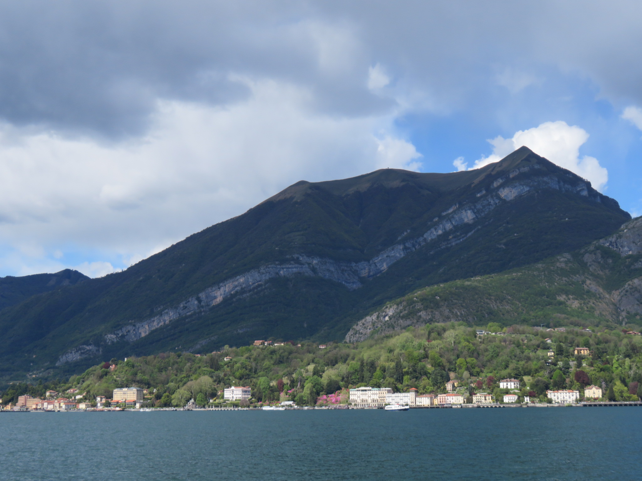
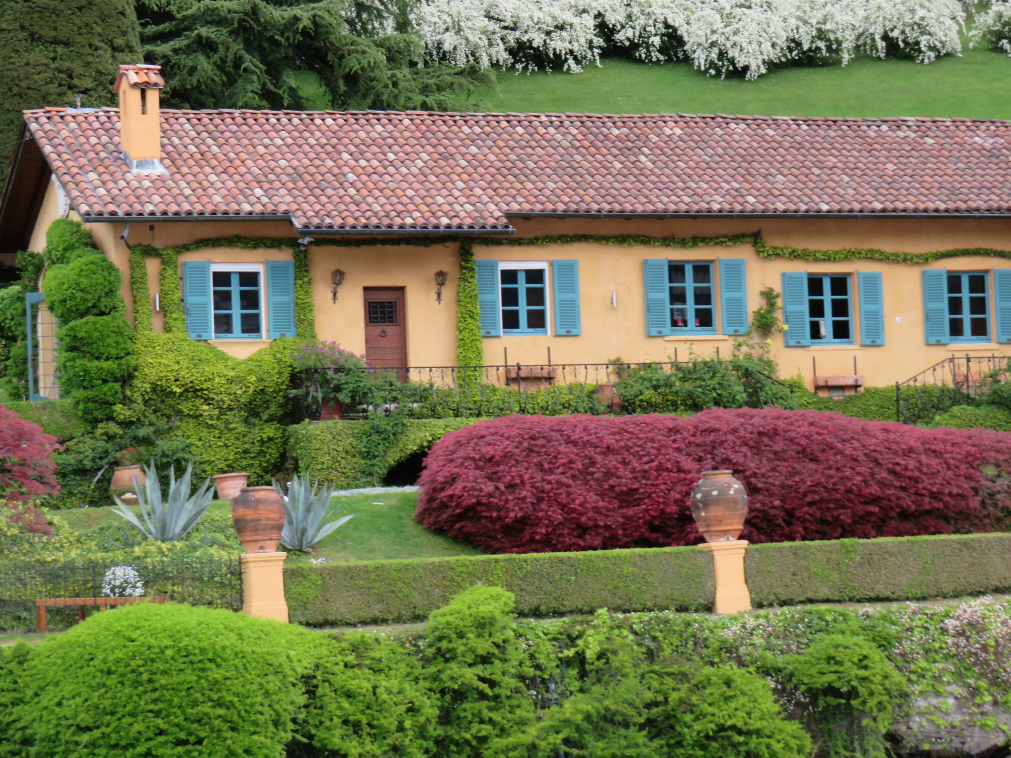
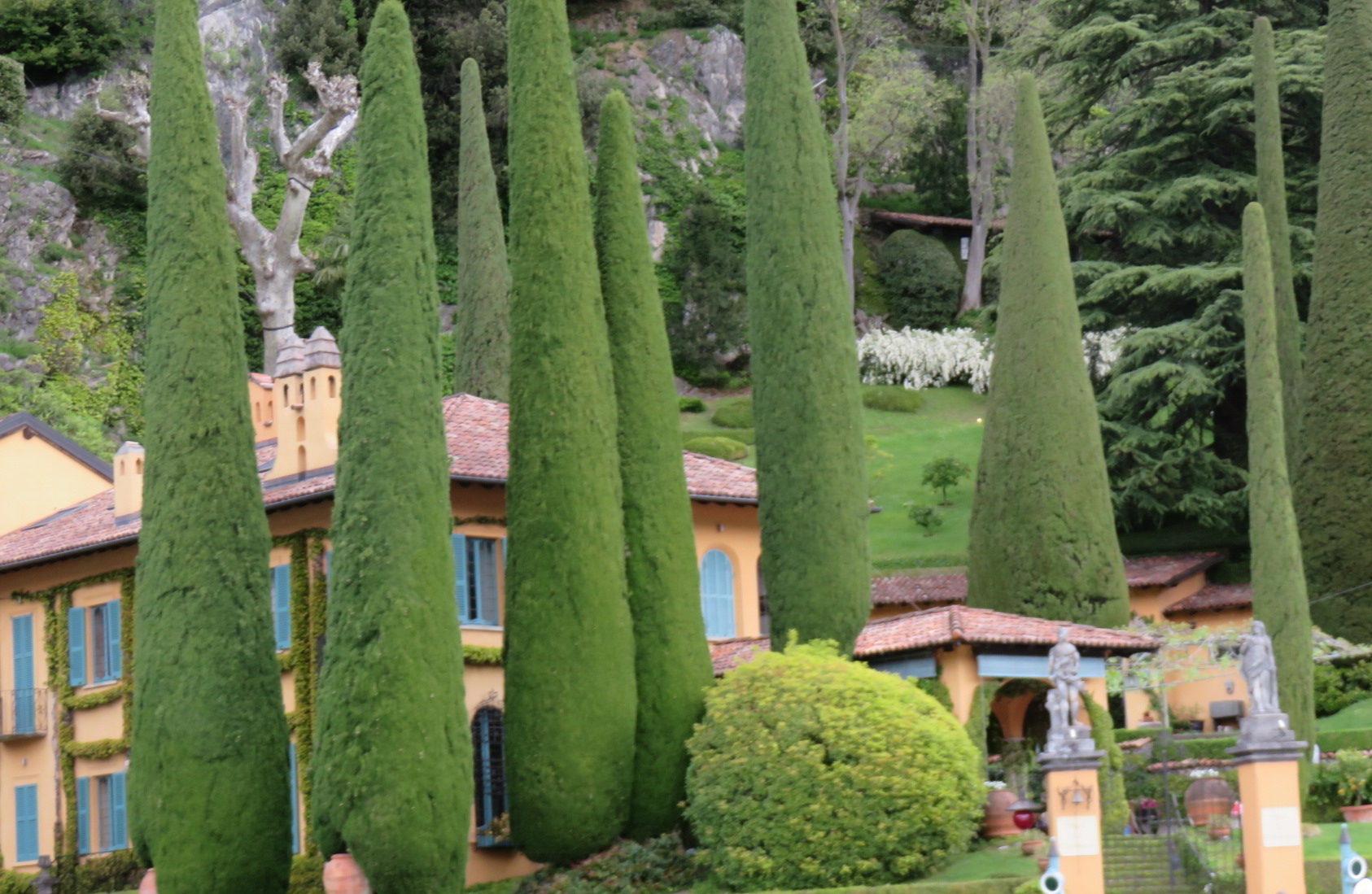
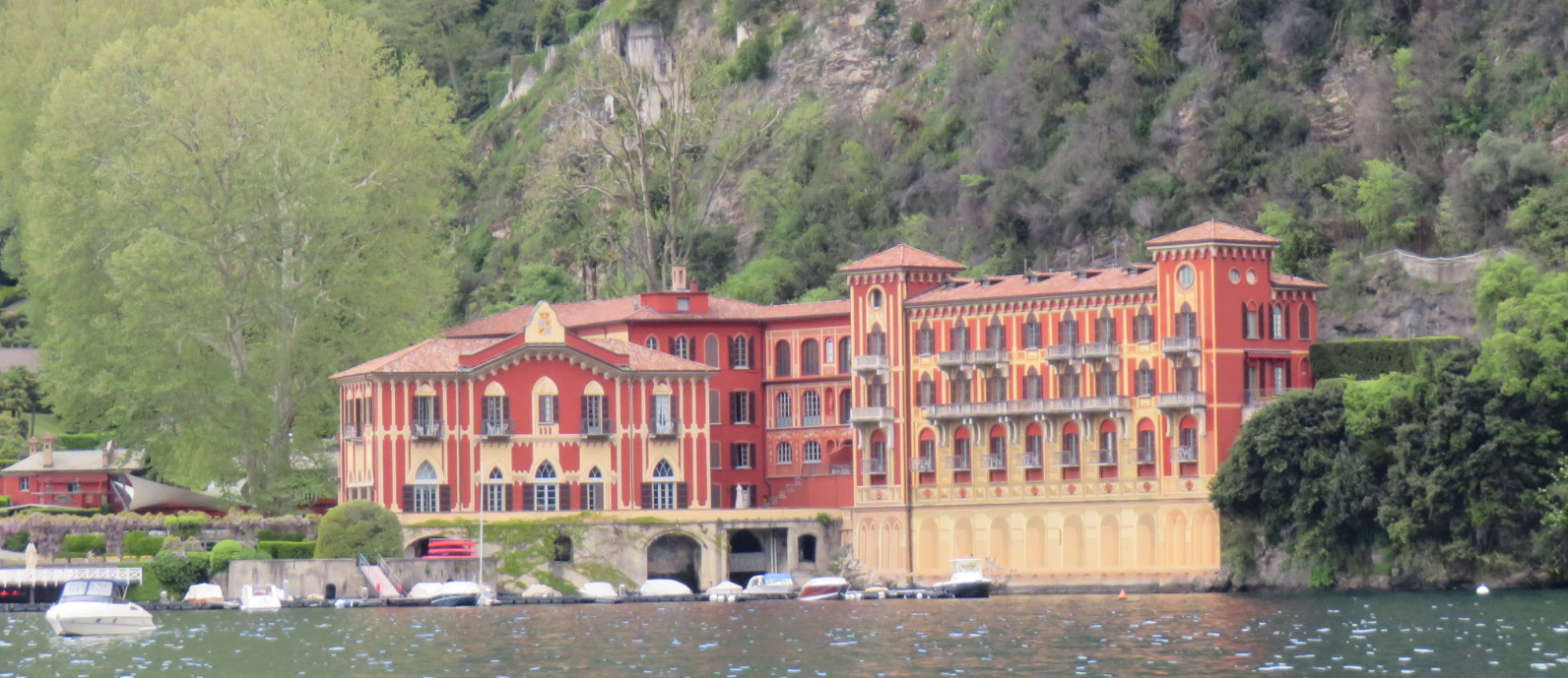
Lake Como, or Lago di Como, is shaped like an upside-down “Y”. Malgrate is located at the southeastern fork of that “Y.” This side of the lake is actually Lake Lario, the other side is Lake Como. Lake Como is the third largest lake in Italy, with an area of 56 square miles. While that may not seem large to us Minnesotans, our Minnesota lakes are not surrounded by mountains, which gives this one an edge. The area has been popular with tourists for centuries. The shore is lined with magnificent villas and palaces.
Our hotel, the Hotel Promessi Sposi is named for a beloved 1827 Italian novel by Alessandro Manzoni – “I Promessi Sposi,” or “The Betrothed.” The novel is supposedly the most famous and widely read novel in the Italian language.
Thursday, April 18
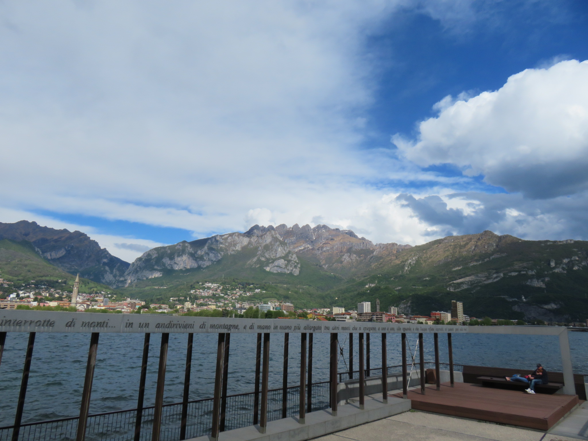
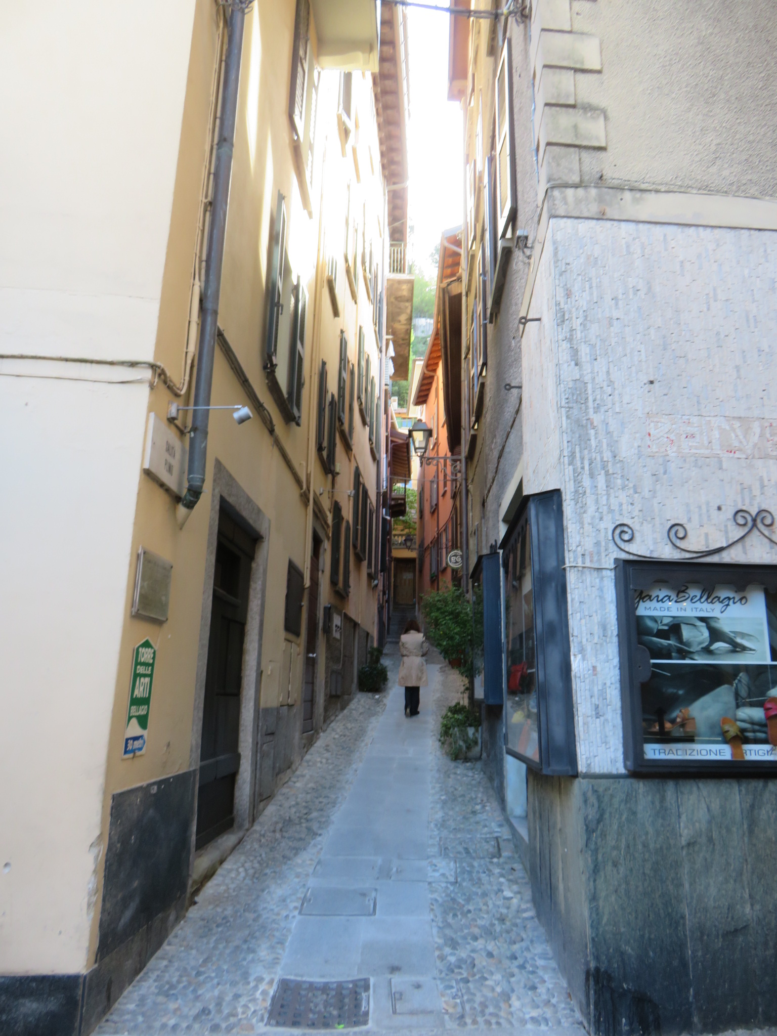
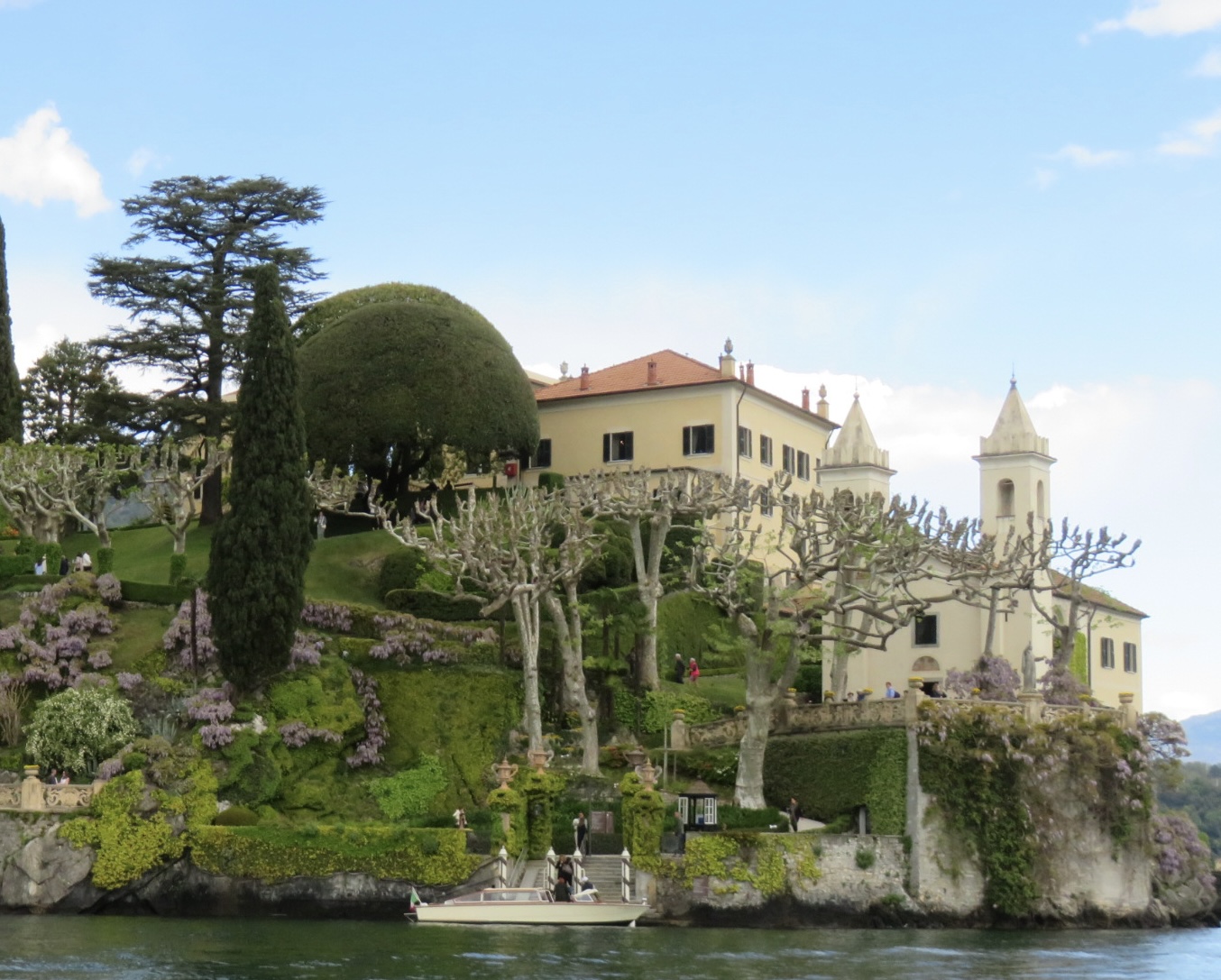
We took a private boat tour this morning, stopping first in Bellagio, which is nestled in the crook of the lake’s “Y”. Lake Como was formed by glacial activity during the Pleistocene Era. The glaciers carved the lake around Mount St. Primo, resulting in the “Y” shape we see today.
The earliest signs of habitation in Bellagio date to 30,000 years ago, though little is known about the peoples who lived here then. Insubres (a Celtic tribe) and Gauls occupied the area when Romans arrived in 225 BC, and conquered them. The Romans established a garrison, and the soldiers were joined by colonists about 150 years later. These colonists introduced Mediterranean crops, such as olives, chestnut, bay laurel, and many other plants.
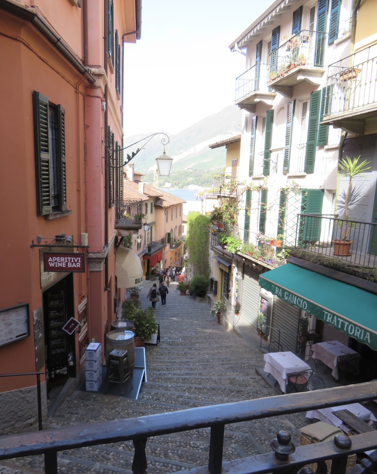
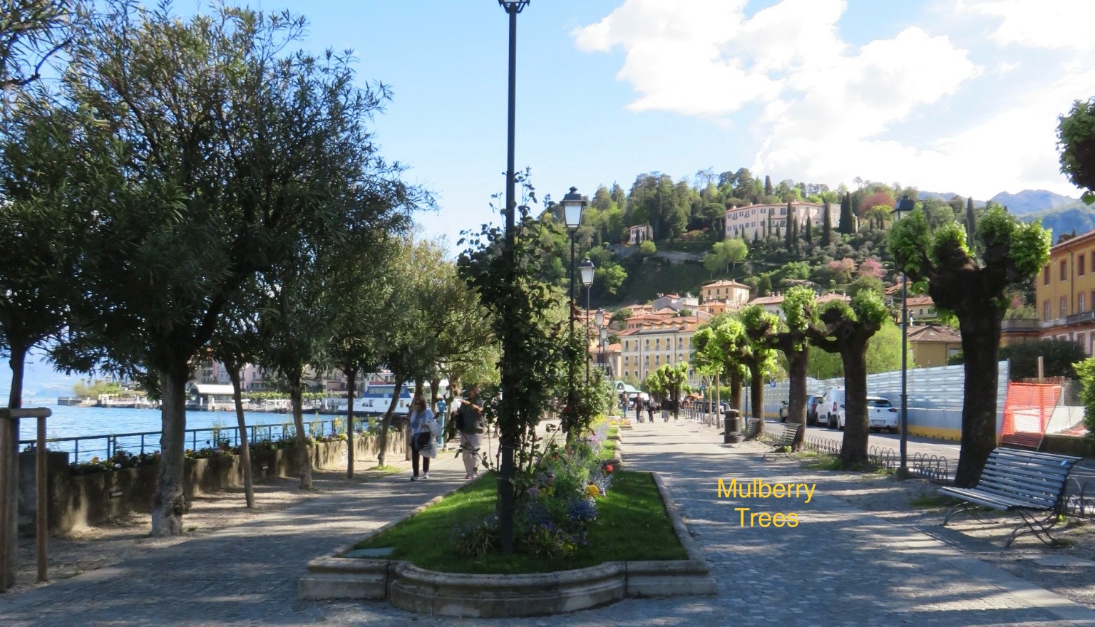
Called the “Pearl of Lake Como,” Bellagio is famed for its olive oil and silk. Around 1400 AD, the Duke of Milan imported mulberry trees from Asia. Silkworms feed on the leaves of these trees. Soon, silk was being produced, and it became a major part of the local economy. A school to train “silk masters” was even built here. Several shops in Bellagio sell hand made silk scarves, shawls, ties, and more, making for some great shopping opportunities for me.
Mulberry trees line walkways in the downtown area of Bellagio. Each year, they are pruned way back, so they will produce many leaves in the following spring. Right now, there are just beginning to leaf out again.
After leaving Bellagio, we sailed on to Como, passing several beautiful villas on the way, including the one owned by actor George Clooney in the Village of Lario. Clooney purchased one villa about 20 years ago, and has added four more since then, all along the lake. We stopped for a few minutes to “ooh and ahh,” and take photos. The Clooneys spend their summers there, and are said to be well-liked by the villagers.
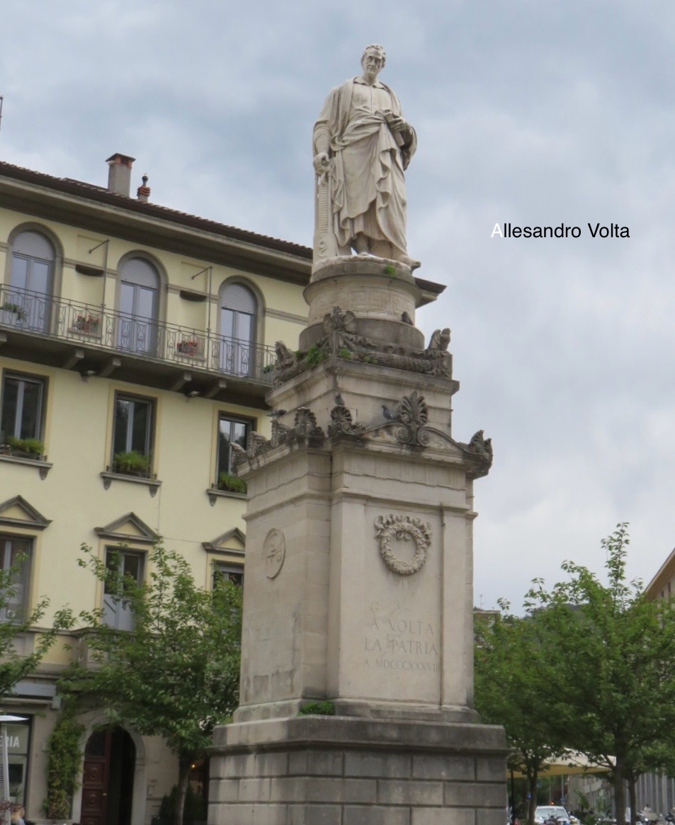
While in Como, we enjoyed a lunch of prosecco and bruschetta – this is the life! After that, we had a guided tour of the old part of Como. There is a statue of Allesandro Volta, the Italian physicist and inventor of the battery, who was born in Como in 1745, and died there in 1827.
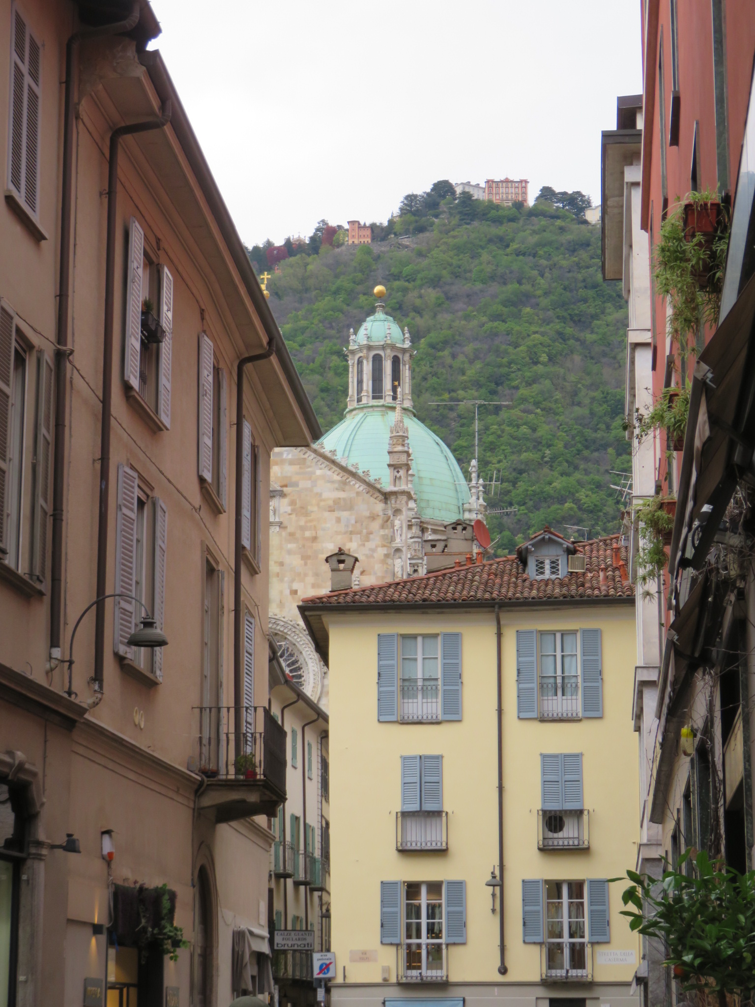
Como is a beautiful town, and we do wish we could have spent more time here. Perhaps we will return some day.
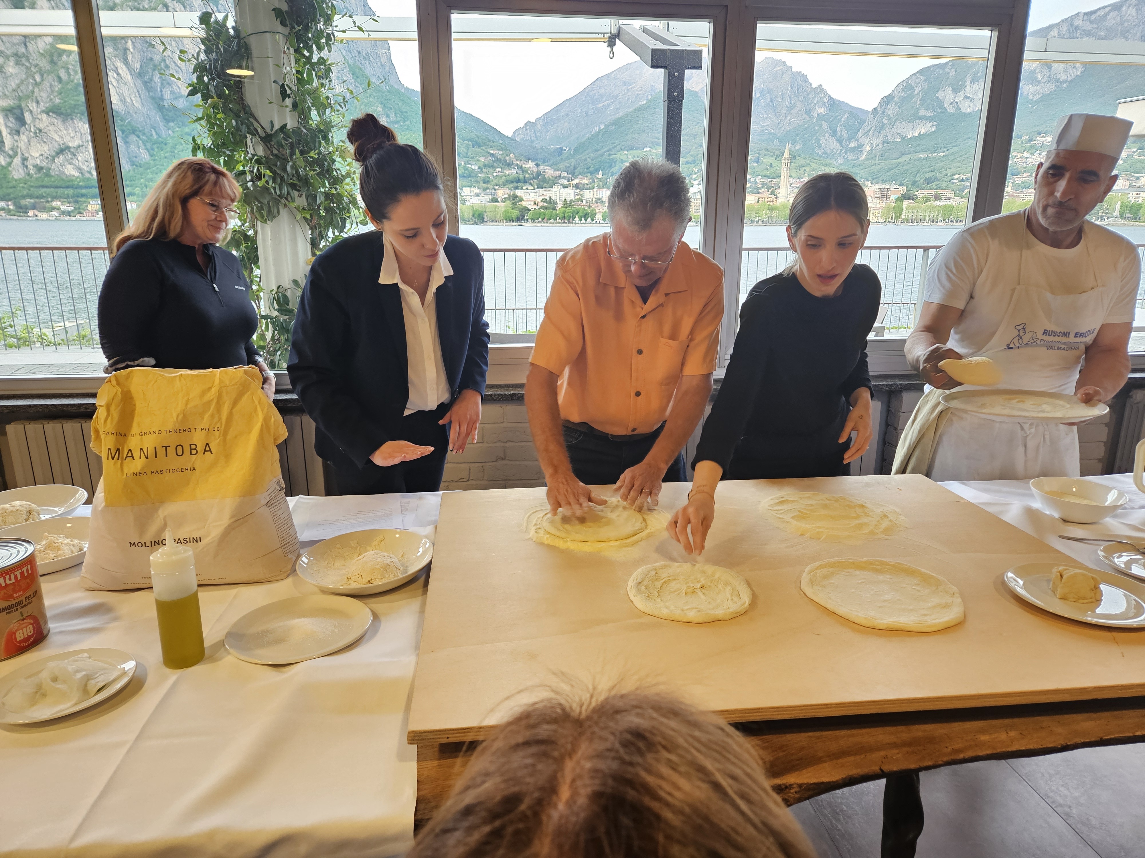
We took a cooking class this evening, then enjoyed the meal we prepared – six different types of pizza – delicious but way more than we could eat. Various members of the group were called upon to work on making the dough and adding the ingredients, including Mark. It was a delightful evening.
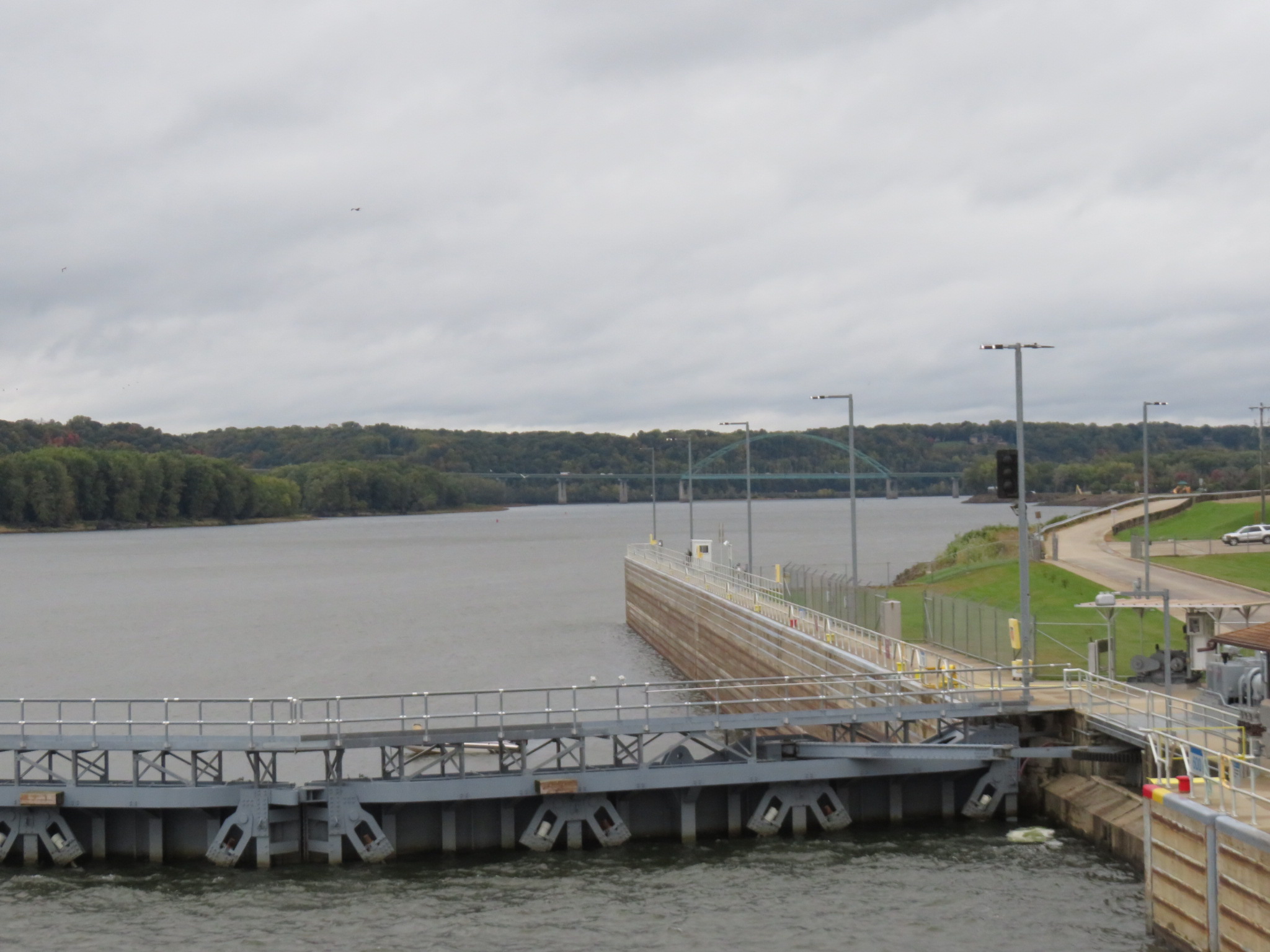
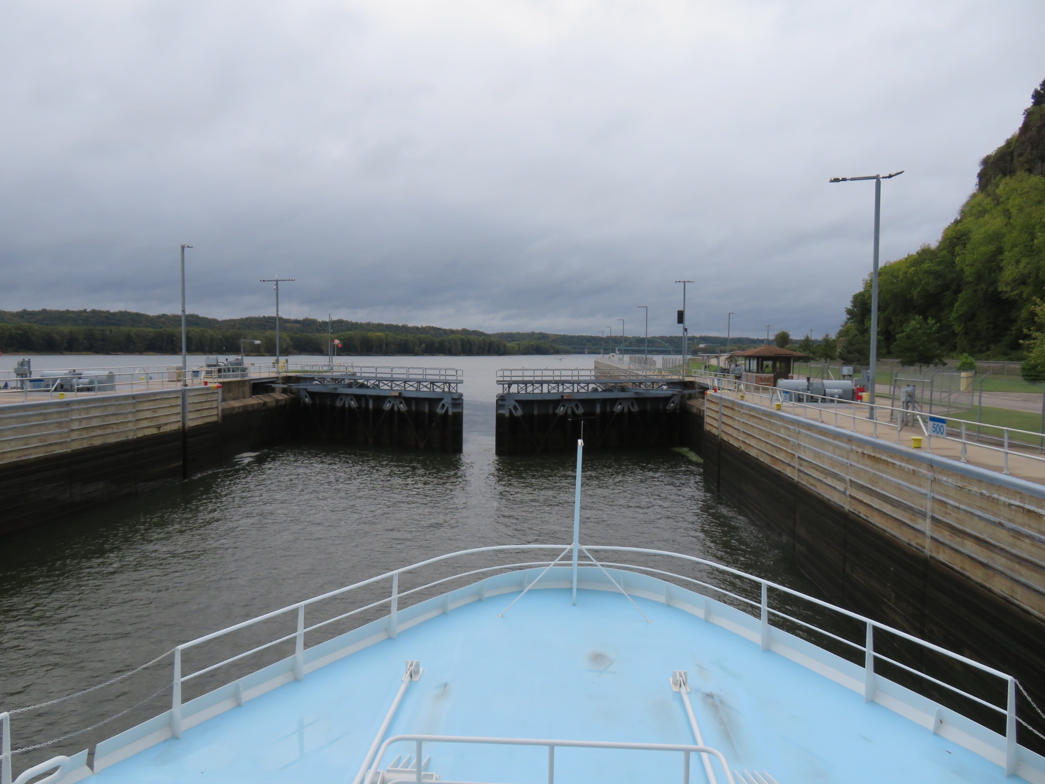
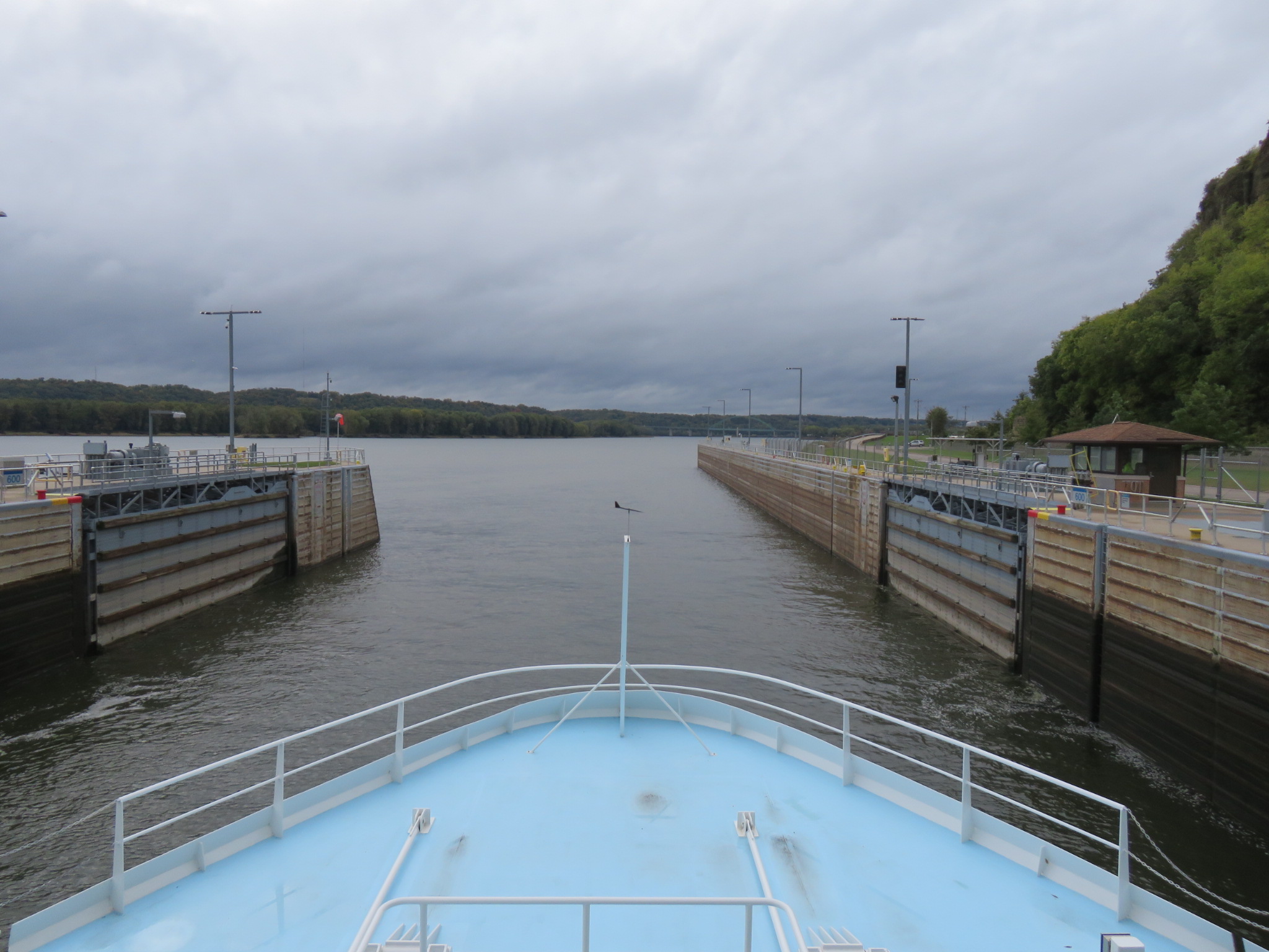
We passed through three locks on our way to the Quad Cities: Lock and Dam Number 12 near Bellevue, Iowa, with a drop of about eleven foot; Number 13 is at Fulton, Illinois, dropping us another eleven feet or so; and Number 14 at LeClaire, Iowa, with yet another eleven foot drop. LeClaire’s main claim to fame is that Buffalo Bill Cody was born here. That seems to be the extent of his connection, as his family moved to Canada when he was still an infant.
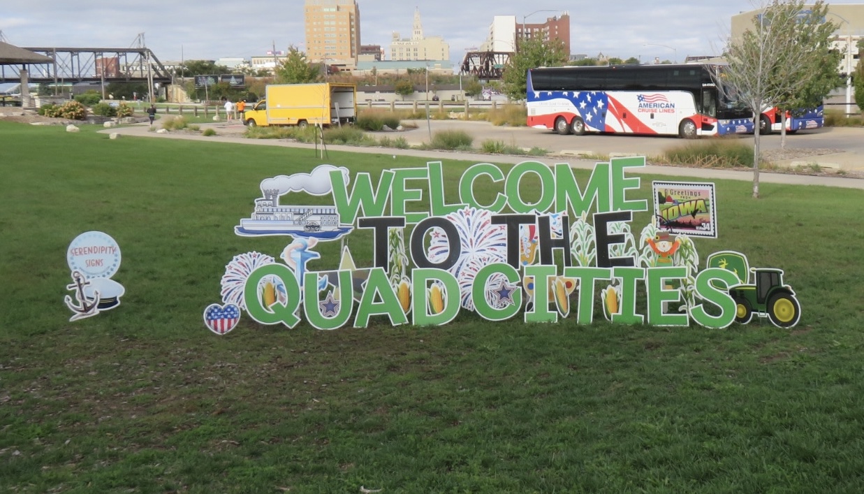
Wouldn’t you think that an area called “Quad Cities” would be comprised of four cities?According to Merriam-Webster, the meaning of quad is: “having or composed of four items or elements.” I guess every rule has an exception. The Quad Cities include two cities in Iowa (Davenport and Bettendorf) and three in Illinois (Moline, Rock Island and East Moline.)
Riverboat traffic contributed to the settlement of this section of the Mississippi River, with three cities enjoying initial growth. After the Civil War, the cities of Davenport, Rock Island and Moline began calling themselves the “Tri-Cities.” As East Moline grew, it was added to what would be called the Quad Cities. Bettendorf was added some years later, and the community discussed changing the name to “Quint Cities,” but that name didn’t catch on, so it remains Quad Cities to this day. Perhaps it simply rolled off the tongue more easily than did Quint Cities.
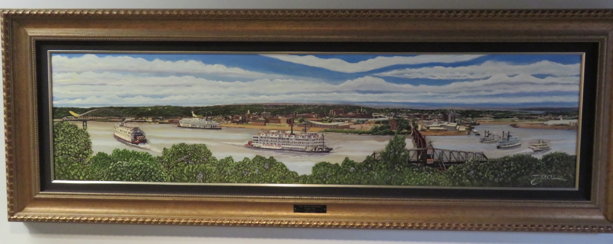
The Quad Cities are located where the Rock River meets the Mississippi. We are no longer in the Driftless Area. Retreating glaciers dumps tons of soil here, and we see many signs of the agricultural richness of both Iowa and Illinois.
Davenport, Iowa, incorporated in 1839, is the largest of the Quad Cities. Following the Black Hawk War, the defeated Native tribes were forced to sell the land Davenport now occupies to the United States.
The Sauk chief Black Hawk was born at Saukenuk, located at what is now Rock Island, Illinois. Other claims to fame include: it’s the home town of the fictional “Blues Brothers,” Jake and Elwood Blues; and the Chicago, Rock Island & Pacific Railroad was founded here in 1851.
Rock Island was also the starting point of the Grand Excursion of 1854, which celebrated the completion of the railroad from Chicago to the upper Mississippi River. Passengers took the train from Chicago to Rock Island, and about 1,200 passengers cruised upriver by steamship from there to St. Paul, MN. The boats passed through some of the widest stretches of the river, stopping at several locations on the way. The passengers were awed by the beauty of the bluffs and the vast areas of open land just begging to be settled. The Grand Excursion was replicated in 2004, 150 years later. A steam locomotive pulled a collection of historic railroad cars from Chicago to the Quad Cities, where their passengers boarded several boats to cruise to St. Paul. This excursion celebrated an extensive cleanup of the Mississippi River, which had become very polluted.
Moline, Illinois‘ biggest claim to fame is as world headquarters of Deere & Company. When you’re in town, you can visit the John Deere Pavilion, the John Deere Tractor & Engine Museum, the John Deere Historic Site as well as the World Headquarters Display. The eponymous John Deere was born in Vermont in 1804, and moved to Illinois at the age of 32 to escape bankruptcy. A blacksmith, Deere opened a shop in Grand Detour, IL. A few years later, he began fashioning a steel plow that worked better in the rich soil of the central states than wood ones did (they kept getting stuck.) He began manufacturing plows, and, in 1848, moved his business to Moline with its access to the railroad and river. In the early 1960s, the company added tractors to its line, and the rest is history. You can’t go far without seeing a John Deere in a field, on the road, even in your garage or back yard.
As the name implies, East Moline abuts the eastern boundary of Moline. It was incorporated as a village in 1903, and began growing after John Deere opened his headquarters in Moline.
Latecomer to the Quad Cities was Bettendorf, Iowa. The first modern riverboat casinos in the US were launched here in April, 1991. At that time, many states prohibited gambling on land, but allowed them on water, as long as the ship was on navigable water.
The Mississippi River has been the source of power and industry in the Quad Cities, but it has also been the source of tragedy, as occurred with the Great Flood of 2019, when the area was hit by unprecedented levels of flooding. A record was set for consecutive days at major flood stage, over 200 days. Record rains tested spillways and destroyed levees, and disrupted traffic on the river. The cost of damages in the area exceeded $2 billion. We humans work hard to control the river, and she tolerates some of our interference, but always wins in the end.
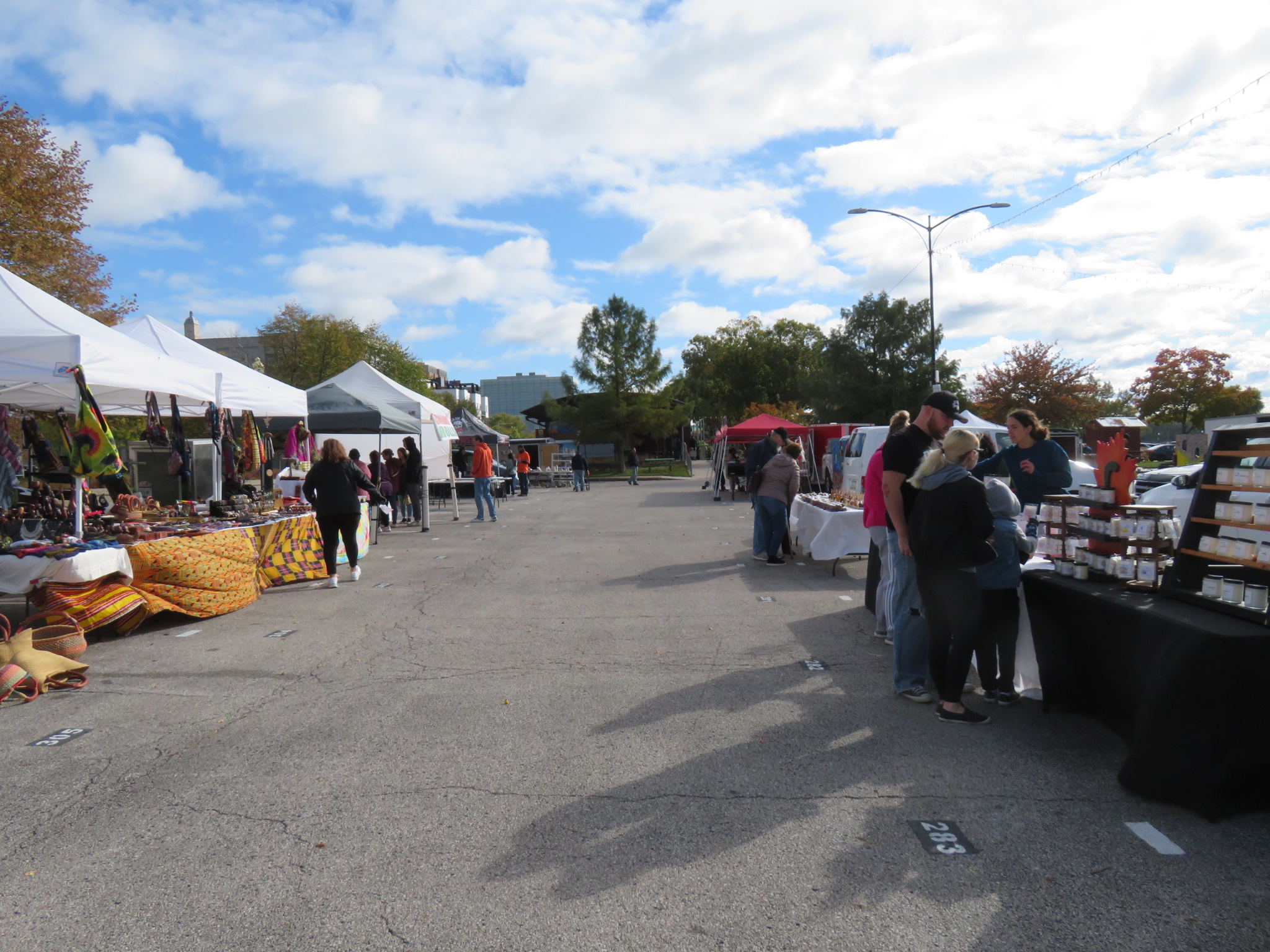
This morning, we visited the Freight House Farmers Market, a year-round farmers market located at the historic Freight House Market Place on the riverfront. Besides fruits and vegetables, we could have had our fill of pastries, jams and jellies, honey and maple syrup. Over 150 vendors from Iowa and Illinois produce products that are sold at this market.
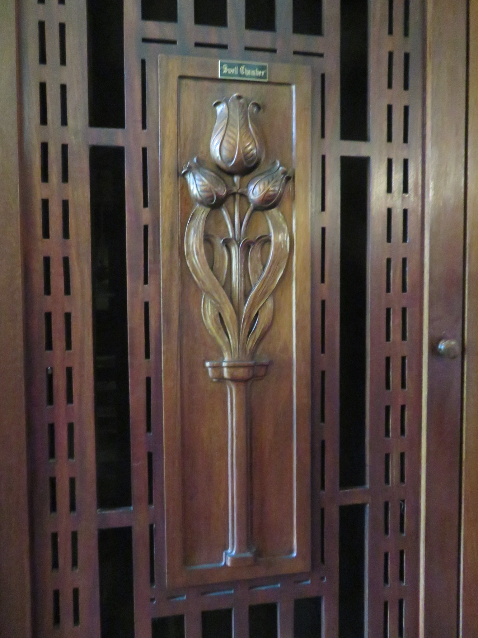
This afternoon, we visited the Hauberg Estate in Rock Island. The house was designed for Susanne Denkmann, by architect Robert C Spencer, a contemporary of Frank Lloyd Wright, in the Prairie style. Denkmann was an heiress of the Weyerhauser-Denkmann lumber business. Shortly after commissioning the house, she met her future husband – John Hauberg. The Haubergs were philanthropists, with Susanne founding the Rock Island West End Settlement and YMCA. After the Haubergs both passed, their children donated their house to the city of Rock Island as a civic and event center.
From there, we headed to the Putnam Museum & Science Center in Davenport. Mary Louisa Putnam and her husband, Charles, moved to Davenport in 1832, where Charles started his law practice. While his practice did well, their son, Duncan, was often ill. Duncan was interested in the study of insects, and to encourage this interest, Mary Louisa and Duncan joined the Davenport Academy of Natural Sciences. Mary Louisa was the first female member of the Academy, and she later became its president. She was very committed to developing natural history programs for children and adults. Mary Louisa was inducted into the Iowa Women’s Hall of Fame in 1991.
After the first railroad bridge was built in 1856 by the Chicago, Rock Island & Pacific Railroad, steamship companies worried about the threat to their business. John Hurd, owner of the steamboat “Effie Afton,” crashed it into the railroad bridge, then sued the Rock Island Railroad Company, arguing that the bridge violated the navigation rights of boat traffic. Future foes Abraham Lincoln and Jefferson Davis played roles in the legal battles. The case found its way to the Supreme Court which upheld the right to bridge navigable streams. People have as much right to cross the river as they have to travel on it. This case helped propel Lincoln onto the national stage.
Twenty-year-old Samuel Clemens (Mark Twain) was a passenger on the Effie Afton at the time of the crash. In a letter we wrote afterwards, he said “Yes, the loss of that bridge almost finished my earthly career. “ I am certainly grateful that he survived, as are book lovers around the world.
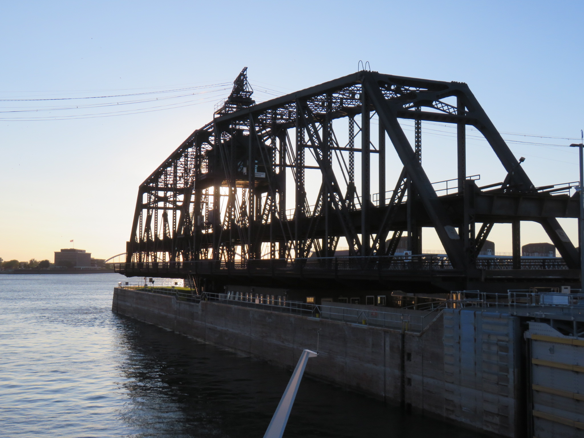
That first railroad bridge has been replaced three times. The current bridge, called the Government Bridge, or the Arsenal Bridge, was built in 1896, and has a 360 degree swing section over Lock Number 15, which we passed through when we left Davenport tonight. The drop here is about eleven feet again. The bridge connects Davenport to the Rock Island Arsenal, the largest government-owned weapons arsenal in the United States, built here in 1862.
On our way to Dubuque, we passed by Prairie du Chien, Wisconsin, home of the historic Fort Crawford. It was here that future US President, Zachary Taylor, accepted the surrender of Sauk war chief Black Hawk following the Black Hawk War of 1832. A series of misunderstandings on both sides led to the death of 77 settlers and between 450-600 Sauk tribe members.
On the opposite shore of the river, Marquette, Iowa is about 4 miles south of Effigy Mounds National Monument. More than 200 mounds were built here by the Eastern Woodland Indians between 500 BC and 1200 AD. It isn’t know why the mounds were built. There are four styles: conical, which are the oldest and were often used as burial mounds; linear, long and narrow mounds that may have been ceremonial; compound, a combination of conical and linear, like a row of beads; effigy, among the more recent mounds, that are built in animal shapes. The linear and compound styles are only found in this region.
Lock and Dam Number 10 is near Guttenberg, Iowa, with another nine foot drop. We reached Lock and Dam Number 11 just north of Dubuque, with a drop of about eight feet.
There were rich lead deposits on the west side of the river, which drew more settlers. The Meskwaki Peoples had been using unrefined lead for years prior to this. They would grind it into powder, mix it with water, and create a black paint for face and body decoration. The French explorers taught the Native Americans how to melt the ore and shape it into statues, tools, sinkers and cooking utensils.
The Meskwaki traded chunks of ore to the French and English traders, who would then smelt the ore and produce lead shot, often trading them back to the Native Americans. The Meskwaki were secretive about their mines, guarding them form the traders. Julien Dubuque came to the area, drawn by the lead, and gained the trust of the Meskwaki, even marrying the daughter of their Chief Peosta. Dubuque worked with the Native Americans to find new sites, and he ran the mines for them until he died in 1810. At that time, the mines were taken over by the United States Army instead of being returned to the original owners – the Meskwaki.
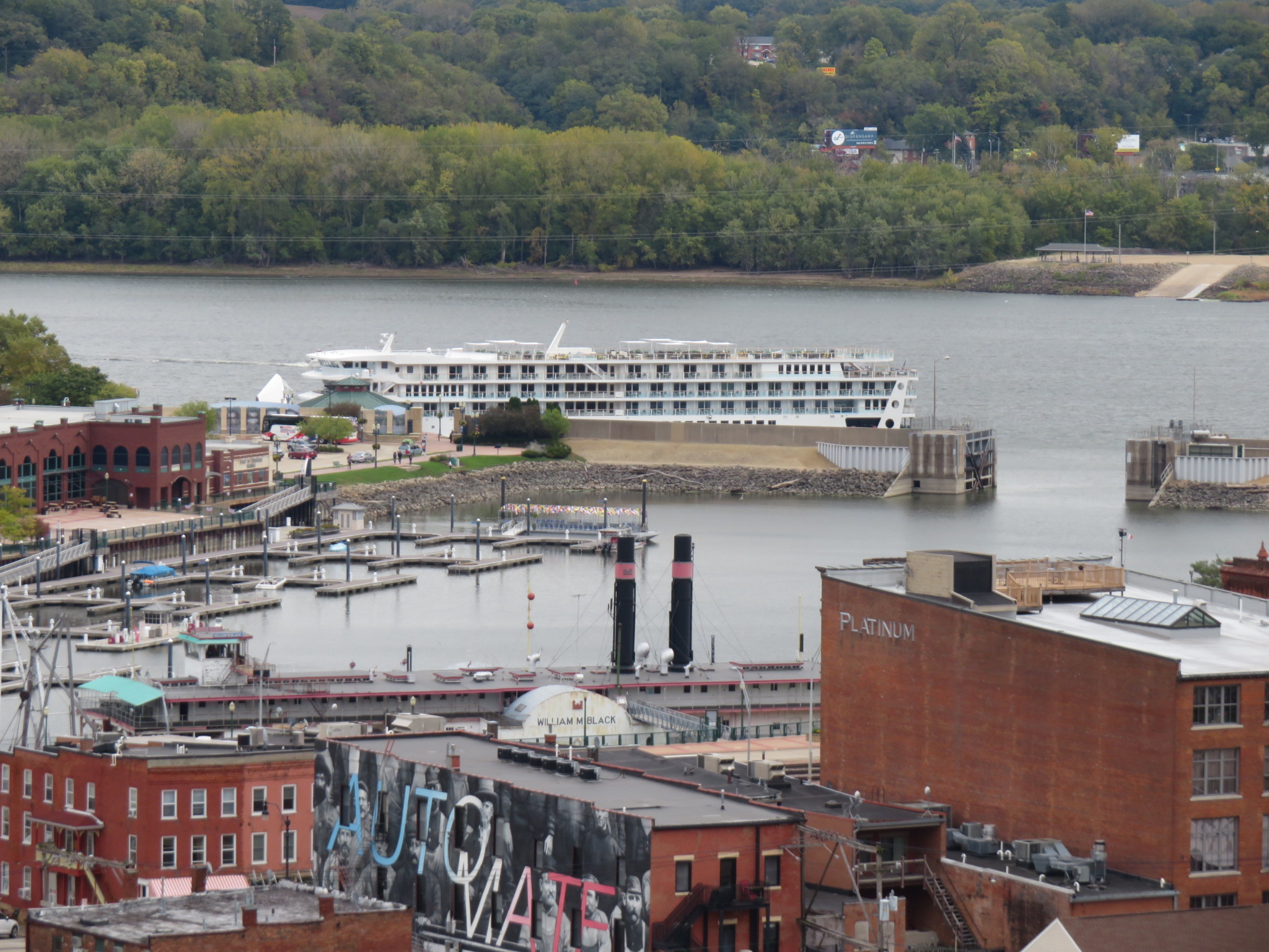
We arrived in Dubuque late this morning. The city, which sits at the juncture of three states, Iowa, Illinois, and Wisconsin, was founded in 1833, and named for Julien Dubuque.
I grew up in north central Iowa, where the flat prairie and rich topsoil make agriculture and food production the number one industry in the state. We lived west of the Driftless Area, so I wasn’t aware that Iowa had any bluffs or rolling hills until I first visited Dubuque at the age of 16.
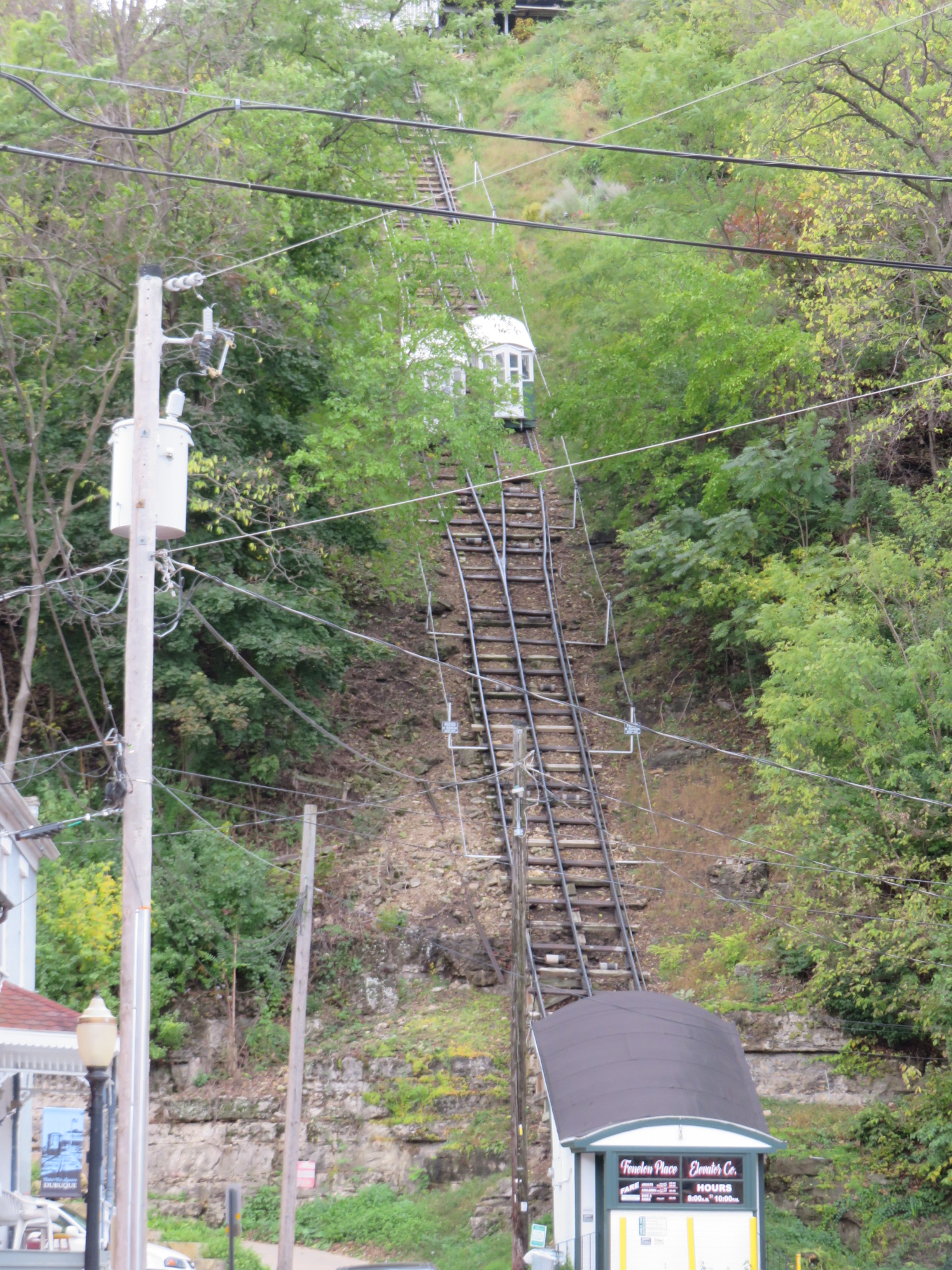
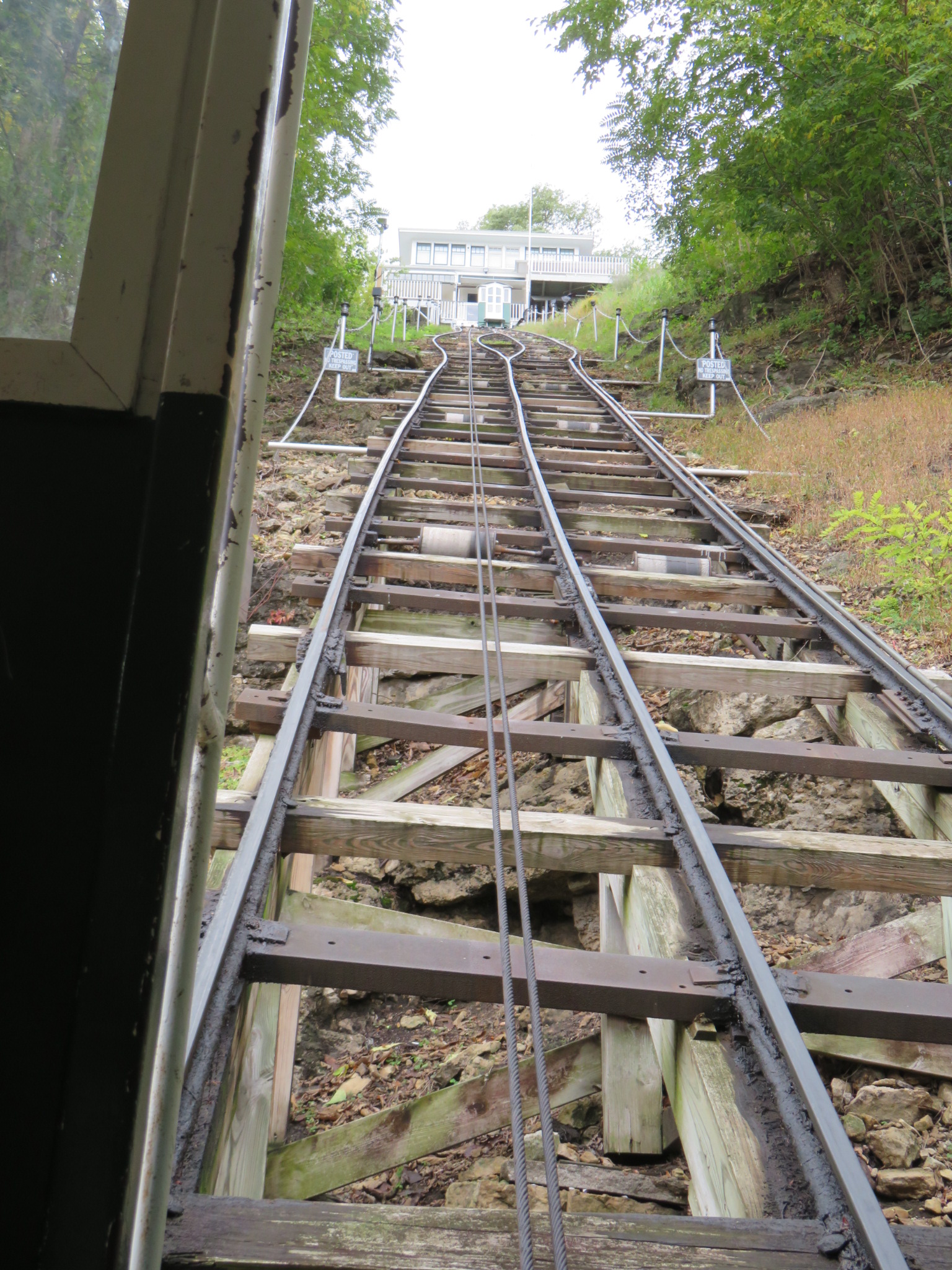
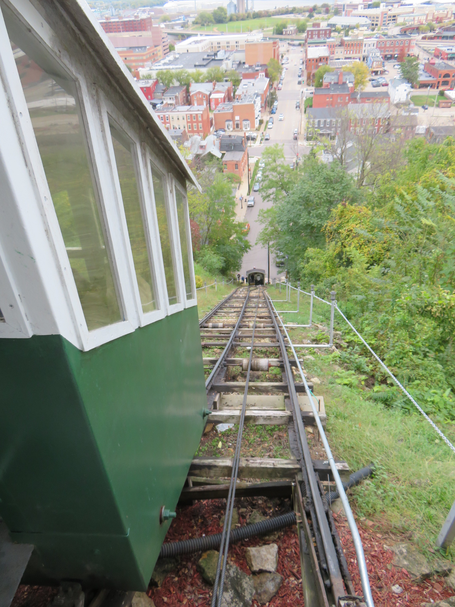
In the 1880s, If you lived on the bluffs of Dubuque and worked closer to the river, it could take you 30 minutes to drive your horse and buggy each way. At this time, Dubuque residents took 1.5 hours for lunch, enough for most people. However, J.K. Graves, former mayor, former State Senator, and banker, liked to have time for a nap over his lunch break. Driving 30 minutes each way didn’t leave enough time to eat and nap, so he decided to build an incline railway with cable car. The city granted him a franchise to build it, and a local engineer was hired to design and build a one-car cable modeled after those in the Alps of Europe. Graves had his gardener operate the car, a plain wood building with a coal-fired steam engine boiler and winch. Other locals paid him 5 cents to use it as well. It’s been called the world’s steepest and shortest scenic railway. It is 296 feet in length, and elevates passengers 189 feet.
The funicular style elevator, experienced a couple of fires over the years. After the second fire, in 1893, Graves could not afford to rebuild the elevator. Neighbors banded together to raise the money, and formed the Fenelon Place Elevator Company, and built an improved elevator which operates to this day. Now it costs $2 each way to ride. It’s well worth the price, though, for the views of the city and river.
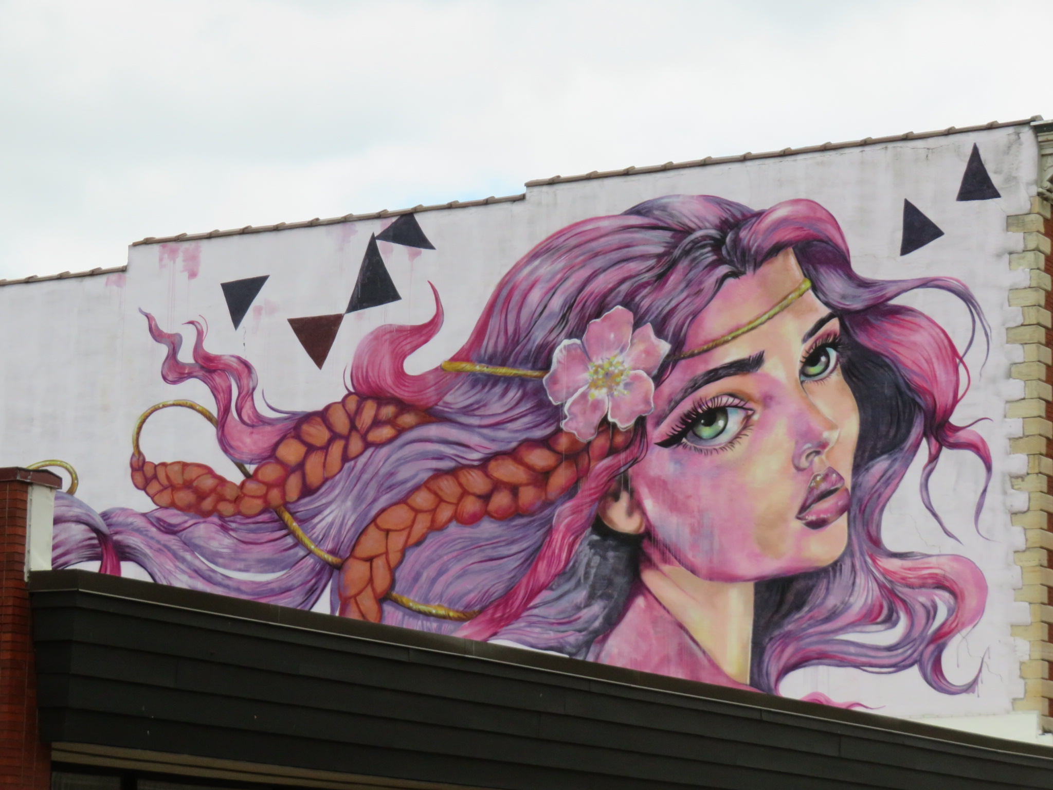
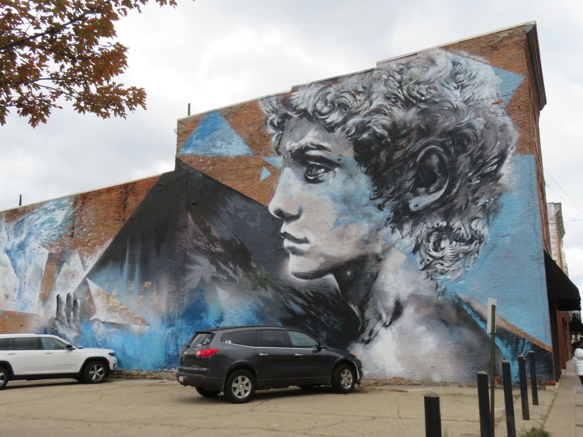
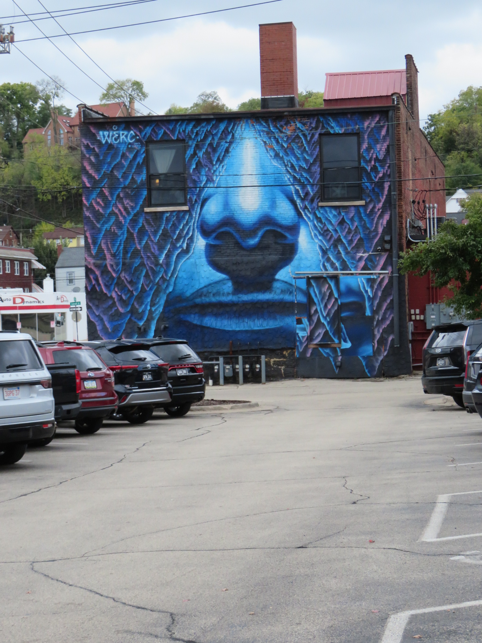
From here, we walked by the downtown area with its lovely buildings and many murals.
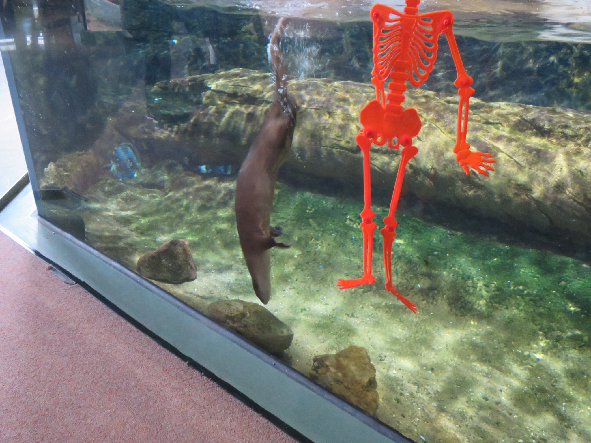
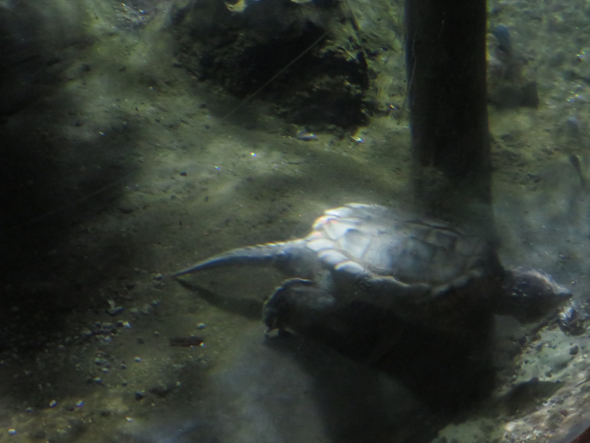
The National Mississippi River Museum and Aquarium graces the western shore of the river, just blocks from downtown Dubuque. This museum was established in 2003 by the Dubuque County Historical Society.
Last night, we cruised through Lake Pepin, a natural lake in the river, the largest such lake on the Mississippi. We miss a lot of the river because of night time travel. I guess we’ll have to do a road trip some day.
Lake Pepin was created by the outflow of a glacial lake at the end of the last Ice Age. About 40 square miles, the lake measures 2 miles across at its widest point, and 22 miles long, ending north of Wabasha, Minnesota. At one time, the lake extended as far north as St. Paul, but natural sedimentation has caused the upper end of the lake to migrate south over the last 10,000 years. Today, the sedimentation has accelerated, creating threats to the lake’s natural flora.
Lake City, the home of the river’s only functioning lighthouse, is also famous for being the home of the inventor of water skiing, Ralph Samuelson. In 1922, at the age of 19, had already mastered the sport of aquaplaning. similar to today’s wake boarding. He wanted to create something like snow skiing, but on water. He experimented with staves from wooden barrels before he created new skis made of pine boards. He began jumping wakes, but broke the original skis. His second pair, with slight modifications, are at Lake City’s Chamber of Commerce.
On the other side of the lake is Pepin County, Wisconsin, birthplace of Laura Ingalls Wilder. As a child, Wilder lived in several different communities in Wisconsin, Minnesota, Kansas and the Dakotas. Many of us have read her books and/or watched the television series, “Little House on the Prairie.”
The National Eagle Center is located a few miles south of Red Wing in Wabasha. Visitors are given the opportunity to see bald eagles and golden eagles up close. These eagles have defects, or have suffered injuries that prevent them from being returned to the wild. Our home on the river allows us to observe bald eagles almost daily, golden eagle sighting are very rare. Although close in size, the bald eagle and golden eagle are not closely related. The bald eagle is a fishing eagle, while golden eagles are related to hawks.
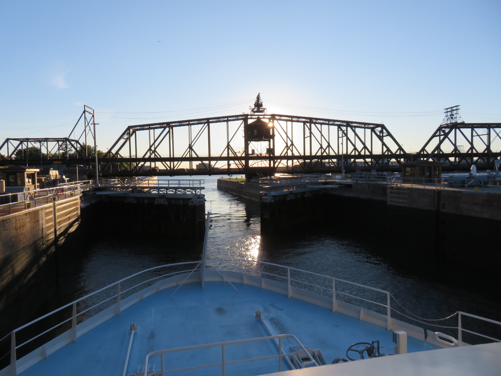
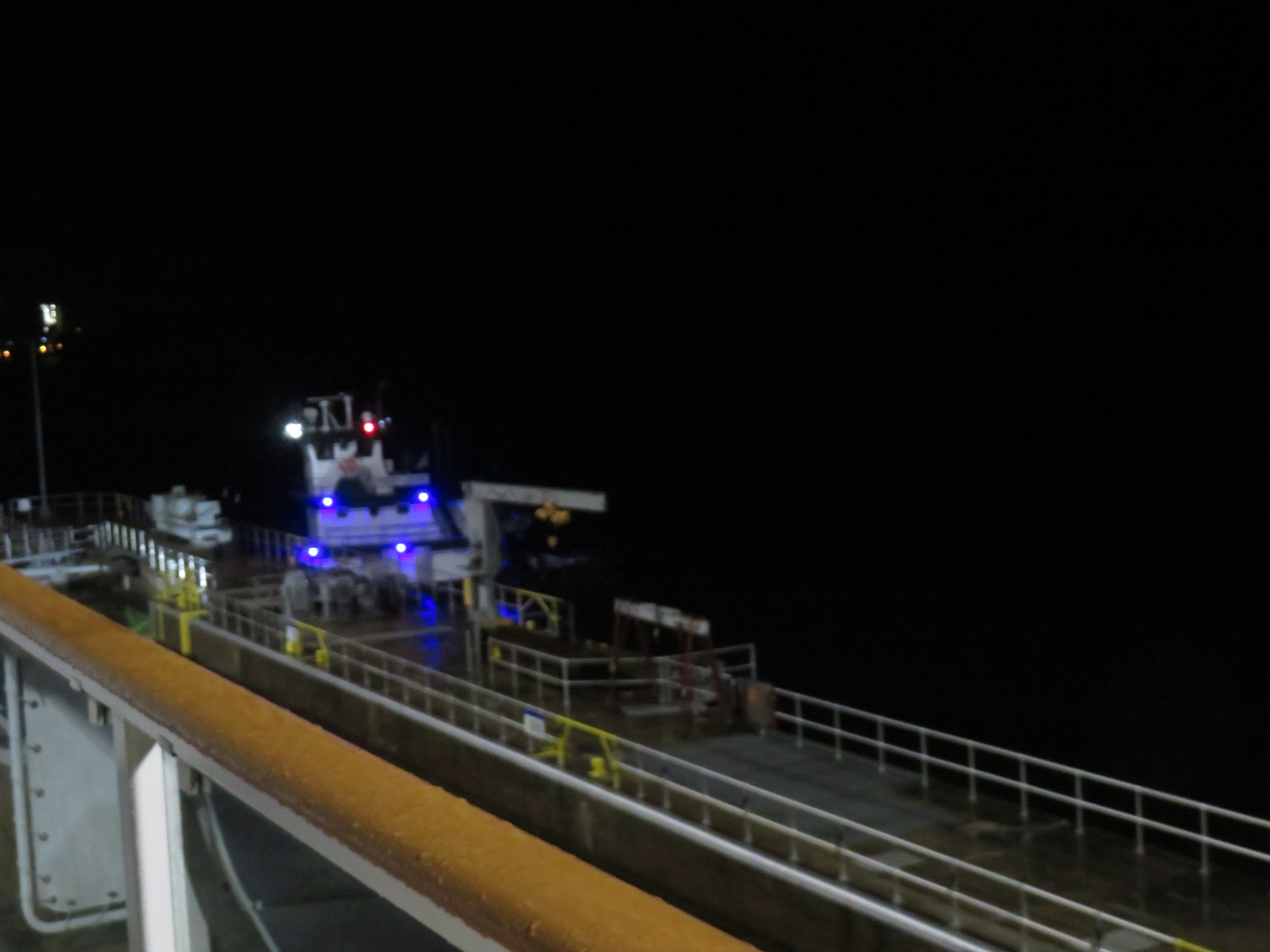
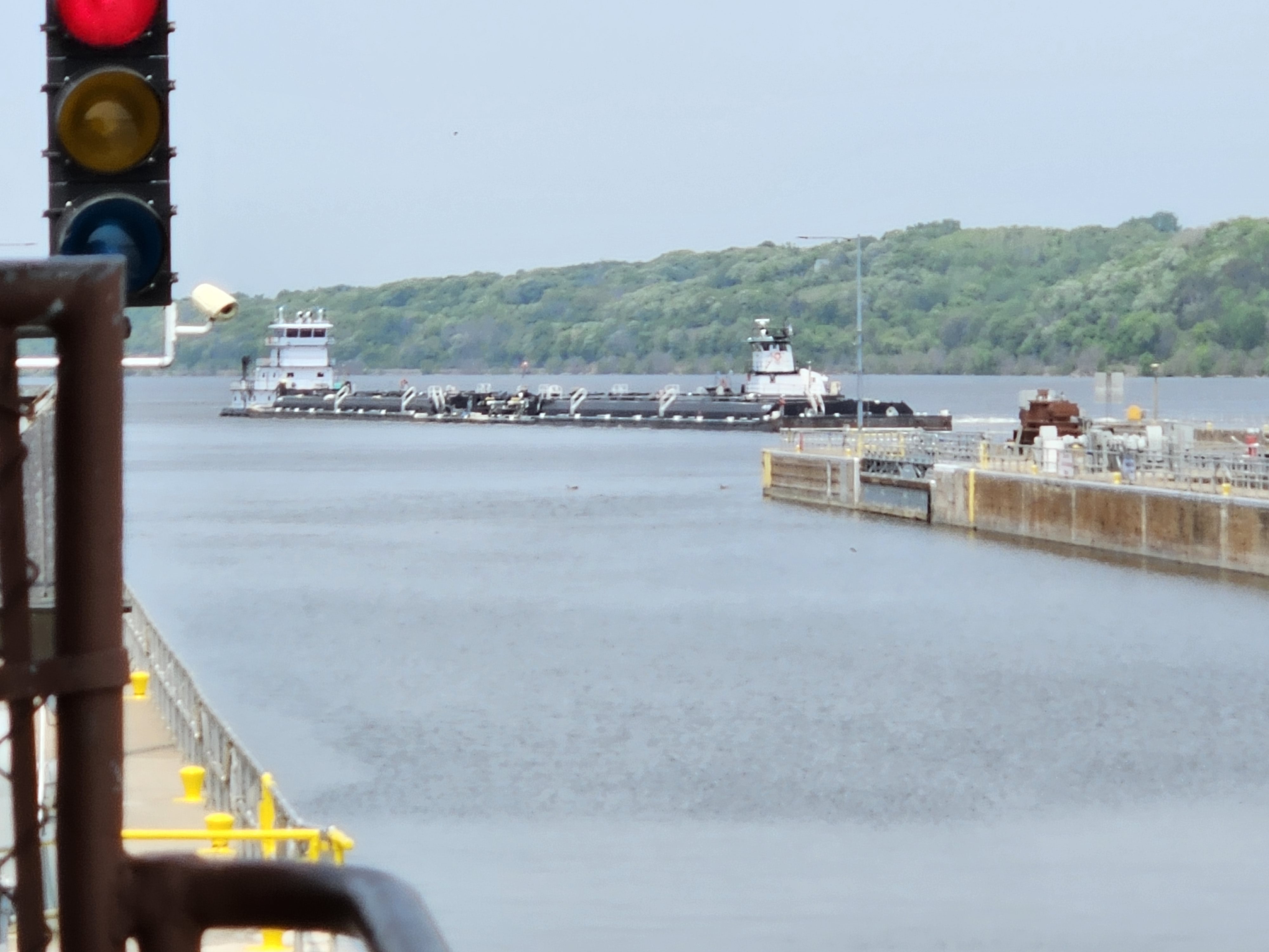
Just a few miles past Wabasha, at Alma, Wisconsin, we encountered the first lock of the trip, Lock and Dam Number Four at about 1:45 am. The ship hit the bumpers on the sides of the lock, and the noise woke us up so we could watch for a bit. It was raining, but we will managed to see what was going on. This lock was constructed in 1935, and is 110 feet wide by 600 feet long. It raises and lowers river traffic by about eight feet.
Our next one. Lock and Dam Number Five, was about 20 miles further down, at Minnesota City. That one we slept through. Then, we cruised another ten miles before hitting Lock and Dam Number Five A at Fountain City, Wisconsin, across the river from Winona, Minnesota.
The city of Winona was named for a Dakota Sioux maiden who was said to have leapt to her death from Maiden Rock, on the Wisconsin side of Lake Pepin, a few miles east of Red Wing . By the way, Winona Ryder was named for the city because her mother like the name. Her birthplace is listed as Winona County, Minnesota.
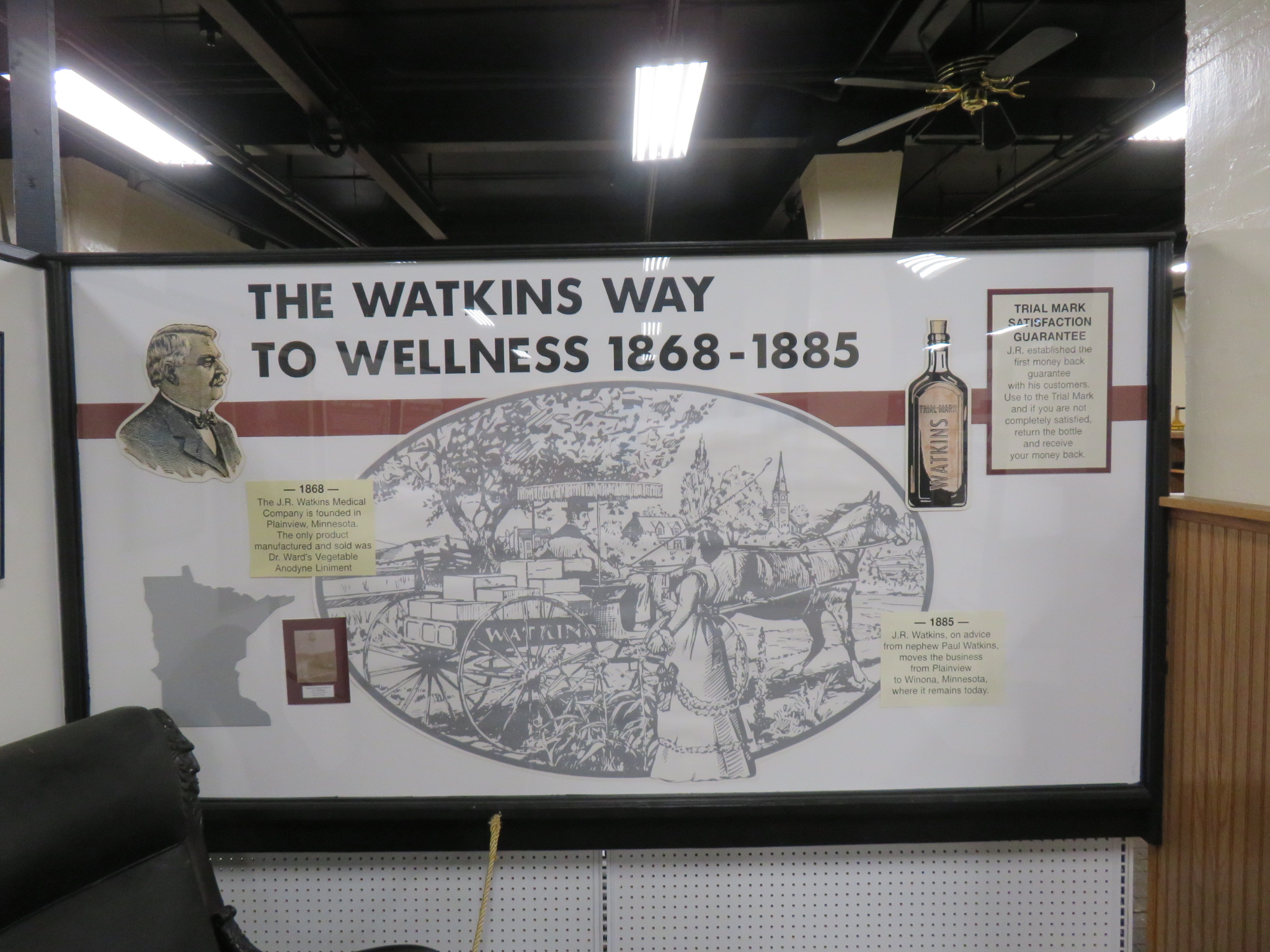
The town is also home to the J.R. Watkins Company, which has provided household products since 1868. One that was well-known to me was their Vanilla Extract, which my mother used to buy from door-to-door salesmen. The company sells seasonings, flavorings, recipe mixes and more, in grocery stores, by catalog and on-line. We visited the Watkins Museum of History, where we also learned they are now selling a brand of bourbon. Naturally, we had to track some down to bring it home. We now have a bottle of their Spiced Orange Bourbon.
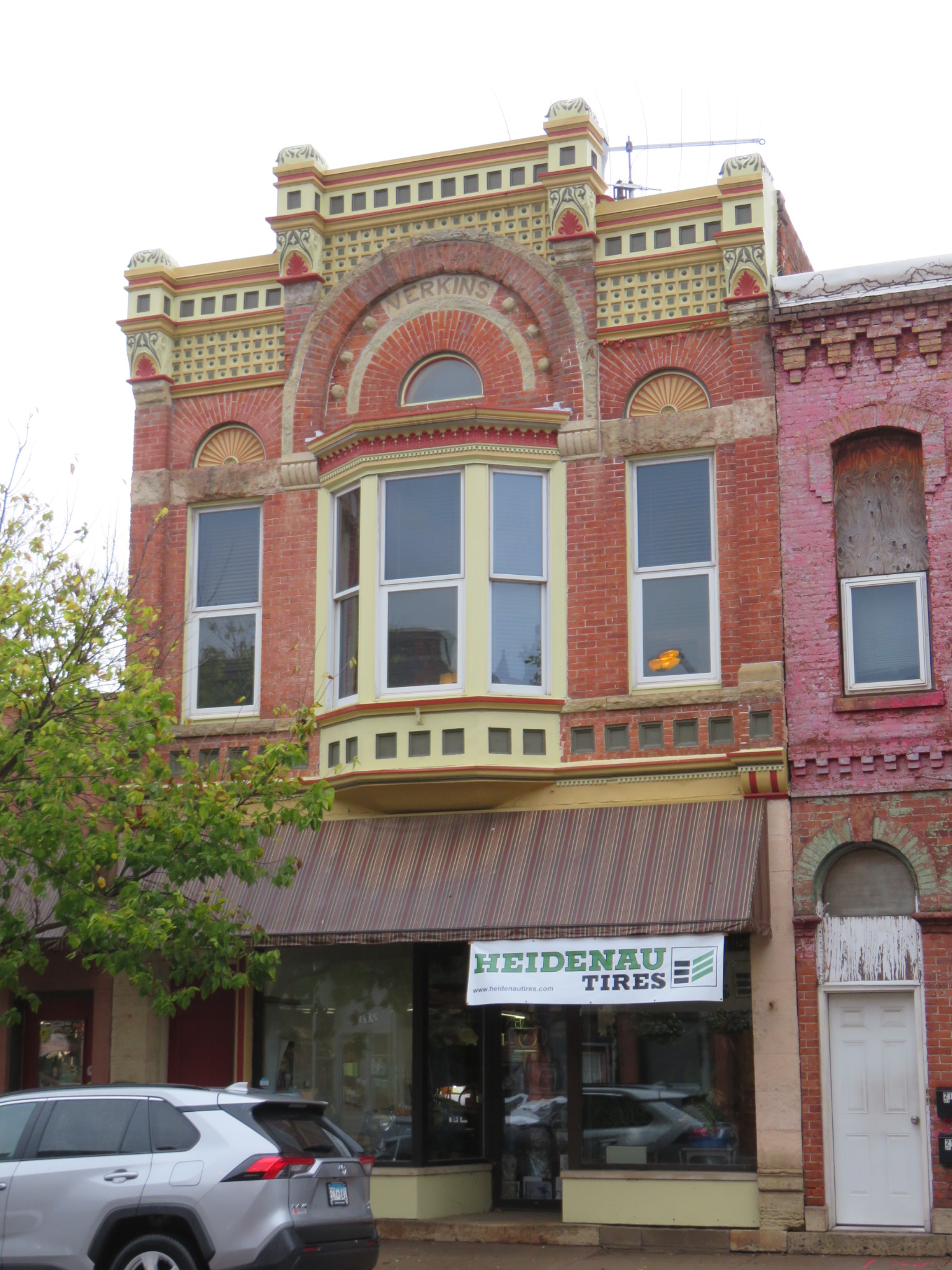
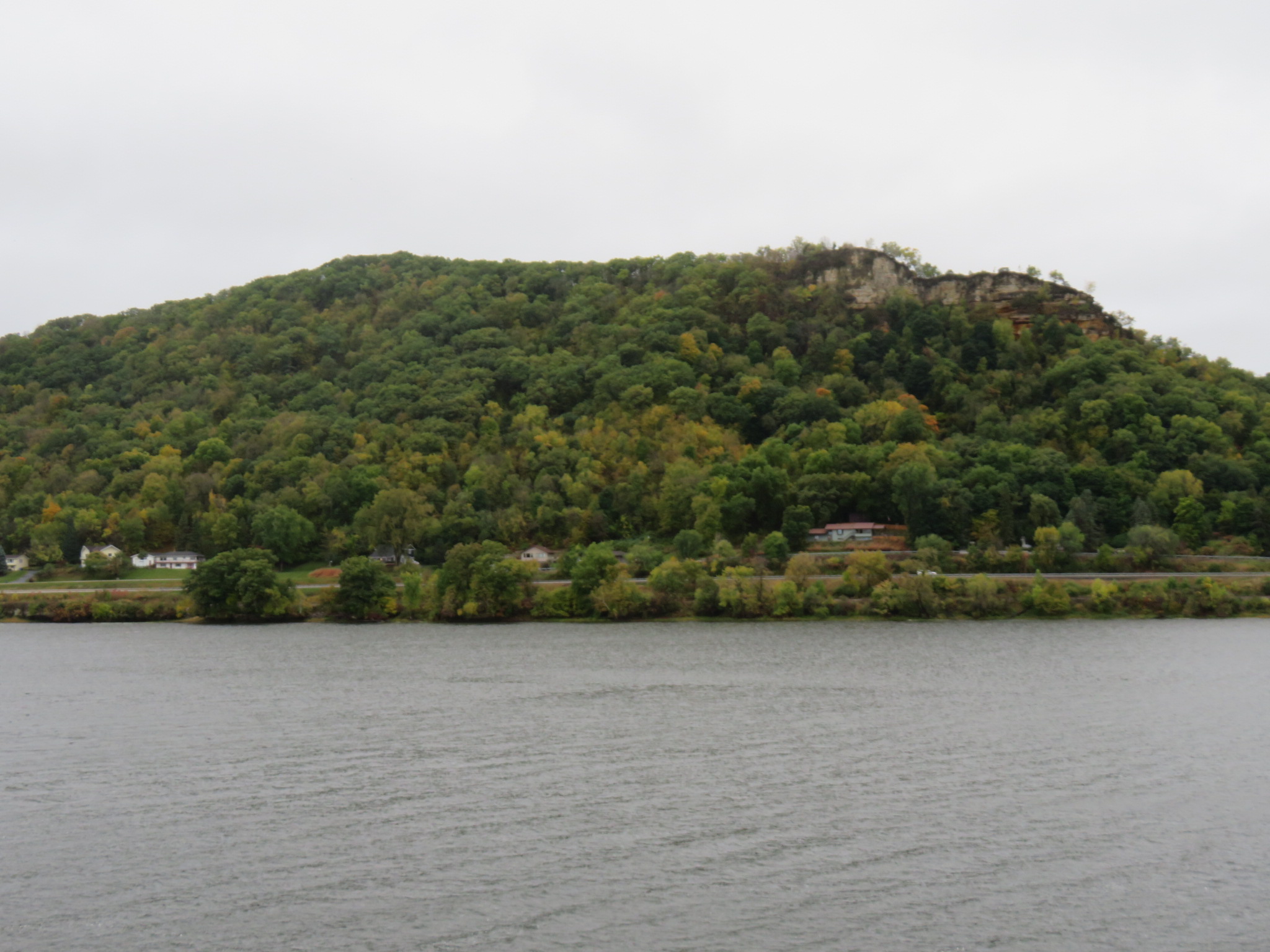
Winona is nestled between the river to the northeast, and bluffs to the southwest. The town has preserved many of its beautiful old buildings in the downtown area.
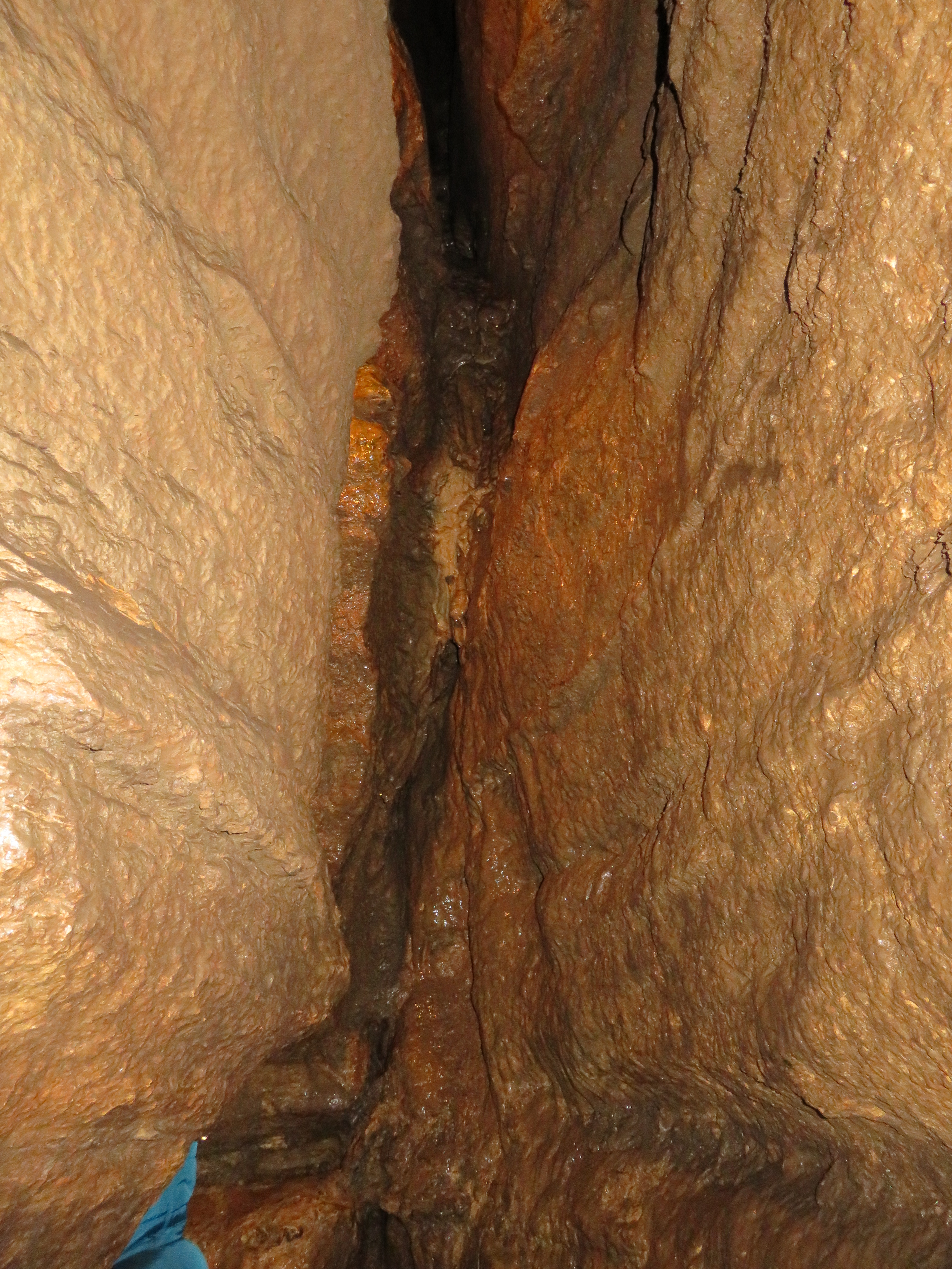
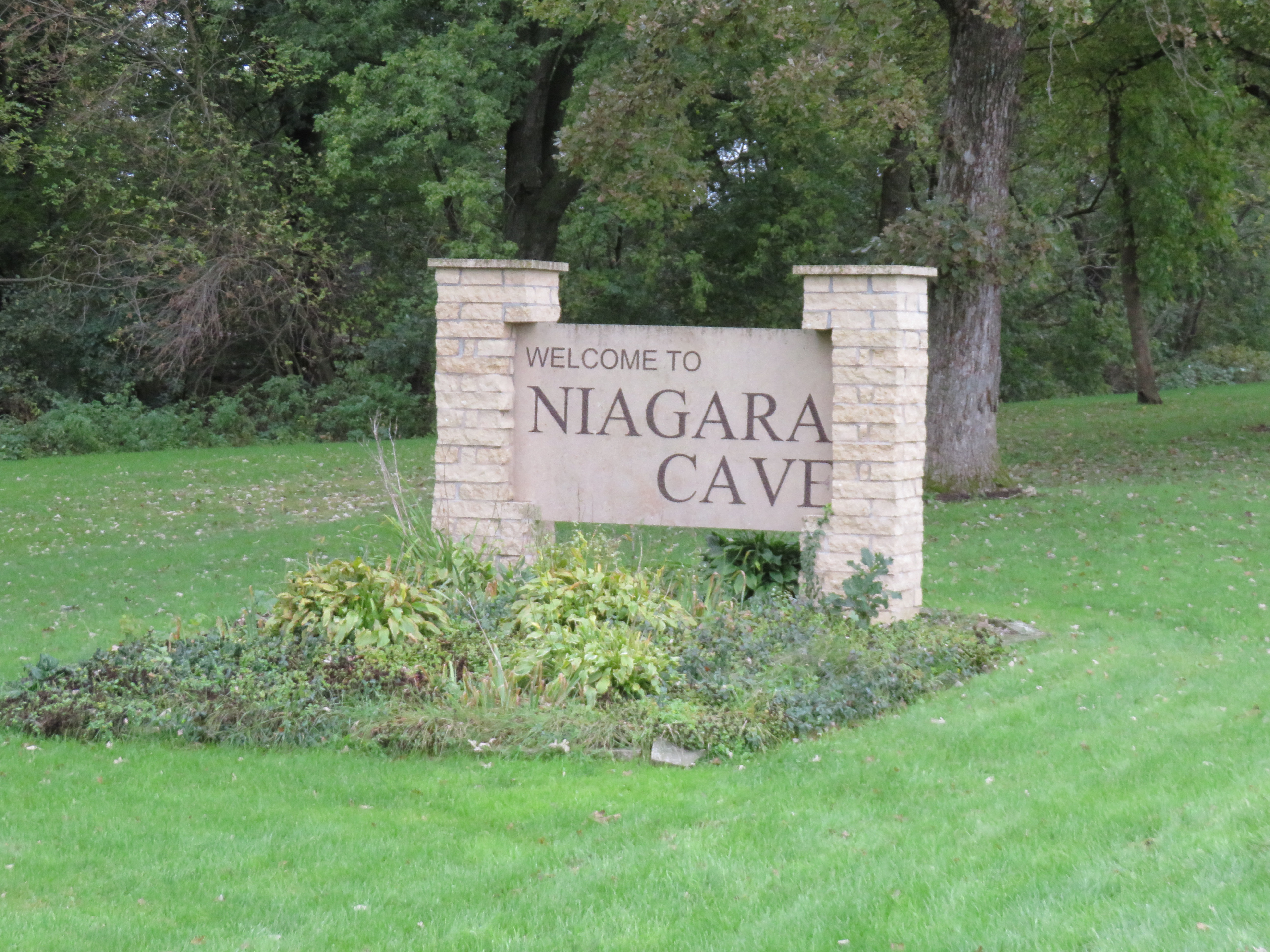
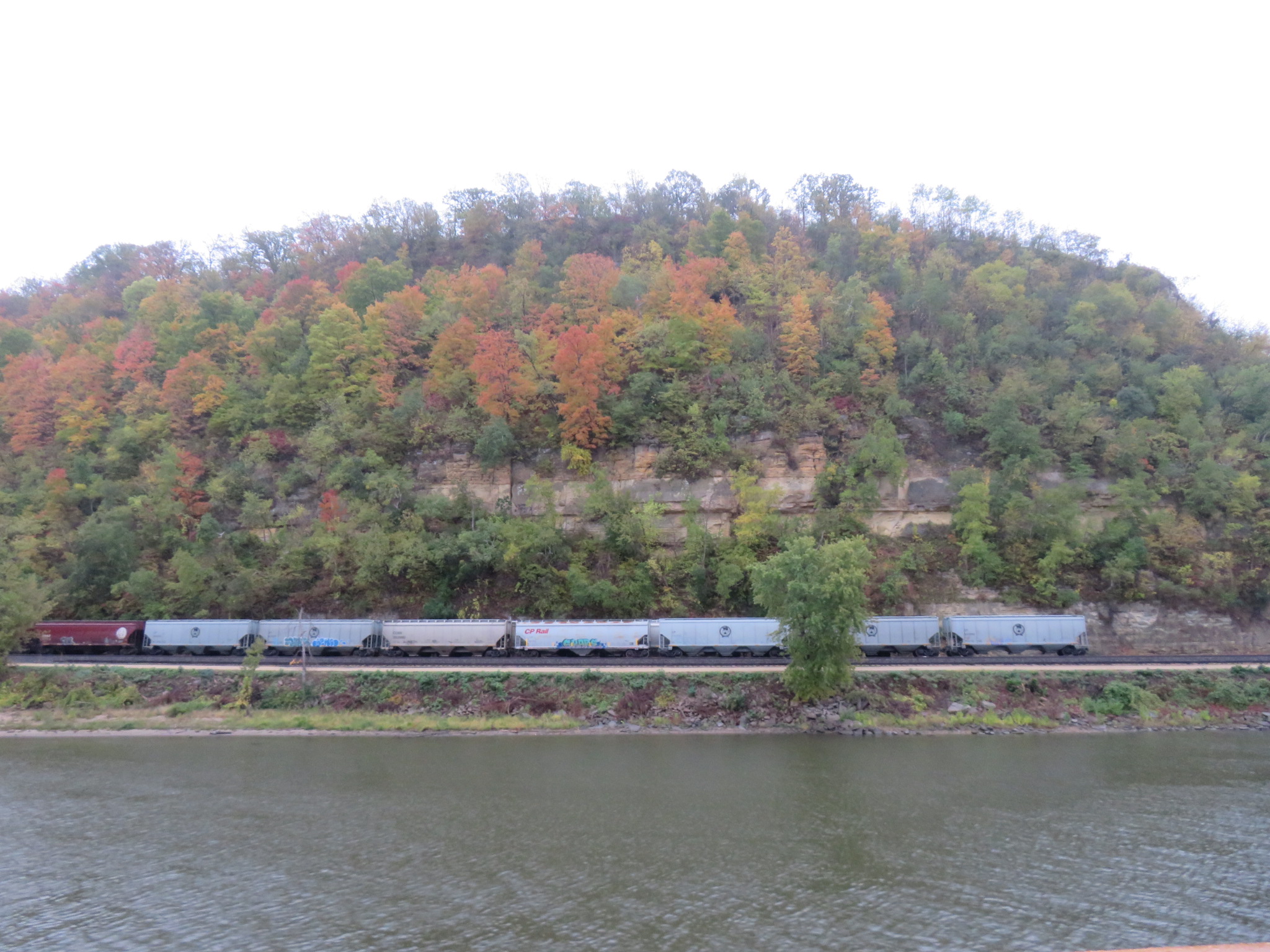
Winona is located in The Driftless Area, a 24,000 square mile area of land that covers parts of Wisconsin, Minnesota, Iowa and Illinois. Drift refers to the soil that was transported and deposited by the glaciers passing through. The last ice age, which ended over 10,000 years ago, missed this area. While surrounding land was flattened by glaciers, the Driftless Area contains deep river valleys, steep ridges, and spring fed waterfalls. You can find caves and underground streams, even underground waterfalls such as the one at Niagara Cave near Rochester, Minnesota, which we visited a few years ago.
The drive along the river is especially beautiful in the fall when the leaves are changing color. We left town shortly after lunch. It continued to rain most of the day, but still we enjoyed the scenery as we passed by.
Lock and Dam Number 6 is located at Trempealeau, Wisconsin, with about a five foot drop. Number 7 is at LaCrescent, Minnesota, just north of La Crosse. The drop here is about seven feet.
The City of La Crosse, Wisconsin was named for a game that indigenous peoples played with stick and a ball. French fur trappers named it la crosse, meaning the stick in French. The game of Lacrosse is the oldest organized sport in North America, and the city promotes it with their La Crosse Lightning Lacrosse Club for youth.
La Crosse also boats the World’s Largest Six Pack, six 54-foot high storage tanks that were built in 1969 by G. Heileman Brewery, then painted to resemble beer cans. The brewery was sold 30 years later, and is now owned by City Brewing Company in La Crosse. The tanks were wrapped in 2003 to advertise their product – LaCrosse Lager. According to the sign, the tanks can hold enough beer to fill over 7 million cans. A permit was issued recently to give the tanks a new “label,” no news yet on what that will be.
We reached Lock and Dam Number 8 south of La Crosse, at Genoa, Wisconsin, around 8pm, where there is an approximately eight foot drop. Then Lock and Dam Number 9 near Harpers Ferry, Iowa (not to be confused with the more famous town in West Virginia. At this point, we experienced a drop of about eleven feet.
We hopped on a bus today to head to Red Wing, where we will board our ship and begin the journey down the Mississippi. We are cruising with American Cruise Lines, taking the Grand Heartland Cruise to New Orleans. Our riverboat holds about 150 guests, providing a nice intimate voyage. This particular cruise is labeled a Fall Colors cruise. We have been seeing some color change already, so expect this to be a beautiful trip.
Our ship is a riverboat, but not a paddlewheeler. We will probably see some along the way. Traditionally, paddlewheelers on US rivers were powered by steam, but that has only been since the early 1800s, a few years after Robert Fulton and Robert R. Livingston built the first commercially successful steamboat. Before that, some paddlewheelers were powered by horse. Several horses were placed in a treadwheel, and hitched to strong timbers. Forward movement of the horses’ feet caused the treadwheel to revolve and operate the gear wheels.
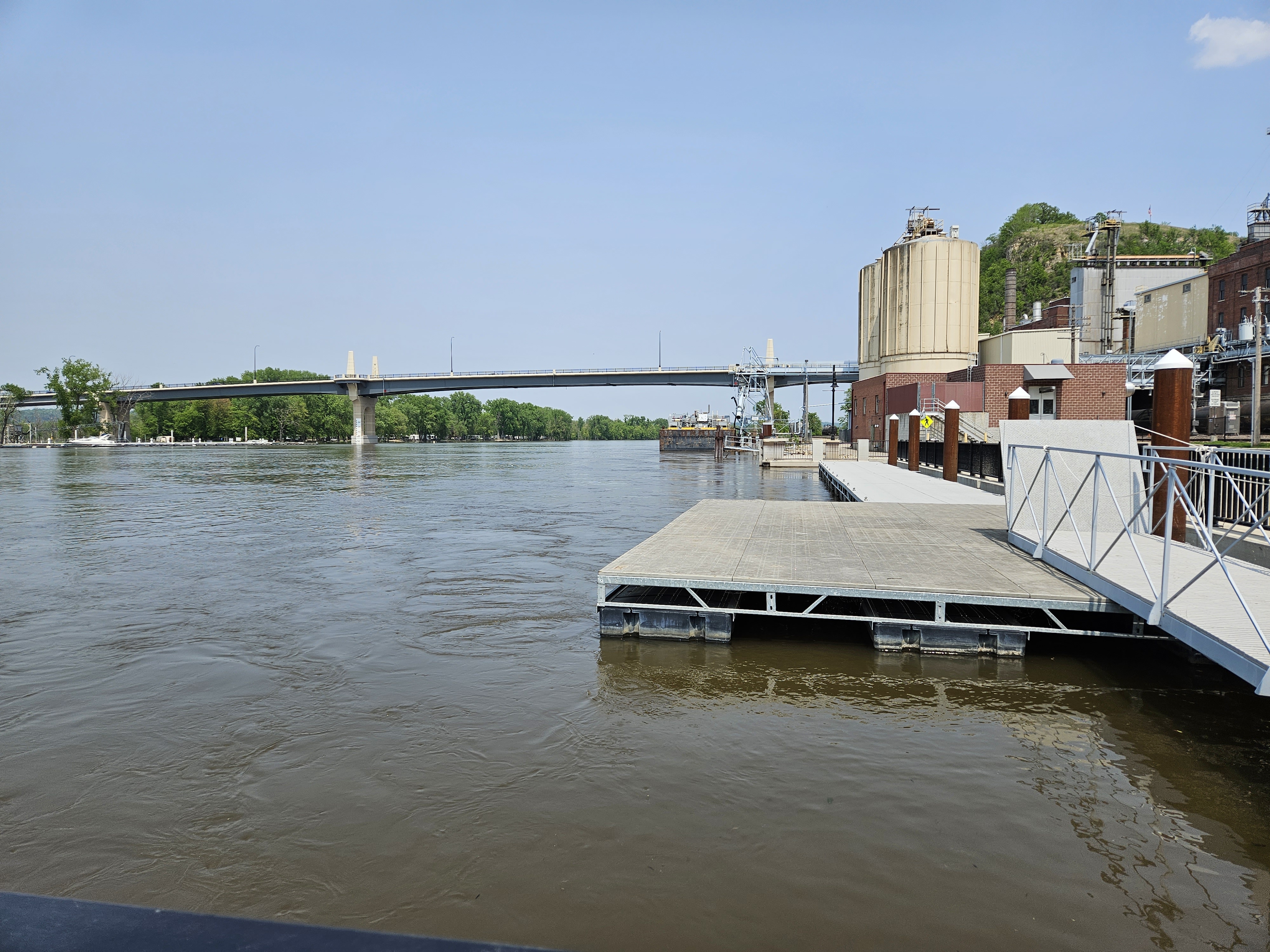
In May, this year, we drove along the river south of St. Paul, stopping first near Hastings, by Lock & Dam #2 (actually the fourth dam, three are located in the Twin Cities.) The Mississippi River lock and dam system has 29 structures from Minneapolis to Granite City, Illinois. The system allows commercial and pleasure boats to navigate the river as it drops 420 feet over 800 miles. We arrived in time to see a long barge approach and negotiate the entry to the lock. Normally, there is a 38 foot drop here, but spring flooding almost eliminated that on this day.
Our next stop was Red Wing, where we will actually board the boat in October. The loading dock is located at Levee Park, which was partially flooded on this day.
Today, we arrived at the dock where our ship was waiting for us – American Serenade. It’s pretty chilly today, but we did walk into town for a little bit before returning to meet the ship’s crew, hear about the daily schedules, learn safety procedures, and about the upcoming excursions we can choose. We will be busy.
Named for 19th century Mdewakanton Dakota chief Hupahuduta (Wing of the Wild Swan Dyed Red), the city of Red Wing was settled in the early 1850’s on land occupied by the Mdewakanton Sioux. Hupahuduta was a firm friend of the United States, helping to keep peace with the traders and settlers. Red Wing is now home to the Prairie Island Indian Community, a reservation established in 1889.
Norwegian settlers opened one of the first ski clubs here, the Aurora Ski Club, which operated from the 1880s into the early 1950s. Red Wing is home to Red Wing Stoneware & Pottery, whose history dates to 1877, and Red Wing Shoes, founded in 1905 and well-known for their sturdy leather workboots.
The ship left port at about 5:30 pm, during happy hour, passing by some lovely fall colors already.
Minneapolis is known as the “City of Lakes,” thirteen of which are at least five acres in size, with the largest, Bde Maka Ska, being 421 acres. Some of you may remember this lake as Lake Calhoun, which was the name given it in the early 1800s, but the original name was reinstated in 2018. If you are in the neighborhood, and love to read, pay a visit to Birchbark Books. This neighborhood book store is owned by Minnesota author Louise Erdrich. Pick up an autographed book, maybe “The Sentence,” set mostly in a bookstore that looks a lot like this one.
This area was originally occupied by the Dakota Sioux. French explorers arrived in 1680, followed by more European-Americans. After the Louisiana Purchase, the US Army built Fort Snelling, located at the confluence of the Mississippi and Minnesota Rivers. More settlers followed, displacing most of the original peoples. In 1852, the name Minneapolis was proposed for the city, combining the Dakota word for water (mni) with the Greek word for city (polis.) The city was incorporated in 1867.
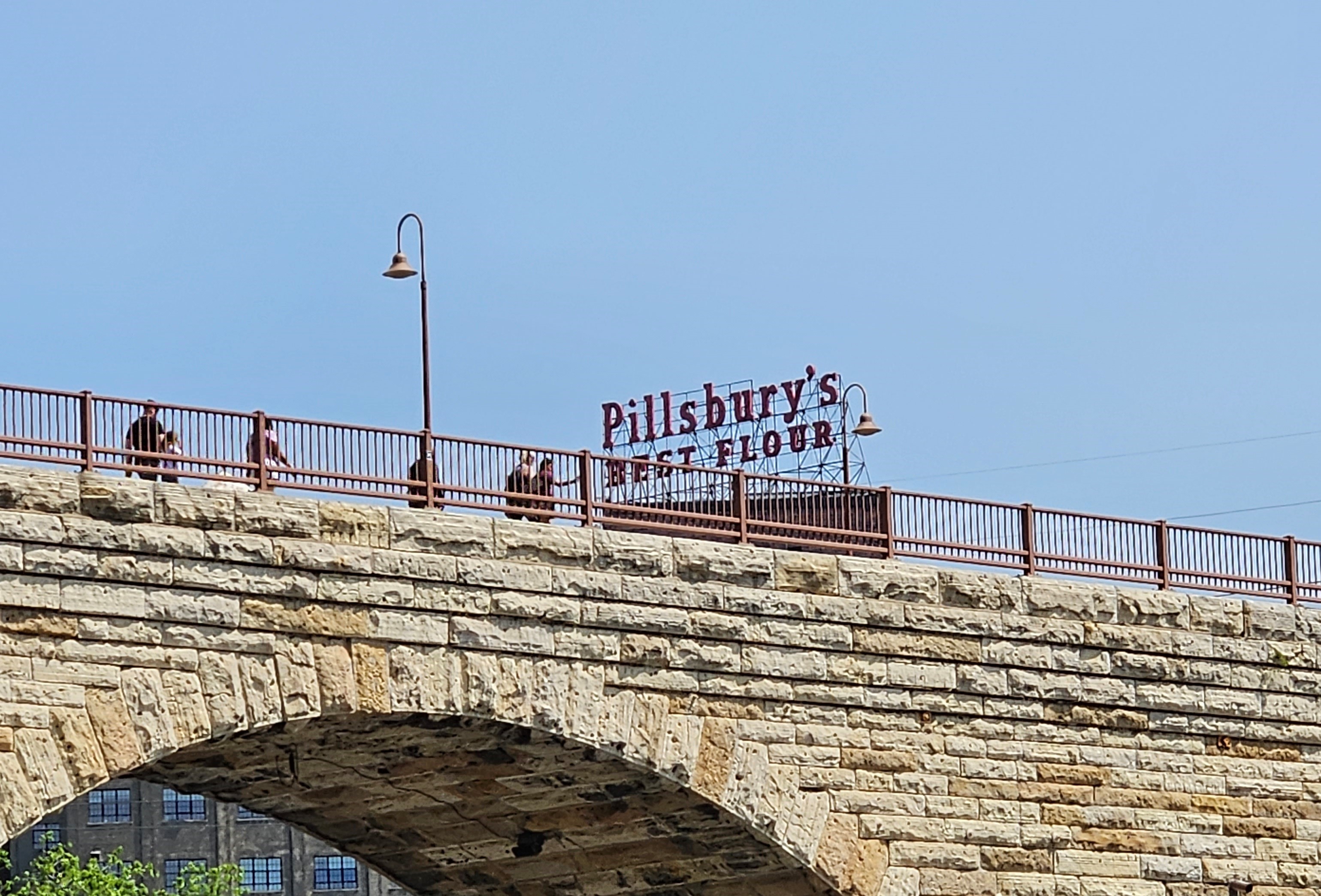
Minneapolis’ location on the Mississippi made it a good home for milling operations, which harnessed the river’s energy to power their mills. At one time, Minneapolis produced over 20% of the nation’s flour. There were more than twenty flour mills at one time, the largest of which were the Washburn-Crosby Company (part of the future General Mills), the Pillsbury Company, and the Northwestern Consolidated Milling Company. In 1880, Washburn-Crosby’s flour won a gold medal at the first Millers International Exhibit in Cincinnati, Ohio. Their Superlative Flour brand was renamed Gold Medal. Remains of some of the old mills can still be seen on the river banks in downtown Minneapolis, near the Mill Ruins Park.
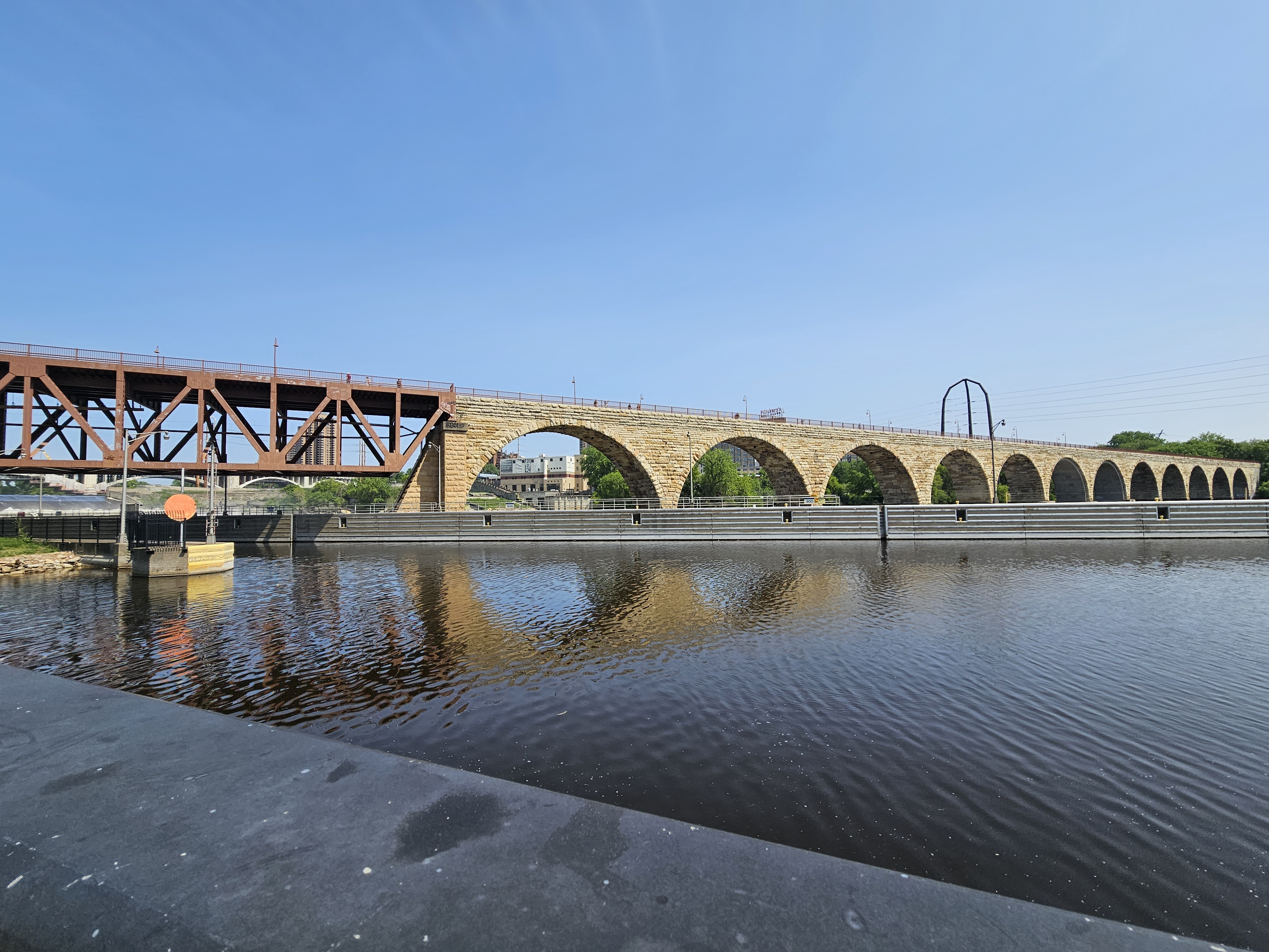
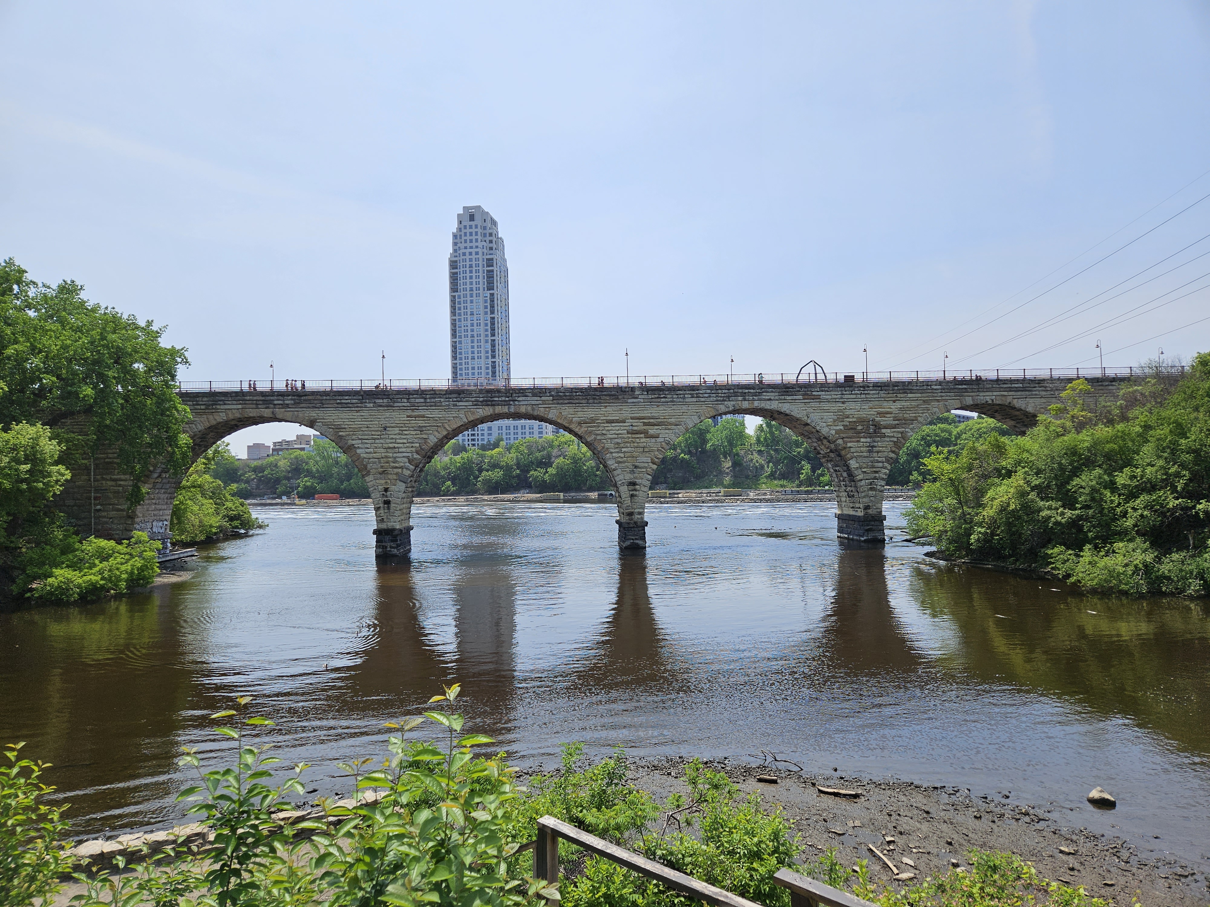
Cross the Stone Arch Bridge to St. Anthony Falls, and you quickly escape the urban landscape of downtown Minneapolis. The James J. Hill Stone Arch Bridge was built between 1881 and 1883, as a railway bridge. It served that function for almost a century, when it was converted to pedestrian use on the St. Anthony Falls Historic District. It was designated a National Historic Engineering Landmark.
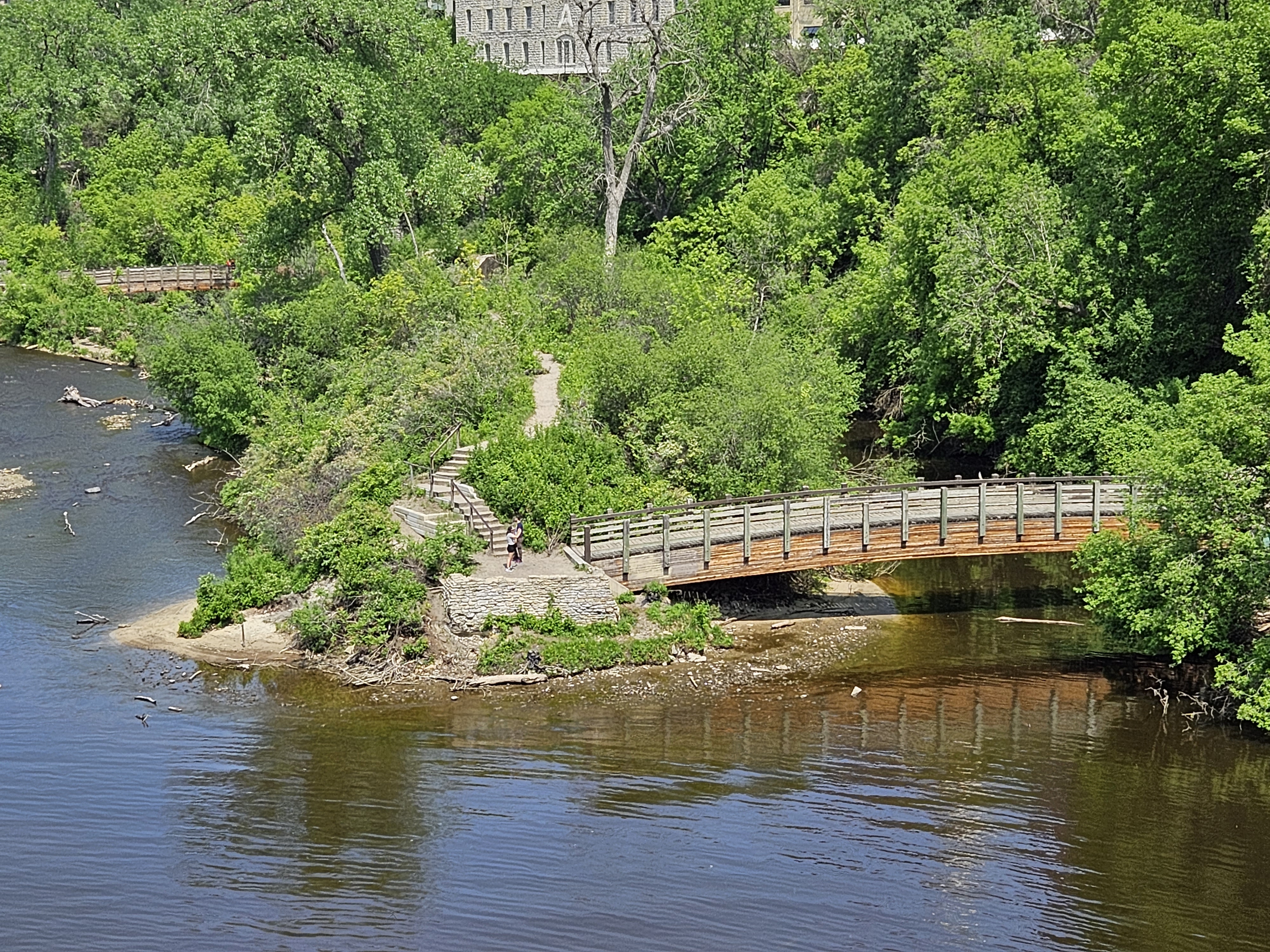
On the St. Anthony Falls site, you can take a trail down to the water, and get a good views of the falls and Minneapolis. We returned to the top, and continued to Nicollet Island, home of the Nicolet Island Inn and DeLaSalle High School.
The northermost lock in the Mississippi Lock and Dam system is located at Upper Saint Anthony Falls. It is currently closed to prevent the spread of Asian Carp. There is another one at the Lower Falls, with a drop of 49 feet. Built in 1917, Lock and Dam Number One is located just north of Fort Snelling, and drops about 25 feet. Also known as the Ford Dam, there is a powerhouse that was once owned by Ford Motor Company, which fed electricity to its assembly plant that operated from 1925 to 2011.
St. Paul was named the capital of the Minnesota Territory, which was formed in 1849. When the territory applied for statehood, there was a push to move the capital to St. Peter, about 75 miles southwest. The territorial legislature had actually voted to move the capital to St. Peter, but one of the legislators, Joe Rolette, stole the text of the bill, thus preventing the move. I guess politics has always been dirty.
In 1819, the US Army built a fort at the confluence of the St. Croix and Mississippi rivers – Fort Snelling. Less than 20 years later, the 1837 Treaty with the Sioux ceded all tribal lands east of the Mississippi to the US government. With the added security, settlers moved into the area, establishing a community known as Pig’s Eye, named for a bootlegger, “Pig’s Eye” Parrant. Missionaries followed the settlers, and built a chapel on a bluff downriver from the fort. This chapel was named for St. Paul. Before long, Pig’s Eye became known as St. Paul.
St. Paul’s location at the confluence of two rivers was prime for riverboat traffic, especially steamboats. It was the last good point to land when coming upriver. With all of this river traffic, lighthouses were important for navigation. In 1885, at the age of 23, Jane Muckle Robinson, living in St. Paul with her husband and family, was in need of work. She was hired by the Department of Commerce and Labor as a light keeper. She kept lights going on four river channels from Dayton’s Bluff to the St. Paul stockyards. If a light went out, boat pilots would blow their whistles, and she would wake up, row out to the lamp, and relight the flame. She worked this job for 36 years, retiring in 1821.
Today, there is only one working lighthouse on the Mississippi, located in Lake City, Minnesota, about 60 mile southeast of St. Paul. We should pass by after we board our ship in Red Wing tomorrow.
St. Paul, Minnesota is 175 miles almost due south of Grand Rapids. Following the Great River Road adds about 80 more miles, all of them worthwhile. The drive takes you through several small towns in the heart of Minnesota’s lake country.
Aitken has been celebrating Riverboat Heritage Days every year in August since 1980. They also host the World Famous Fish House Parade in November. I must confess I haven’t been to either of these events yet.
Nearby Crosby is located near the Cuyuna Iron Range which was mined between 1907 and 1967. Much of the former mine land was converted to a park, The Cuyuna Country State Recreation Area. There are 25 miles of mountain bike trails, plus paved bike paths, as well as cross country ski trails and snowshoe trails in its 5,000 acres. Other activities include swimming, fishing, picnicking, and canoeing. It truly is a beautiful refuge in the middle of lakes country.
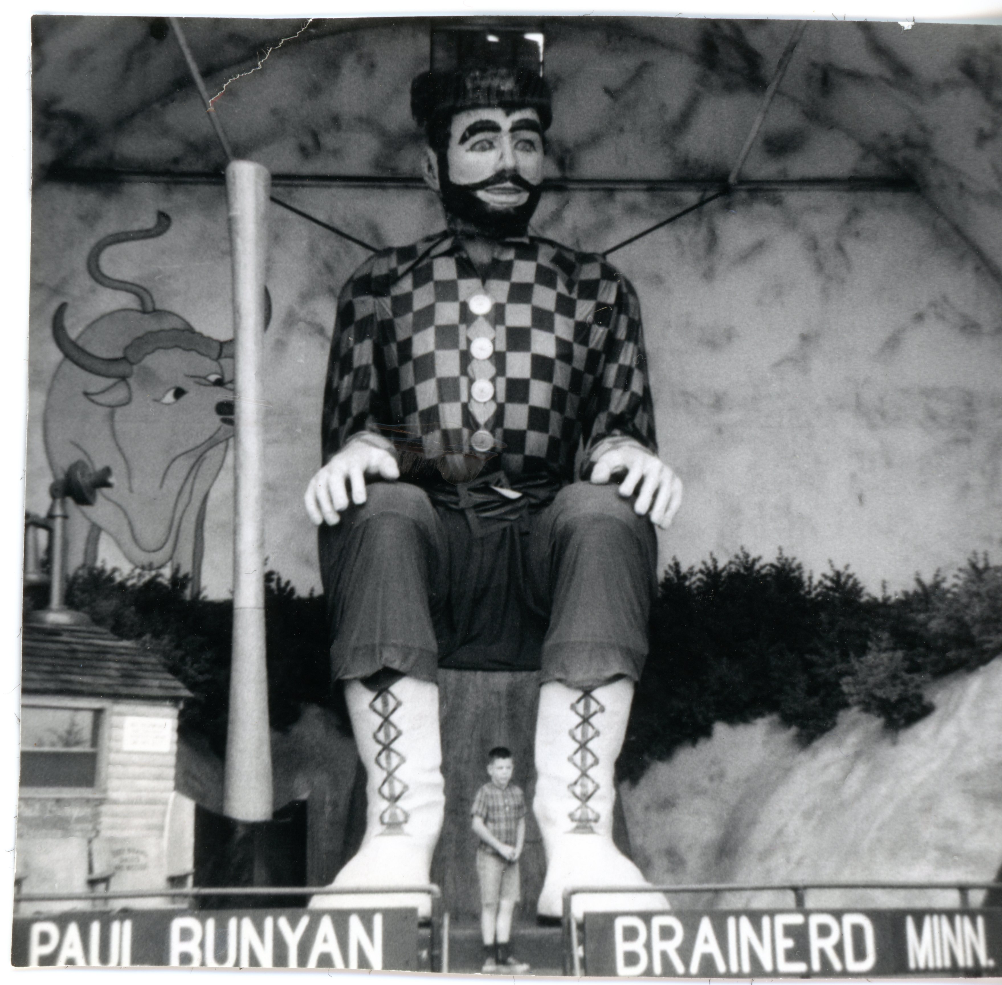
The cities of Brainerd and Baxter sit smack dab in the middle of Minnesota. When I was a child, Baxter was home to Paul Bunyan Land, with a talking Paul. Children would be startled to hear Paul call them by name (just tell the employee in the little hut what your child’s name was). This Paul Bunyan is seated, and measures 26 feet in height. The original park was built in 1950, and operated there until 2003, when it was closed. Paul, Babe and all of the rides were purchased by a family owned business and moved a few miles east of Brainerd.
The Crow Wing State Park is located at the confluence of the Crow Wing and Mississippi Rivers, home to the ghost town of Old Crow Wing, the first county seat of Crow Wing County. Following the French and Indian War of 1763, it became a strategic location for trading between the United States and Canada, and was mostly settled by Métis, children from the unions between Native Americans and Europeans, and by Ojibwe. The town died when the US resettled the Ojibwe to the White Earth Reservation in 1868. and the county seat was moved to Brainerd.
Historic Fort Ripley was established near Old Crow Wing in 1848. The first garrison arrived in 1849. Among their duties was supervising the government annuity payments to the Ho-Chunk and Ojibwe peoples. Life was generally peaceful, with any conflicts being resolved without going to war. A fire in 1877 destroyed much of the fort, which was then closed permanently. Fifty years later, the National Guard decided to build a new training site at the location.Camp Ripley trains personnel from the Minnesota National Guard, US Navy Divers, Minnesota State Patrol, Minnesota Department of Transportation, and the Department of Natural Resources. Sometimes, we hear the drone of UH-1 (Huey) helicopters as they make training flights along the Mississippi.
Continuing downriver, we drive through Little Falls, childhood home of Charles Lindbergh, “Lucky Lindy,” who made the first solo non-stop flight from New York City to Paris in 1927 in his airplane dubbed the “Spirit of St Louis.” The Charles A. Lindbergh State Park is home to the Charles Lindbergh House and Museum, located on the old family farm. You can tour the home which was built in 1906, furnished with many of original family objects; enjoy interactive exhibits, see historic flight footage and a replica of the “Spirit of St. Louis;” and see the water tower built in 1939 by the Works Progress Administration during the Great Depression.
You will drive by acres of farmland on your way south, interrupted by small and mid-size towns all along the river. The town of Monticello is home to about 2,000 trumpeter swans between mid-November and March, when the ice goes out. There is a natural open area on the Mississippi River that makes it the perfect home for the swans during the winter.
The original trip to the Headwaters was on July 25, 2020, as we were planning to take a Mississippi River cruise later that year. Well…that didn’t happen because of COVID, and we rescheduled the cruise to October, 2023. I hope the three year wait is worth it!
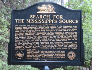
In 1805, Zebulon Pike explored the northern part of the newly acquired Louisiana Purchase, with the goal of locating the source of the Mississippi River. He left St Louis, Missouri on August 9, reached the Minnesota River a few weeks later, and later purchased land for what is now Fort Snelling State Park in St. Paul, MN. Pike’s party reached Leech Lake, about 200 miles south of the current Canadian border, in February, 1806. They continued to nearby Cass Lake, which Pike believed to be the source of the Mississippi River.
Pike was wrong about the Mississippi’s source. In an 1821 expedition, Henry Schoolcraft, a geographer and geologist, sailed upstream from Cass Lake, and, with the assistance of an Anishinabe guide, Ozaawindib, located the source 40 miles to the west at Lake Itasca. Schoolcraft named this small glacial lake, with a surface area of only 1.8 square miles, “Itasca.” He combined two Latin words (veritas for truth and caput for head), meaning true head.
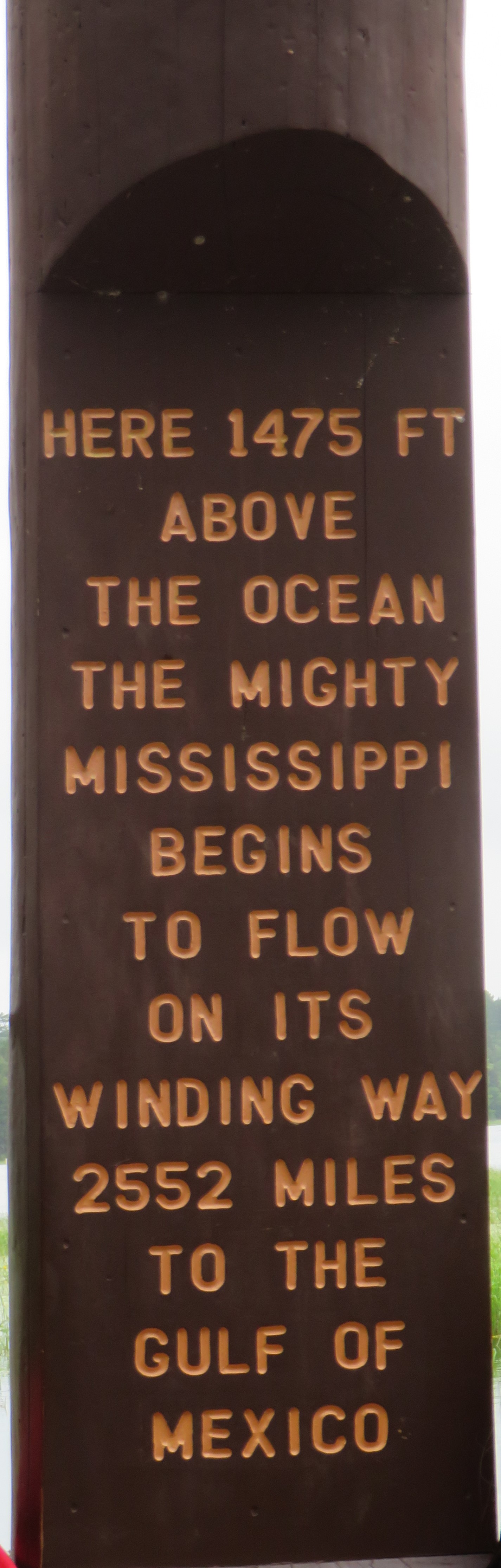
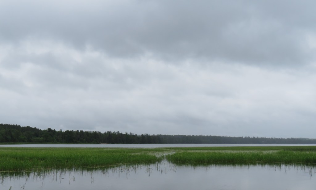
Itasca State Park, Minnesota’s oldest state park, was established in 1891. It covers 32,500 acres, including more than 100 lakes. There are several camping sites and cabins for those who wish to stay more than one day. We just came for the day, with the intention of walking across the Mississippi where it begins its winding journey to the Gulf of Mexico, then following the Great River Road to home.
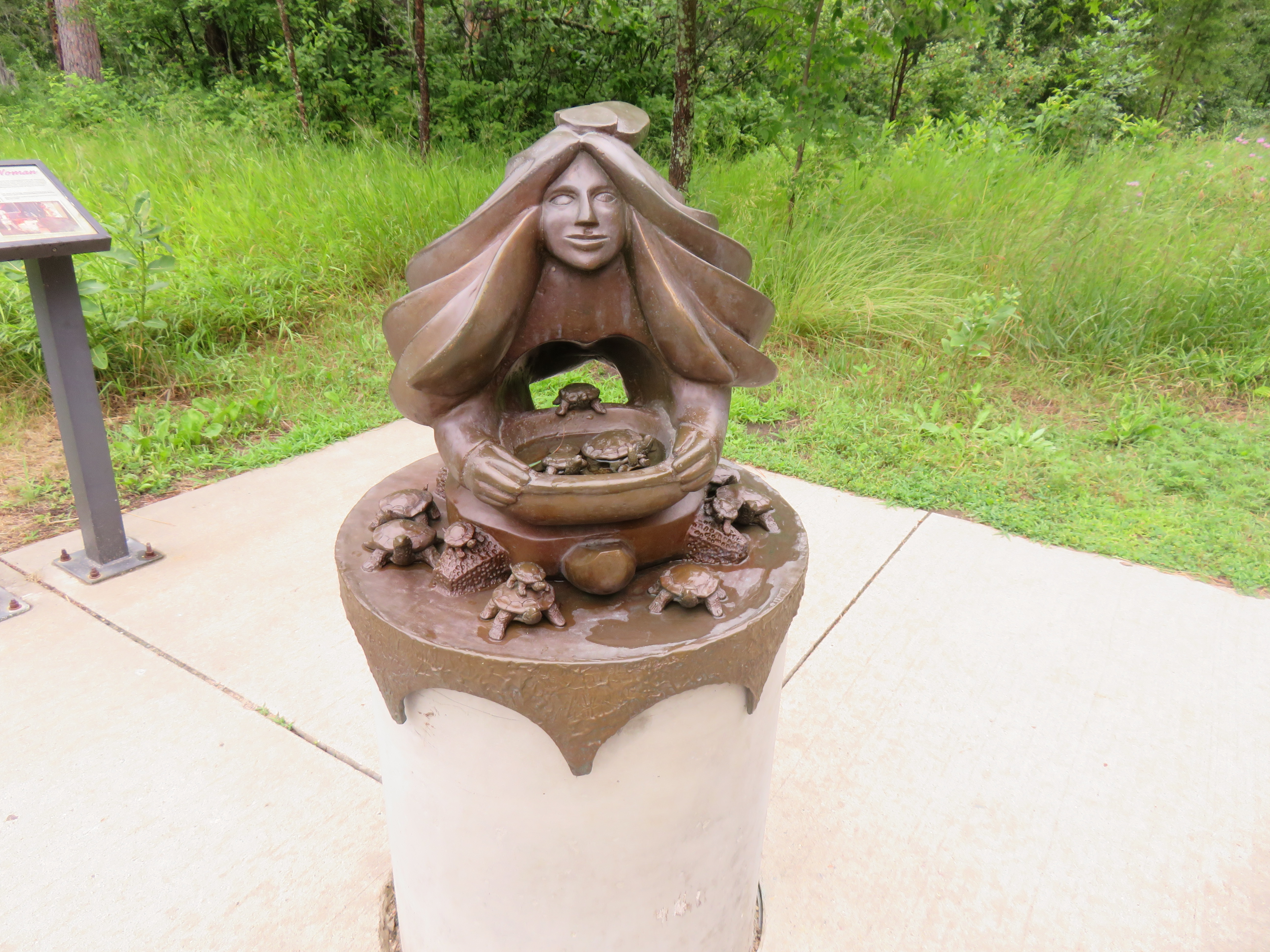
The Anishinabe (Ojibwe) believe that women are the Caretakers of the Water. There is a beautiful sculpture by Jeff Savage, near the headwaters, that depicts a woman leaning forward and releasing baby turtles from a basket. The turtles symbolize the universal cycles of life.
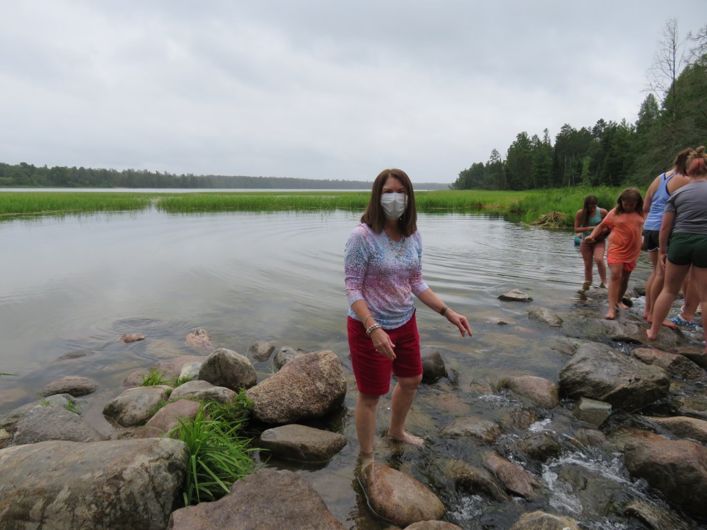
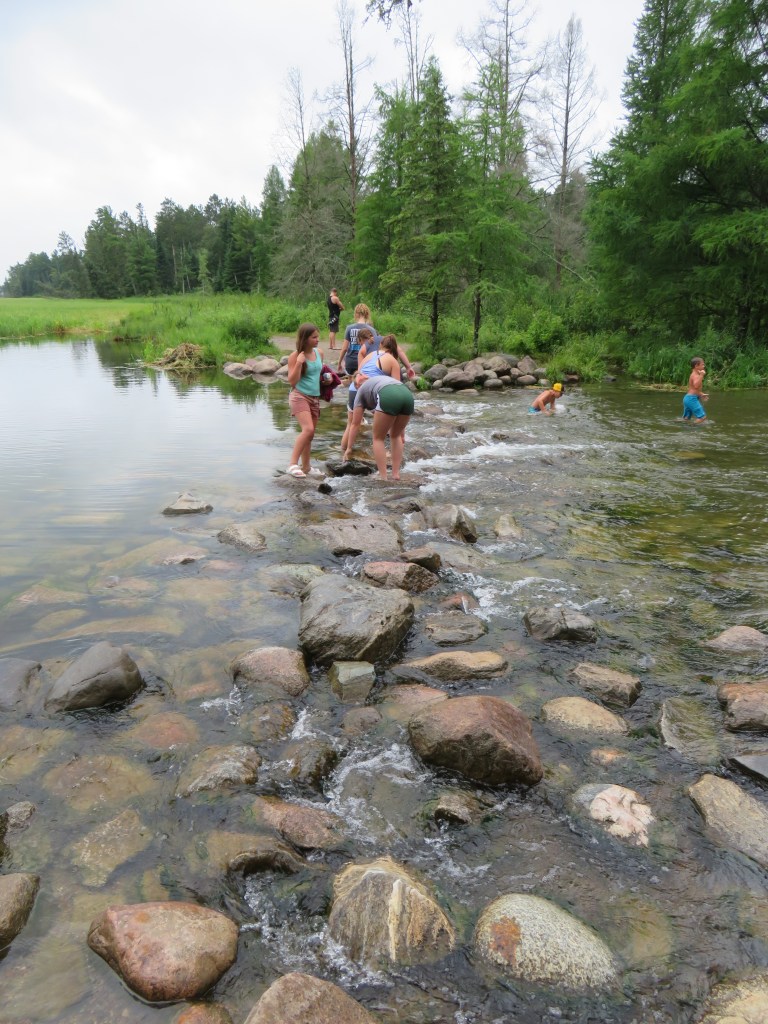
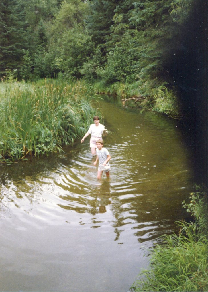
The park was fairly busy, though less than it might be if we didn’t have an epidemic. We did our best to maintain distance, and wore our masks when appropriate. The river is shallow at the beginning, so it’s very easy to cross at this point. It’s even possible to wade down river through the tall grasses, as my son and I did in the 1980’s.
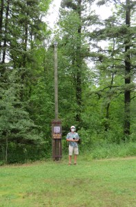
The Minnesota DNR has a webcam focused on the headwaters, so you can check it out any time, just like Mark is doing here.
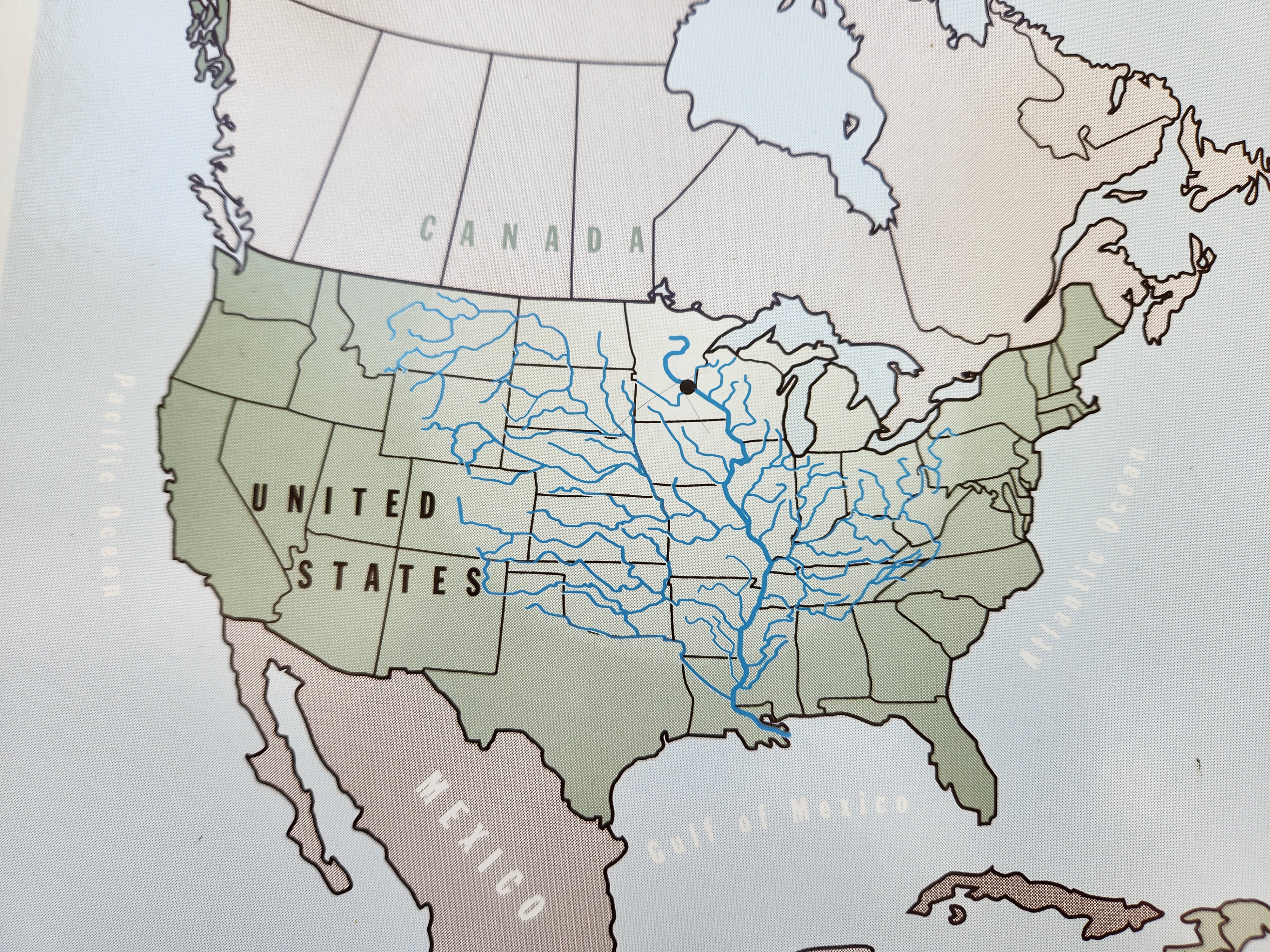
From Itasca, the river flows 2,350 miles to the Gulf of Mexico. Along the way it is joined by 250 tributaries that drain one-third of our country’s landmass. The Mississippi River watershed covers over 1 million square miles, in 32 states and 2 Canadian provinces.
As we were leaving the park, we spied our first National Route sign for the Great River Road, Minnesota. We followed it part of the way to Bemidji. This is Minnesota, and summer is road work season, so we we did have to take a detour for part of our first leg.
After an hour, we arrived in Bemidji, neighbor to three Indian Reservations: Red Lake, White Earth, and Leech Lake. The name means “river or route flowing crosswise.” Timber was big business in the 1800s and 1900s, and there is still some active wood industry.
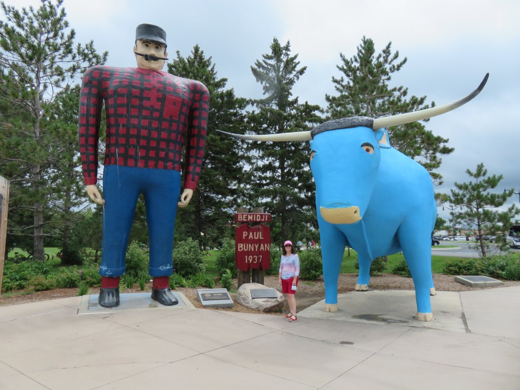
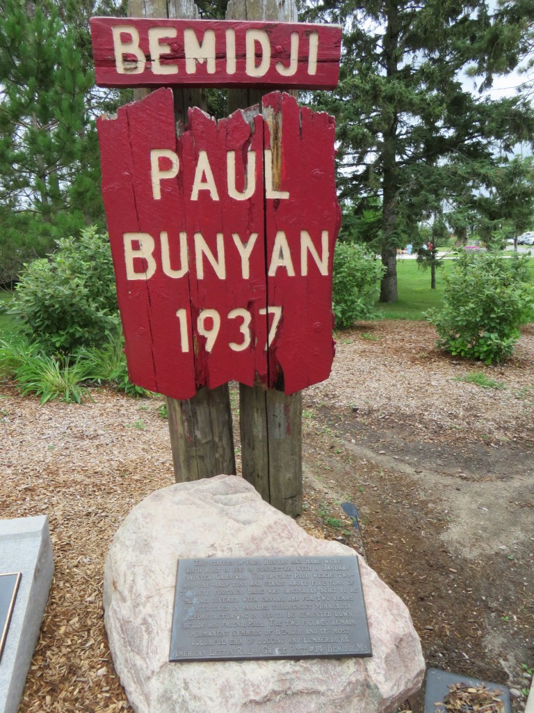
The town sits on Lake Bemidji, called Bemidjigumaug by the Leech Lake Band of Ojibwe. Paul Bunyan and Babe the Blue Ox stand guard over the lake. Their legend dates to the 1890s, with stories told by loggers about this giant of a man who exhibited great physical strength. These particular statues were erected in 1937, with Paul standing 18 feet tall, and Babe at 10 feet in height, and 23 feet in length.
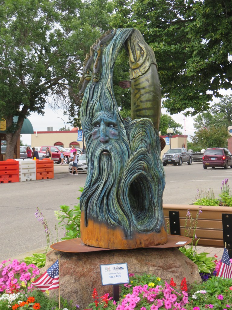
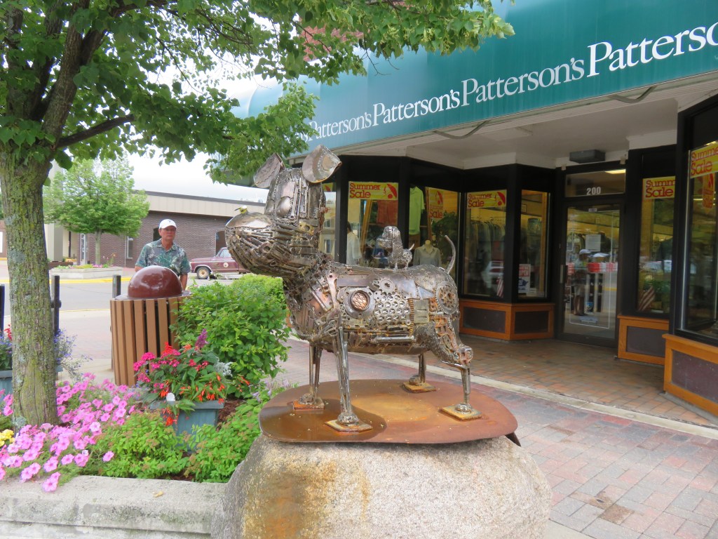
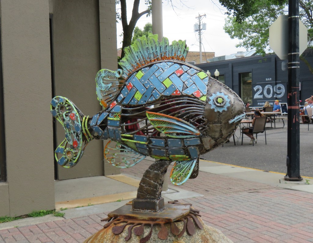
Additional sculptures and murals were on public display in Bemidji’s downtown area as part of the annual Bemidji Sculpture Walk.
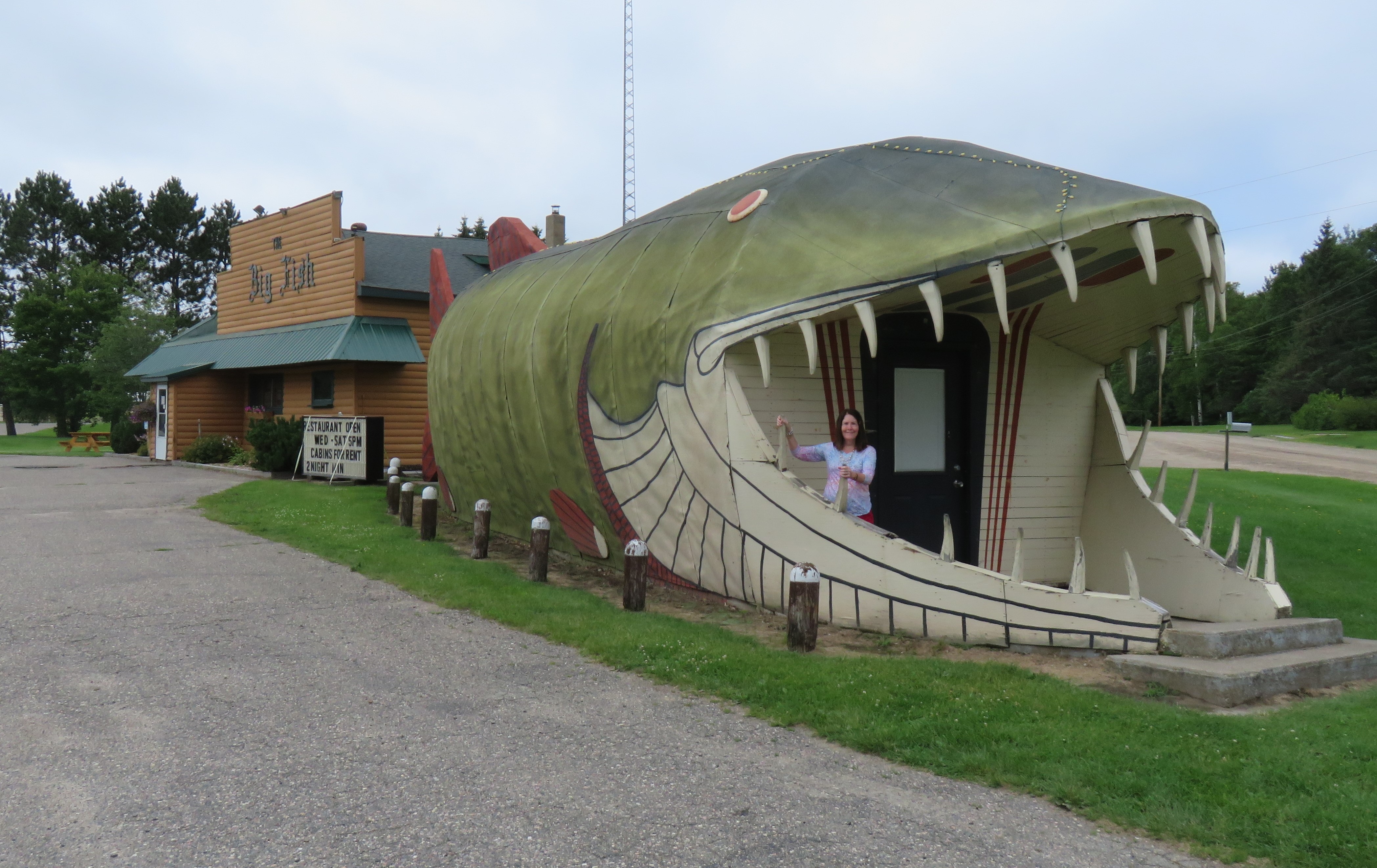
Between Bemidji and Grand Rapids, we drove by Cass Lake and Leech Lake. Located about halfway, is the tiny town of Bena, home of the Big Fish Supper Club. Enter through the jaws of a 65-foot, open mouthed muskie. If it looks familiar, you may have seen it in the 1983 movie “National Lampoon’s Vacation.” Unfortunately, it wouldn’t be open for several hours, so we moved on.
Leech Lake was called Ozagaskwaajimekaag-zaaga’igan (lake abundant with bloodsuckers) by the Ojibwe, and”Lac Sangsue” (Bloodsucker Lake) by the French. Do you see a pattern here? Supposedly, there aren’t any more here than in many other lakes, but I find it hard to get excited about swimming in it.
The third largest lake in Minnesota, Leech Lake also renowned for its fishing, with bass, bluegill, crappie, muskie, northern pike, perch, walleye and eelpout. Until recently, there was even an annual Eelpout Festival in Walker, which drew thousands of visitors to the area in February. The event was canceled in 2020 due to rising costs and difficulty of cleaning up afterwards. However, there is talk about starting it up again in 2024.
All Judy Garland fans know that she was born Frances Ethel Gumm in Grand Rapids, Minnesota. She lived here for only four years before her mother moved her and her sisters to California. The Judy Garland Museum is housed in her childhood home. The museum began hosting a Judy Garland Festival in 2019, the most recent one occurring in June, 2023. The event included themed dress up days, tours, a parade, a tea party, and more!
The museum had a pair of Dorothy’s Ruby Slippers for a short while, one of several pairs made for the “Wizard of Oz,” but they were stolen in 2005, and finally recovered in 2018. The shoes were on loan to the museum at the time. There was much speculation about those slippers, with even a documentary film titled “Who Stole the Ruby Slippers?” made in 2015. Those shoes have an estimated market value of $3.5 million! In 2013, someone approached the insurance company, claiming to have information about the slippers and how they could be returned. The FBI’s art crime unit organized a sting operation, and arrested a man who lived not far from the museum. Terry Jon Martin was charged in May, 2023 with the theft. The shoes are currently in federal custody, evidence for the case. Will they ever return to Minnesota? Can Dorothy click her heels and have them come home???
We continued a little further down the Great River Road, lined with trees and farms. We’ll be picking it up again soon.
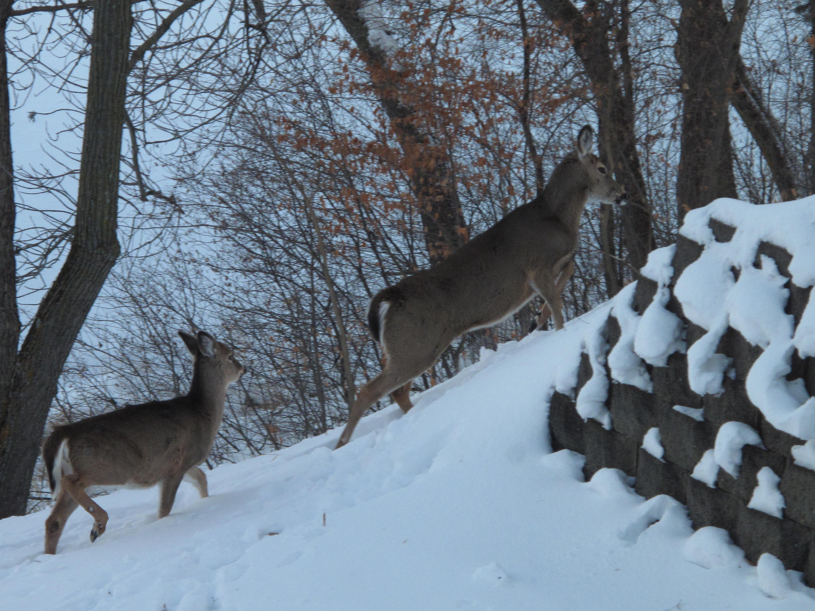
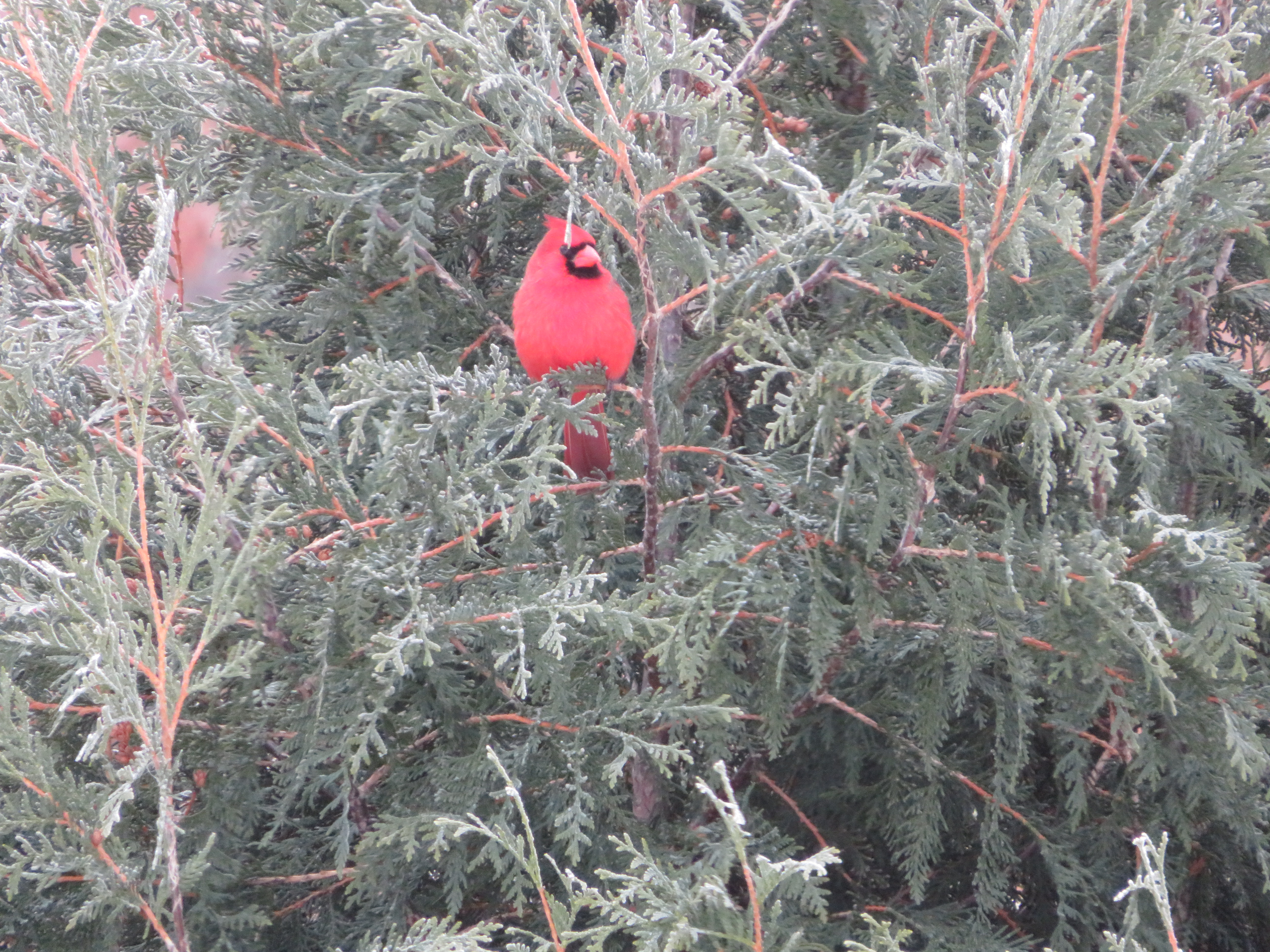
Every day is different when you live on a river, next to the Great River Road. When people admire the view from our home, we tell them that it’s a piece of art that constantly changes. In January, it is covered with ice, a highway for snowmobiles. Deer cross easily from the islands to the shore in search of food. It’s not quite as plentiful at this time of year, but they usually can find enough twigs and leaves to get by. If not, they have been known to nibble on our arborvitaes.
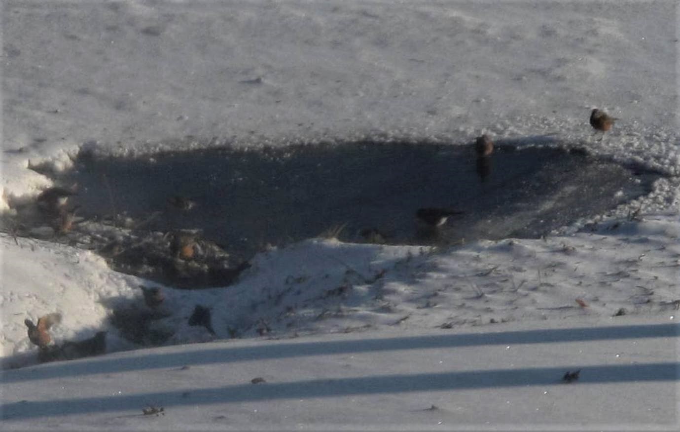
Eagles come by frequently, and can sometimes be seen sitting on the ice eating their catch. We’ve been visited by Sandhill Cranes, turkeys, fox, and stray cats and dogs as well. A few robins stay through the winter, and appreciate the small openings in the ice where they can get a drink. Cedar Waxwings may stop to dine on the hackberries.
The ice usually goes out in March, sometimes taking a few trees, and often leaving scars on the trees along the riverbank. There’s no guarantee that we won’t still get snow, though.
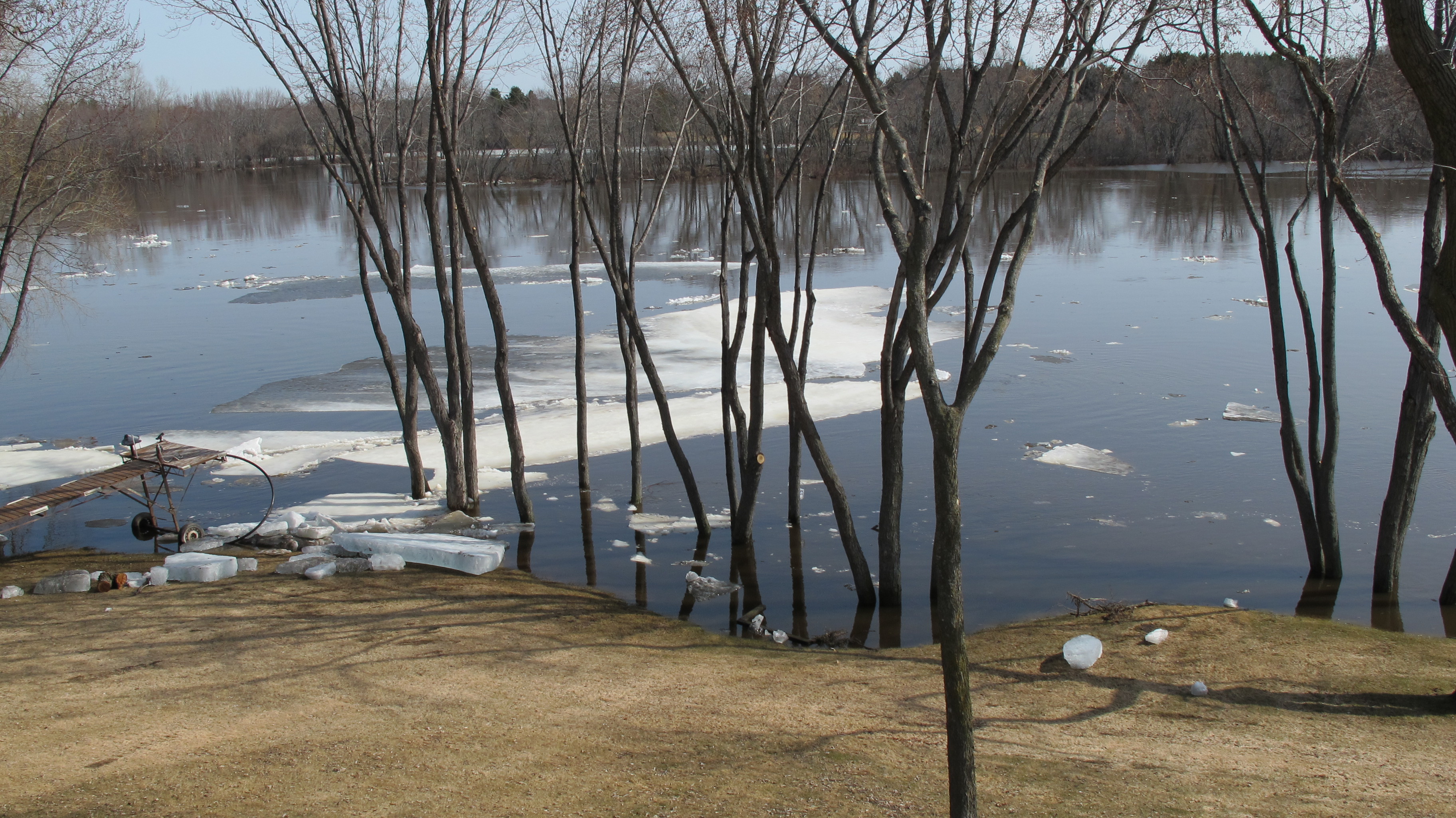
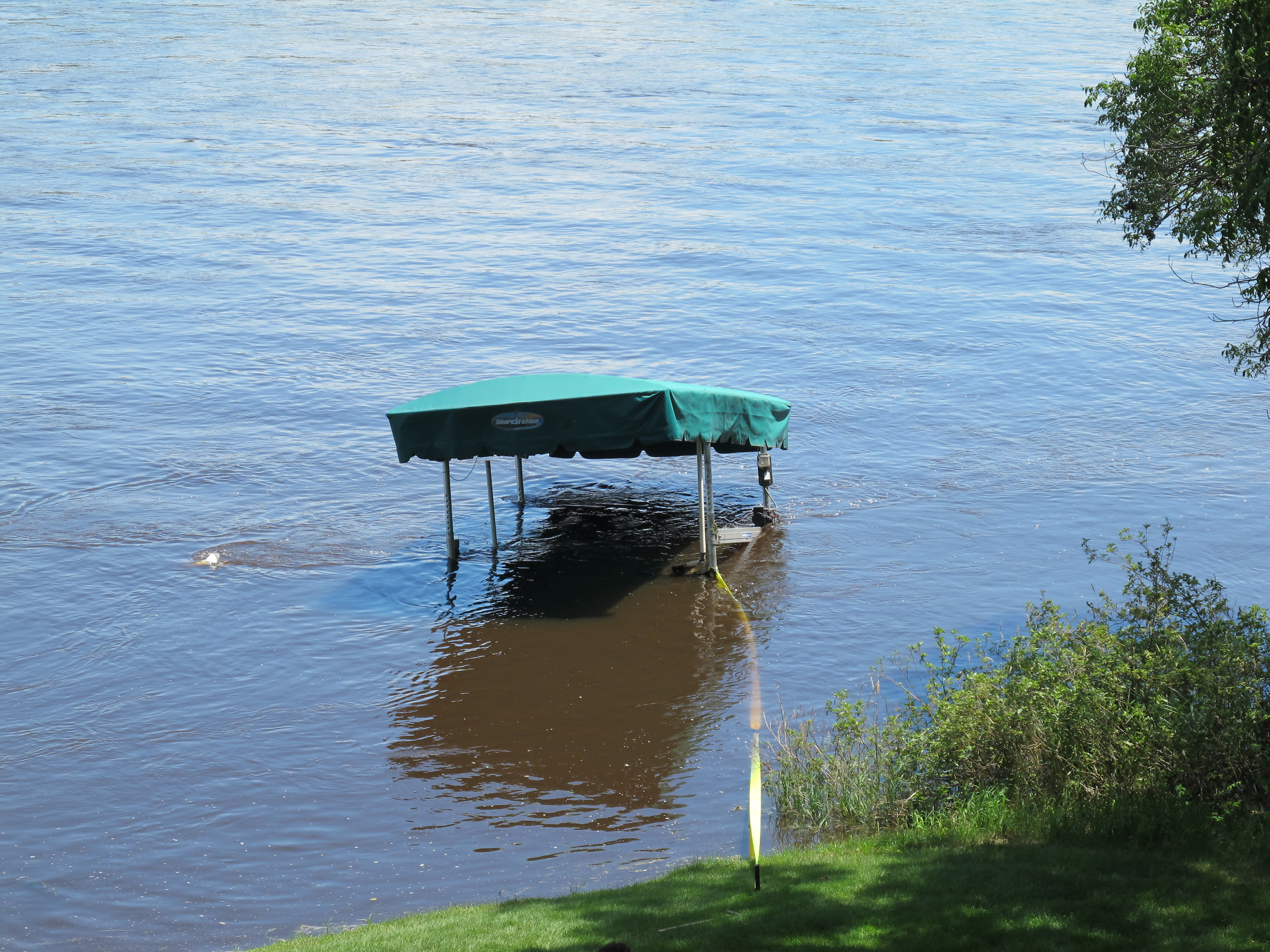
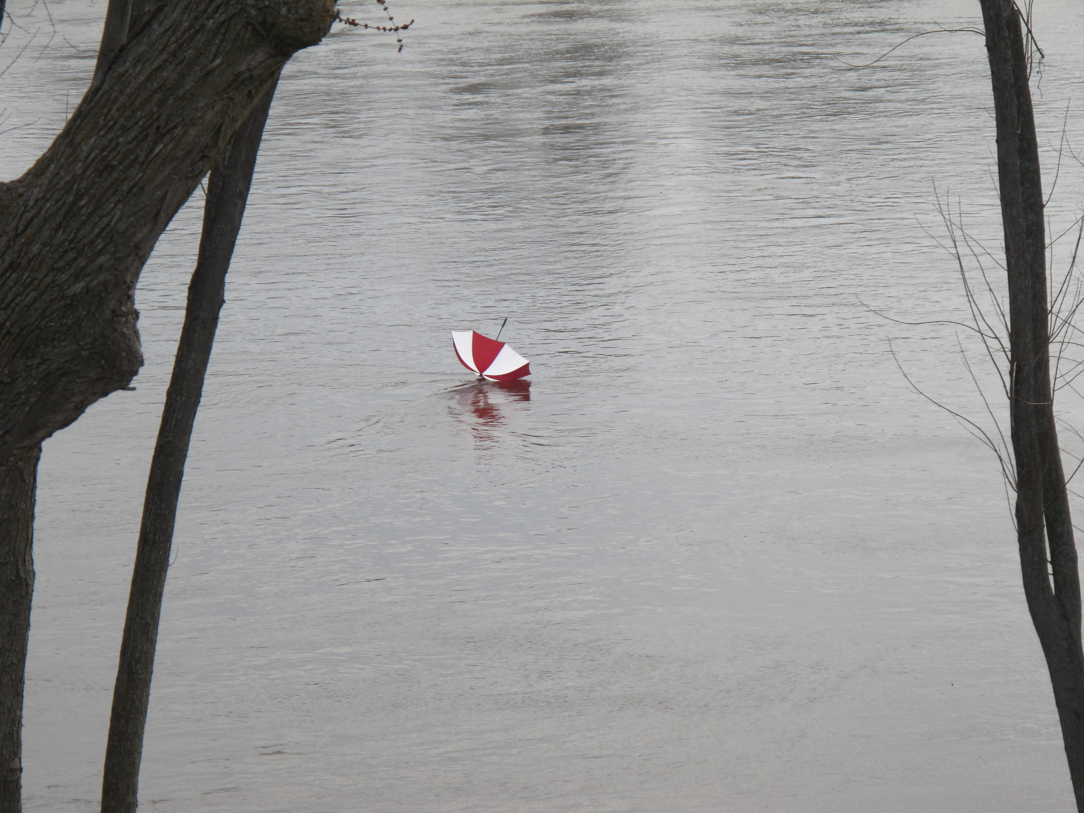
With spring, the river rises, flooding the yard, occasionally washing away docks and boat lifts, as well as other water toys. Most people wait a few weeks to put their boats in just to be sure the river won’t go up again. It’s not uncommon to see entire trees floating down during flood events.
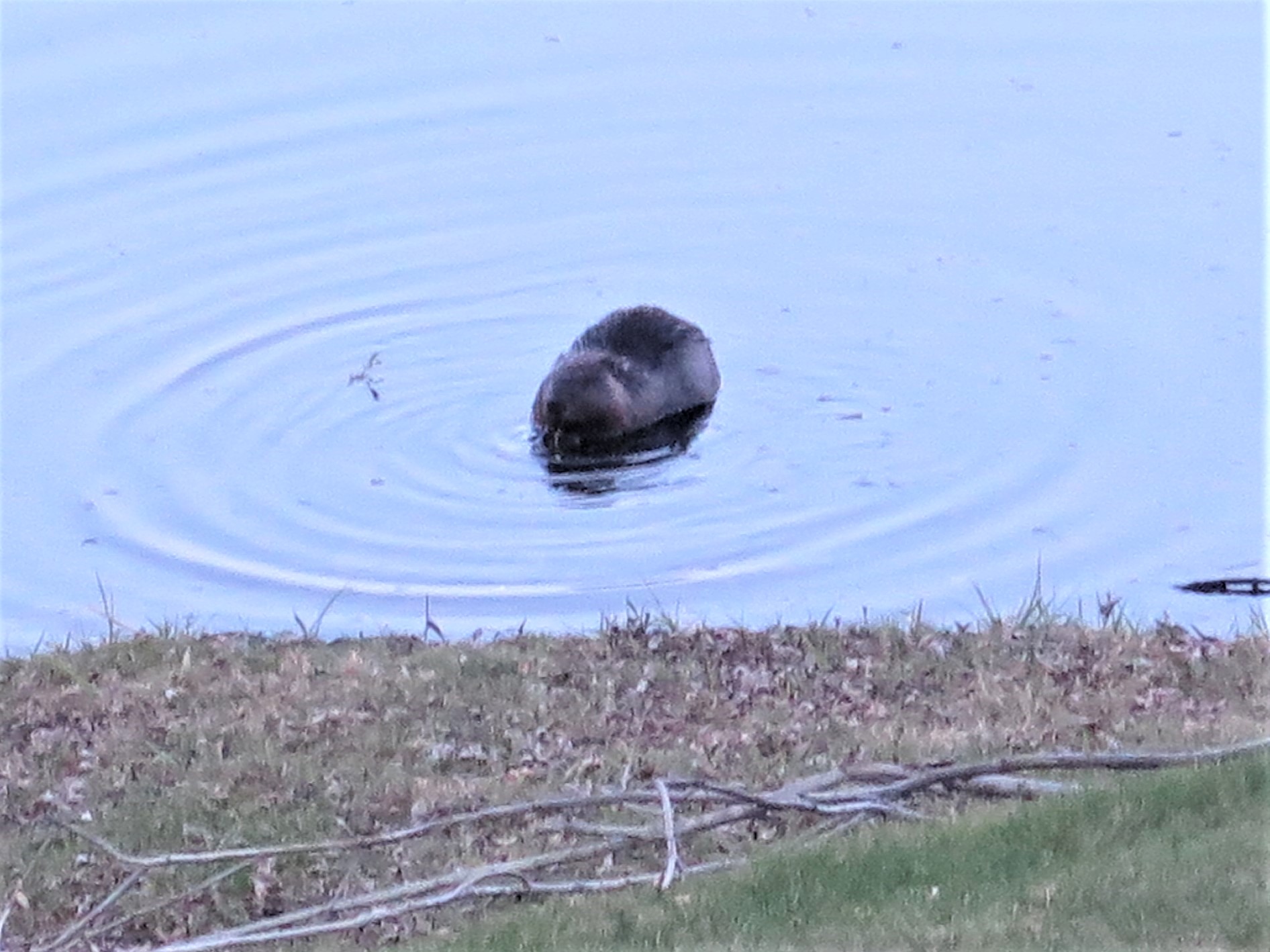
Spring brings many visitors to the river, swans, pelicans, loons, all returning to their summer homes. Beavers are looking for good dam sites; muskrats, otters are fishing, as are the eagles. We are fortunate to have a nesting pair of eagles only a couple of miles from here.
As the weather warms up, people return to the river, with their pontoon boats, deck boats, jet boats, water skis, jet skis, canoes and kayaks. We are frequently entertained with music from the island near our home. I would like to explain to some folks that while we may sometimes like their music, we often don’t, especially when it’s loud enough to hear in the next county. Oh well, it’s a short season, so we put up with it. Most are done by mid-October, but we will see a few die-hards on warm fall days.
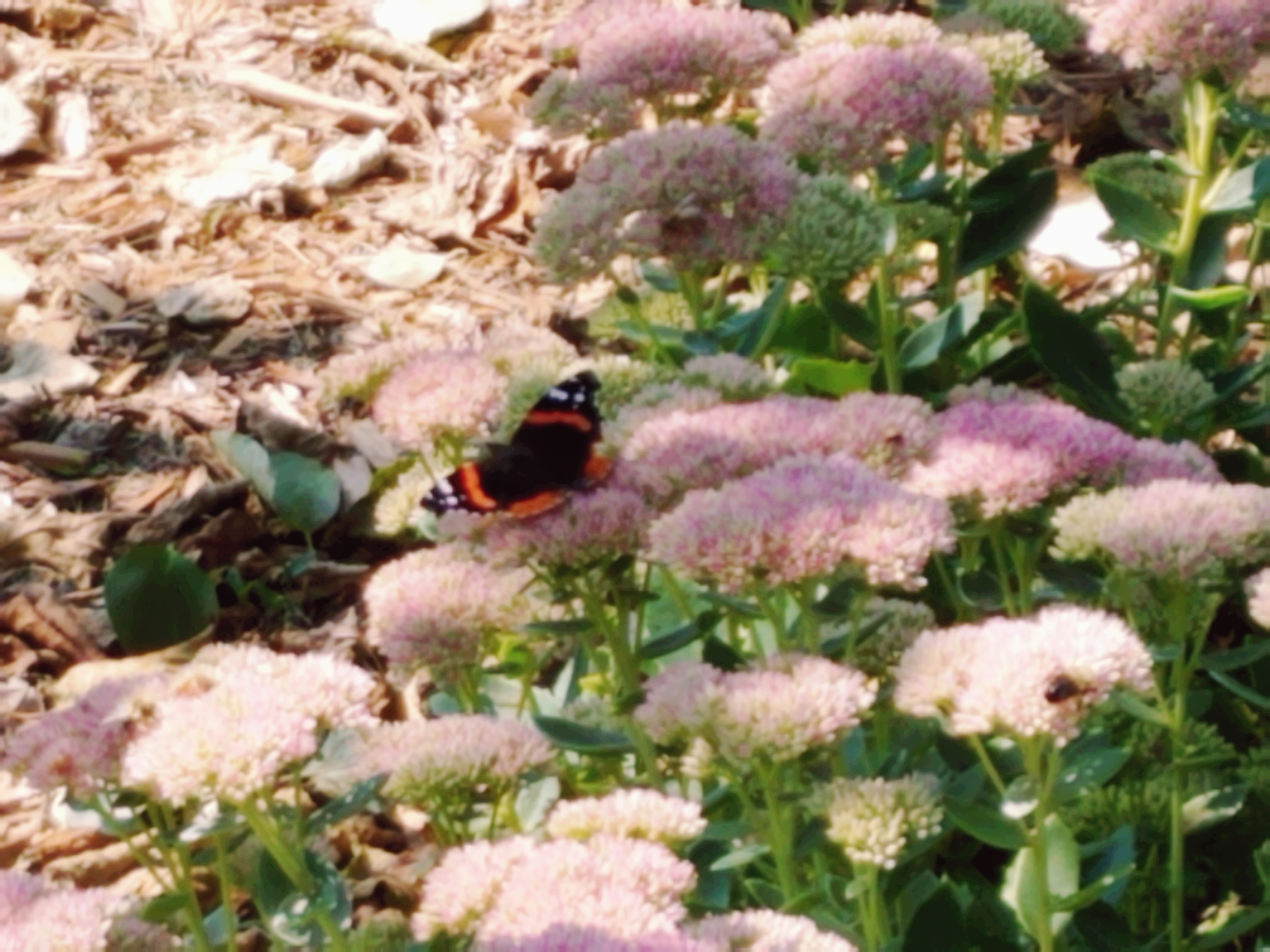
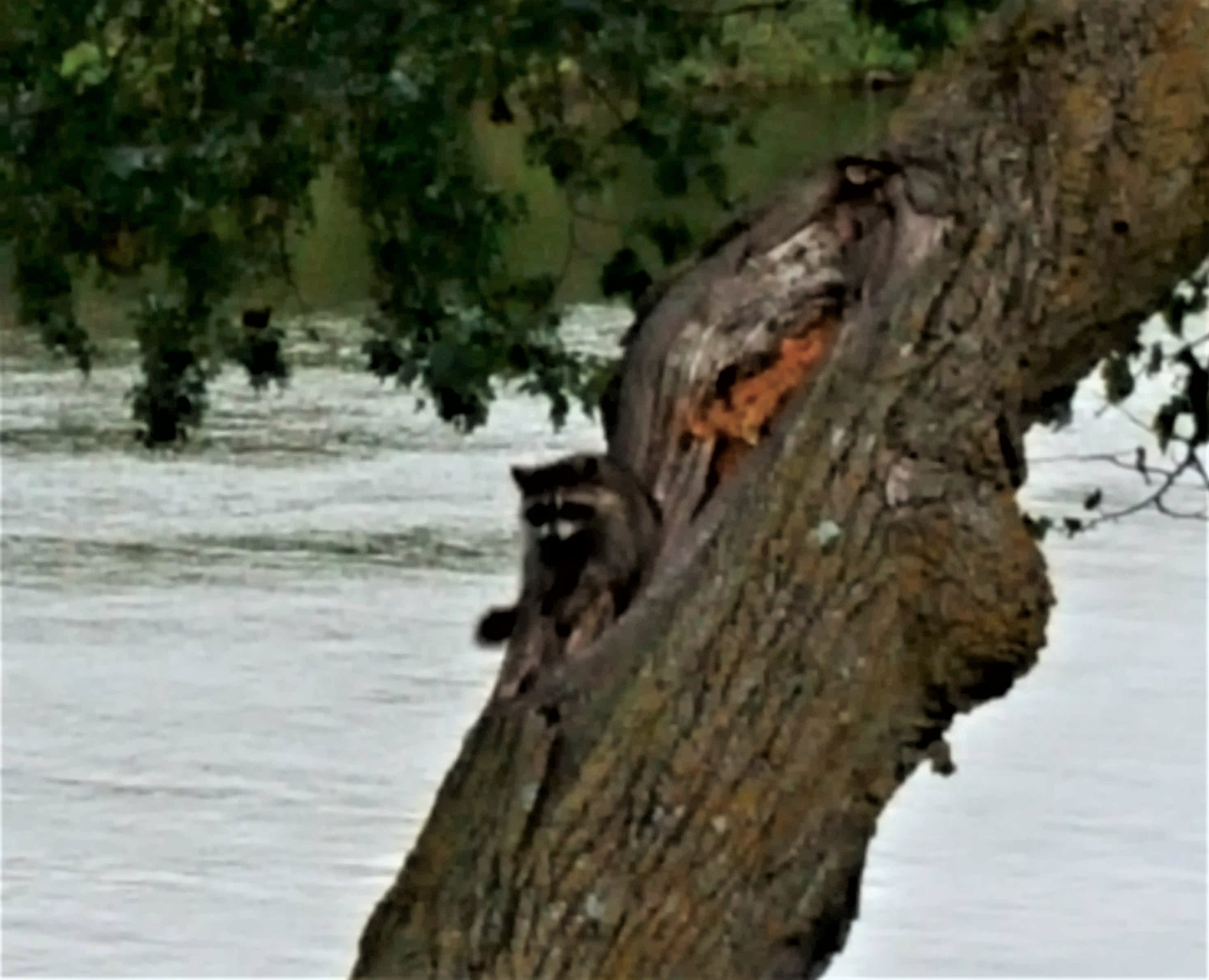
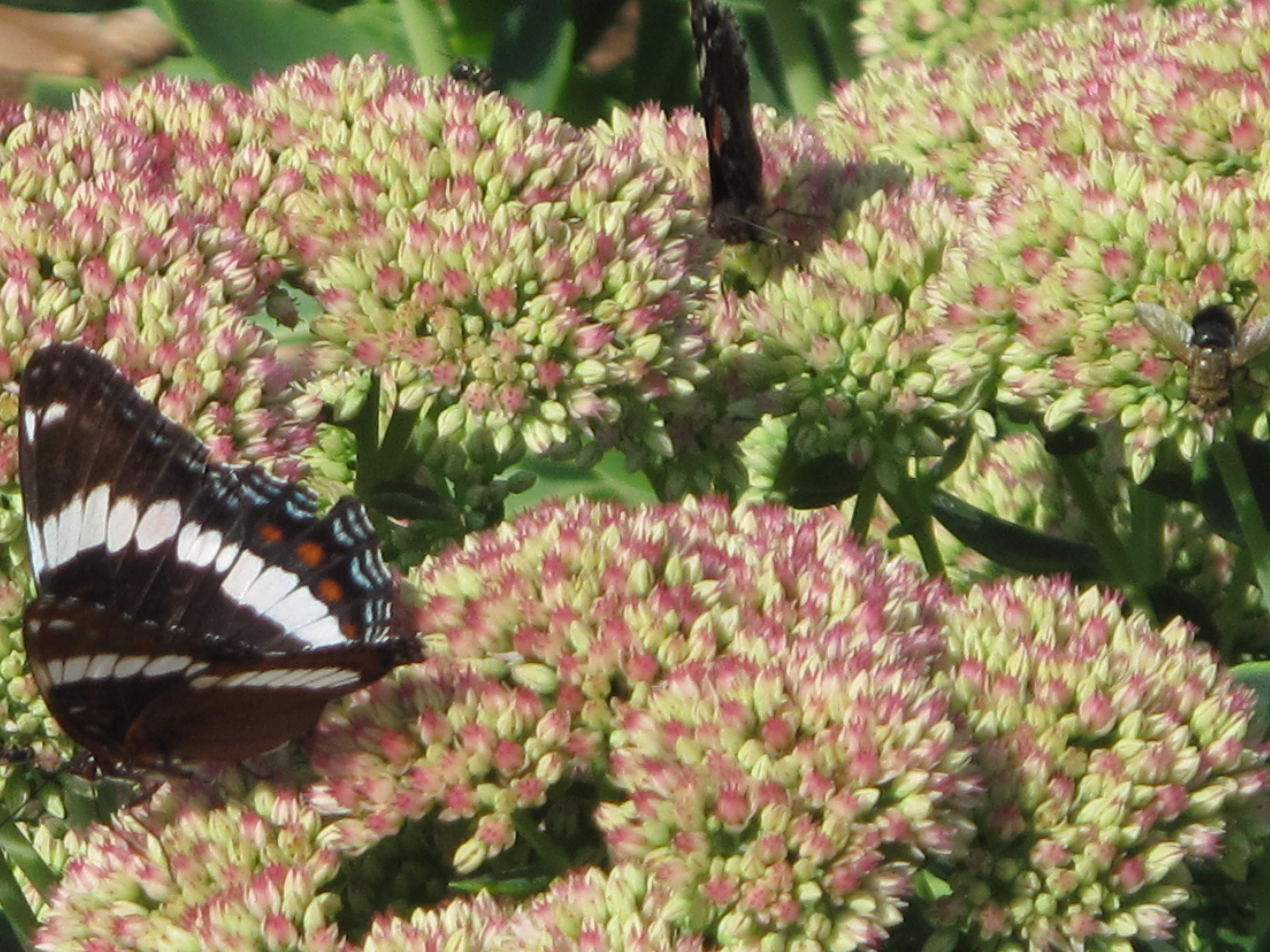
Along with the people, there are frogs and turtles, butterflies, dragonflies and damselflies. There are colorful birds, squirrels, raccoons (who like to eat our raspberries), and deer of course (who consider our flower gardens their personal salad bar.)
One day I even saw dragonflies hatching by the river. The nymphs climbed out of the water onto a warm rock. Then, they started emerging from their shells, head first, looking like small aliens. Next the wings emerged, and soon they were ready to fly. It was fascinating to watch.
Our local river neighborhood has been putting on a Fourth of July fireworks show for quite a few years. We are close enough to enjoy it from our yard. Others on the river begin showing up in their boats after dusk, adding their own lights to the show.
You don’t have to live on the Mississippi River to enjoy the Northern Lights, but you do have to live far enough north. We don’t often get to see them, but when we do, it’s a true delight.
On a daily basis, we experience only a small section of this great river. So much of our nation’s history centers on the Mississippi River, which was a route for many people to begin moving west, especially after the Louisiana Purchase. Many came from Kentucky, Tennessee and surrounding states to find a new home in the new territory, building flatboats to float their possessions down the Ohio River to the Mississippi, then dismantling the boats to build new homes, or wagons for the next phase of their journeys. The Mississippi has also served as a major commercial highway, moving goods up and down, and across the country via its many tributaries. A large part of our country was accessible by tributaries of the Mississippi River.
We hope to learn more about this mighty river on our upcoming Mississippi River cruise, just a few days from now. We have been waiting three years to take this trip, since our first reservation was cancelled due to COVID. We began exploring the Great River Road in anticipation of that earlier cruise, so some of the posts you will read are already three years old! I’ve done my best to update them where appropriate. Enjoy the journey with us!
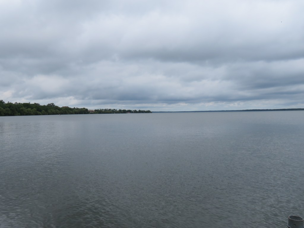
I have lived in Minnesota most of my life, but have never visited the state’s only national park. We are staying at a place near Orr, MN, only an hour’s drive, so today, we took off to remedy this.
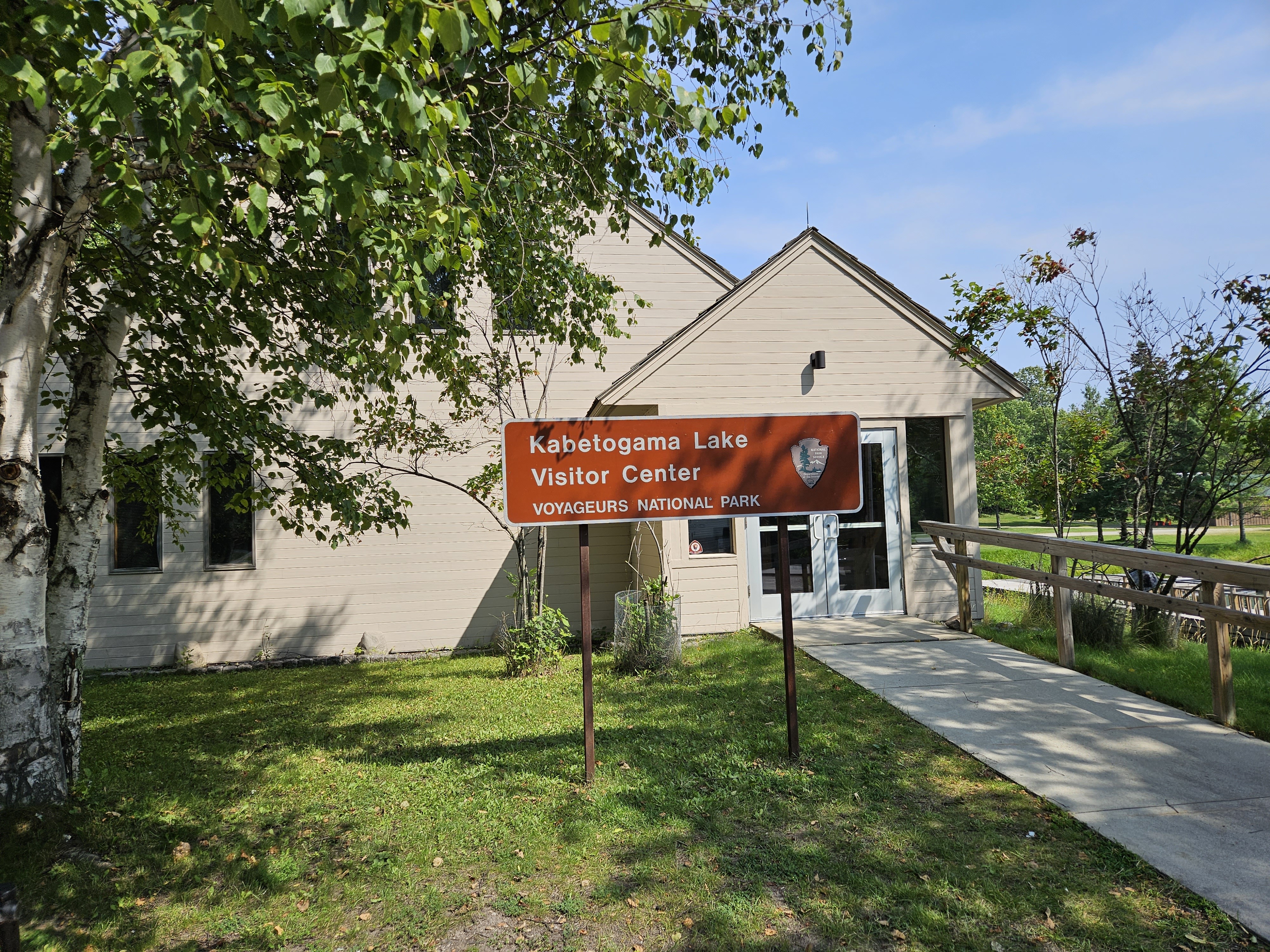
Voyageurs National Park was established in 1975, and includes dozens of lakes, the four largest of which are: Rainy, Kabetogama, Namakan, and Sand Point. The park has 655 miles of shoreline, more than 500 islands, and several campsites and over 50 miles of trails. The northern edge of the park is on the Canadian border in Ontario Province. There are three visitor centers: Ash River, Kabetogama and Rainy Lake. Kabetogama was closest, so we headed there. There are a few exhibits in the visitor center, and we watched a short film about the park’s history.
This area has been occupied by humans for almost 10,000 years, moving here after the glaciers receded. Around 8,000 years ago, nomadic peoples hunted, gathered grains, and fished here. French fur traders, called voyageurs, came in the late 1600s. During the 1700s, demand for beaver fur, increased their presence. These voyageurs traded and interacted with the Ojibwe who where the primary Native American residents. The voyageurs paddled their canoes through these lakes and rivers, transporting goods east and west. A 1783 treaty established part of the trade route as the boundary between the US and Canada. Boaters need to be aware of the boundary so they don’t accidentally cross between countries.
Rainy Lake experienced a mini-gold rush in the late 1800s. George Davis found a vein of gold-bearing quartz on Little American Island in 1893. The Little America Mine was developed, along with Rainy Lake City. Several more mines followed (there are 13 mining sites in the northwestern part of the park,) but very little gold was found here. The industry went bust after only five years, and Rainy Lake City disappeared.
Voyageurs was first proposed as a park in 1891, by people who wanted to keep encroaching industry at bay. It took 80 years for Congress to authorize it as our nation’s 36th National Park in 1975.
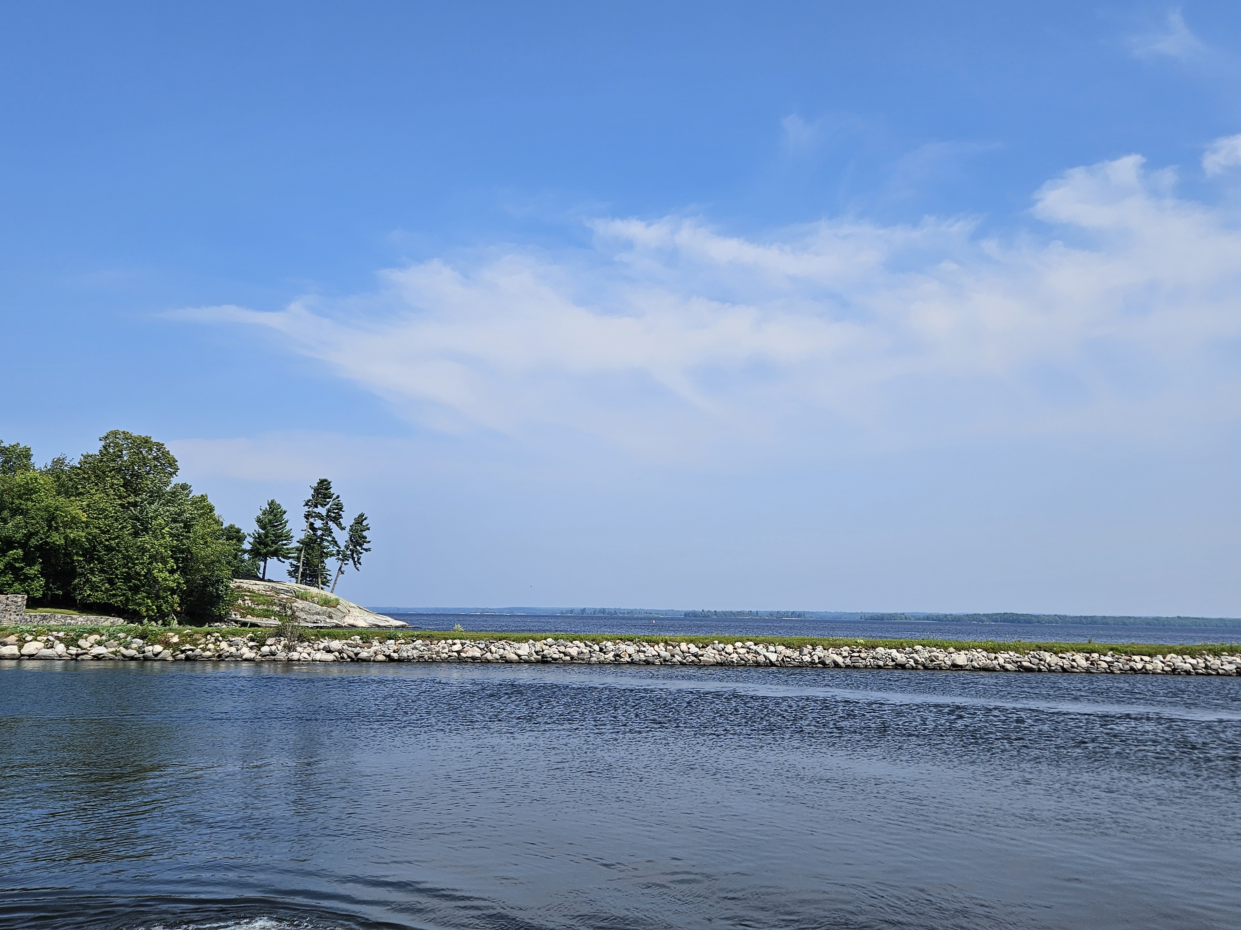
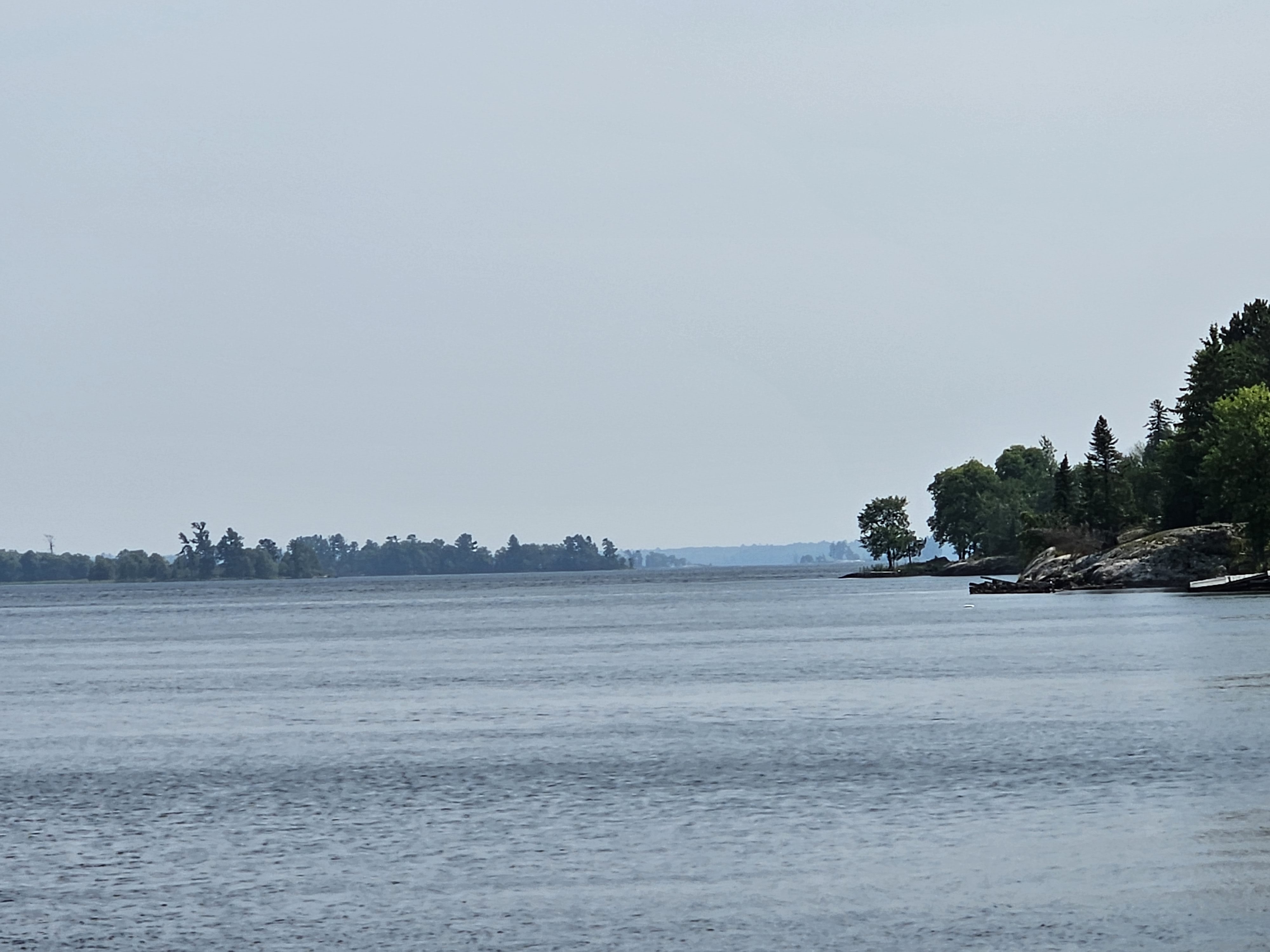
This was just a day trip. The best way to explore the park would be by boat, and rangers do lead seasonal boat tours. In lieu of that, there are several local firms that rent boats, including houseboats. Still, we walked along the shore line at a couple of locations, and enjoyed the views. Sadly, the day was a little hazy due to the wildfires in western Canada. There are some active fires as close as Thunder Bay, only a couple hundred miles away. Today’s air quality was moderate.
The park is also popular in the winter, with 16 miles of trails for cross-country skiing and snowshoeing, and 110 miles of marked snowmobile trails. When the ice gets thick enough, two ice roads, one from Rainy Lake Visitor Center, and one that runs between the Kabetogama and Ash River visitor centers.
You will find people fishing here year round, including ice fishing in the winter, as the lakes are populated with many species, including walleye, northern pike, crappies, smallmouth bass and more.