Crystal Serenity Sea Days

January 8 & 9, 2020

Wednesday

One of the things we love about Crystal Cruises is the quality and variety of lectures and classes that are offered. There are classes in technology, knitting, bridge, art, golf, yoga, dance and much more. Lectures address local culture and history, global and local politics, and more.

Entertainment is also varied, including song and dance, magic, comedy, daily movie offerings (with popcorn), piano bars, and a casino. People have asked me how we avoid becoming bored on “sea days.” My response is that, with the offerings on board, any boredom would be my own fault.

Three different lectures were offered today, and we opted to attend two. Unfortunately, the afternoon lecture interfered with nap time!

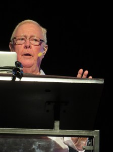
A Special Interest Lecturer, Richard D. Morgan retired as the General Services Director of the Panama Canal Commission. He has worked and lived at the Panama Canal for 26 E30385BC-A7D6-4201-9988-23BAF090AE5Eyears, and clearly enjoys talking about the history of the canal. The Panama Canal Commission was an independent agency of the US Federal Government. As such, it was tasked with the responsibility of breaking even, costing the American taxpayer nothing.
Before the canal was built, the best way to cross the Isthmus of Panama was by rail. The Panama Canal Railway was built in the 1850s in response to the great numbers of prospectors heading to California gold rush of 1849. It was moved and upgraded in the early 1900s to facilitate the building of the Panama Canal. Mr Morgan will be doing a series of four lectures on this cruise.

We learned a bit more about Brexit this morning as well. Roberto D’Alimonte, a professor of politics at Luiss University in Rome, gave us some background about Great Britain’s attitude towards the EU. According to D’Alimonte, Britain’s approach to Europe has been to be “with them, but not of them.” As far back as the 1950s, Winston Churchill made this clear when he said “We are not members of the European Defence Community, nor do we intend to be merged in a Federal European system….We have our own Commonwealth and Empire.” Hearing this, I was surprised that Britain ever did agree to join the European Union. Indeed, it was several years before they joined, and they had to make several concessions at the time, concessions they came to regret.
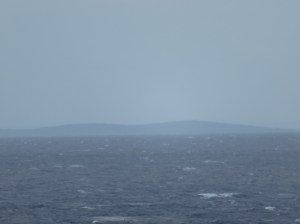
1E9556CC-A563-4339-B027-8A8C8FD249C4On our first morning, we cruised by Cuba. It was barely visible in the distance. I was reminded of a time, some 20 years ago, when I was on a flight that was going through Cuban air space. We were told to close the shades on our windows, and to not take any photos as we flew over. I couldn’t help but wonder who would see those cameras from so many thousands of feet below.

Tonight is our first formal night, so we’ll get dressed up and dolled up for the big night. After dinner, we enjoyed a comedy show with stand up comic John Joseph, who has appeared on several TV shows, in movies, on Sirius XM, and has gone on tour with the likes of Rodney Dangerfield, Huey Lewis and the News and others.

Thursday

C4BC0BB8-51B7-4655-9781-EB60A8B5E0E5Our first lecture this morning was about Cartagena, Colombia which we’ll be visiting tomorrow. Ian Maclachlan, Professor Emeritus of Geography at the University of Lethbridge in Alberta, Canada talked about some of the history, both colonial and recent. Colombia has gone from being a “failed state” to one that is much more stable, both politically and financially.

Another of today’s lecturers is Scott Kelly, retired astronaut whose identical twin, Mark Kelly, is also a retired astronaut. Scott spent a year in space, one of the longest sojourns of any astronaut. He and his brother were subjects of a three year NASA Twin Study, comparing the effects of space on long time travel. Kelly was a very entertaining speaker, one we could have listened to for much longer. He spoke to the value of aiming high, and approaching it with small steps.

After dinner, we attended to a Billy Joel tribute, called “My Life,” by Welsh musician James Fox. We’ve had the pleasure of hearing him on a cruise a few years ago, when his show was called “Piano Man.”

Posted in Crystal Cruises, Panama Canal | Tagged , , | Leave a comment

Panama Canal

Monday, January 6, 2020

Tomorrow, my husband and I will board the Crystal Serenity to cruise the Panama Canal. To prepare for this trip, we watched the PBS American Experience episode: “Panama Canal, Gateway to the American Century.” This 1.5 hour video was very informative, but really only touched the surface of the history on the Canal, and primarily only the US involvement.

To dive deeper, I also read David McCullough‘s book: “The Path Between the Seas, The Creation of the Panama Canal 1870-1914.” McCullough’s study begins in the mid-1800s, when several countries were exploring options to shorten the distance between the Atlantic and Pacific Oceans. Both Nicaragua and Panama (then a province of Colombia) were considered for a canal. The French spent a few decades and hundreds of millions of dollars trying to build a canal, only to have the venture collapse in scandals and bankruptcy. The US took over in the early 1900s after aiding and abetting a Panamanian independence movement, finally completing the job in 1914.

The PBS episode was broadcast in 2011, and is no longer on the website. However, you might find a copy on line or at your local library.

McCullough’s book is over 600 pages, so might be a little daunting. It’s not a fast read, but I did manage to finish it a few weeks ago. If you are interested in more detail than the video gives, I do recommend it.

The US spent over $350 million to construct the canal, after the French had already sunk $287 million. In today’s dollars the total would amount to more than $14 billion! The Canal takes in about $2 billion per year in revenue, netting Panama’s treasury about $800 million per year, not a bad return on the investment.

Control of the canal was transferred to Panama in 1979, with US involvement phasing out over the next 20 years. An expansion project proposed by Panama President Martin Torrijos in 2006, added a new lane of traffic allowing more and larger ships to pass through. The project added two new sets of locks, one on the Atlantic side and one of the Pacific, and widened and deepened existing channels. The expansion, which doubled the canal’s capacity, was completed in 2016, with operation beginning in June of that year. The expansion allowed for a 50% increase in ship length, from 106 feet to 168 feet. Cargo capacity doubled, from 52,000 to 120,000 tonnes.

The history of the Panama Canal dates back much farther than either the French or US involvement. The idea of a passageway between the Atlantic and Pacific Oceans was first proposed at least as far back as the 1500s, when King Charles I of Spain had his regional governor survey a route along the Chagres River.

San Juan del Sur, Nicaragua was once considered in the 1800s for the western end of a Nicaraguan canal, before the current site was chosen. Cornelius Vanderbilt was a well known proponent of the Nicaragua option. The idea wasn’t completely abandoned, though. In 2013, Nicaragua’s National Assembly approved a bill to grant a 50 year concession to a Chinese Billionaire, Wang Jing. However, his fortunes took a hit during the Chinese Stock Market crash of 2015-2016, and the project is now considered defunct by all but Jing.

We look forward to learning more about Panama and the Canal as the days go by.


Posted in Crystal Cruises, International Travel, Panama Canal, Uncategorized | Tagged , , , , | Leave a comment

Arcosanti: An Urban Laboratory

December 18, 2019

This was our last full day in Sedona, and the sun was shining – time for one last hike. Twin Buttes and Broken Arrow Loop are located on the eastern edge of Sedona. The 2.2 mile loop was just right for today. This is a multi-use trail, where we saw mountain bikes and jeeps as well as those on foot like us. A short portion of the trail, rated Double Diamond for mountain bikes, allows less than a foot for passage, but it was definitely doable.

Dinner tonight was at Creekside American Bistro, and we heartily recommend it. Mark enjoyed lamb while I had salmon. Both were good, but the best part was dessert – a delicious warm peach cobbler. We ate every bite.

December 19, 2019

This morning, we had breakfast at the Coffee Pot Restaurant, which offers breakfast 7D4CA31B-4005-48D0-B543-CCF528A7E35F all day, including 101 Omelettes! It took about 10 minutes just to read the menu. We had no complaints about the meals we ordered.

Then, we drove to Phoenix for tomorrow’s flight home. On the way, we stopped at Arcosanti, which describes itself as an urban laboratory. Pablo Soleri, trained under Frank Lloyd Wright, was an Italian architect who had a vision of a community where the architecture was coherent with ecology, a concept he called “arcology.” It was intended as an alternative to urban sprawl. Soleri designed and began building Arcosanti in the 1970s. The community is located about 75 miles north of Phoenix.

The original design was to accommodate a community of 1,500 people, but more recent numbers are closer to 100 permanent residents, with current residents numbering about 50. Besides apartments for the residents, there are dormitories for students and workshop participants. This organization has been around for almost 50 years, and while it may not seem to be very successful, it has proven its ability to persevere.

Arcosanti gets about 40% of its revenues from bells that are made here. We were able to observe some residents at work on the bells while we were there.

Tomorrow, we head back to Minnesota’s deep freeze.

Posted in Architecture, Arizona, USA Travel | Tagged , , , , | Leave a comment

A Grand Day by Plane, Chopper and Boat

December 17, 2019

Grand Canyon National Park, celebrating its 100th birthday this year, is a destination for millions of visitors each year, coming from all over the world to view what many consider to be one of the Seven Natural Wonders of the World. Our first visit was fifteen years ago, by helicopter from the South Rim. The memories are still vivid. We were moved to tears by the stunning landscape below and beside us as we flew into the canyon.

Stretching 227 river miles, with an average width of over 10 miles, the canyon is not fully contained in the park. The West Rim lies outside the park, operated by the Hualapai Tribe, whose land includes a part of the Grand Canyon and the Colorado River. The name Hualapai means “People of the Tall Pines,” referring to the Ponderosa Pines found here.

To drive to the west rim would have taken about five hours each way, a bit longer than we wanted to spend on the road. Fortunately, Sedona Air Tours offered a day trip from nearby Cottonwood. We flew out this morning at 8:00, headed to the Grand Canyon West Airport near Peach Springs, AZ. The day was sunny, though cold, and we were treated to some lovely views of northwestern Arizona.

Then we hopped on a helicopter to take a ride down to the Colorado River, where we boarded a skiff for a short ride up and down the river. Again, the scenery was awe-inspiring.

After the boat ride, we headed back to the top to walk on the Skywalk at Eagle Point. Taking 18 months to construct, the Skywalk was ready for visitors in 2005. It’s a cantilever bridge, consisting of 46 glass panels, weighing over 40 tons, with each glass panel capable of supporting 800 people (not that they could all fit physically)! A cantilever bridge is supported on only one end, in this case by eight columns that support box beams anchored 45 feet into the limestone bedrock.

Although photos online make it look quite large, it actually extends only about 70 feet over the canyon, somewhat disappointing. Granted, it is 4,000 feet above the floor, and that’s impressive. The Skywalk is located at Eagle Point, so named for a rock formation in the canyon.

We weren’t allowed to take cameras onto the Skywalk, but there were official photographers there to take cheesy photos if you wished. We succumbed, but I’m really not sure why. They really were cheesy.

Our final stop was at Guano Point, which proved to be more interesting for the views and the history. Back in the 1930’s a boater on the Colorado River discovered a guano (bat poop) cave, and thought this would be a good source for fertilizer. Guano was big business, in fact, and the 1856 Guano Islands Act claimed that the United States could claim any island that had seabird guano on it. Midway Atoll was acquired under the aegis of this act.

The U.S. Guano Corporation bought the property and cave, thinking there was more than 100,000 tons of guano in the cave. After spending $3.5 million to build a tramway system to extract the guano, they found there was only about 1,000 tons. A 7,500 foot cableway crossed the river from the cave to what is now called Guano Point. The cableway was destroyed some years later when a U.S. Air Force Fighter jet crashed into it.

After lunch, where we were visited by hungry ravens, we hiked a short trail to Guano Point, where there were great views of the Colorado River as well as the surrounding rock.

We did enjoy the day, and think this was the best option from Sedona. Similar trips go out of Las Vegas as well, although it is a much shorter drive from there.

Posted in Uncategorized | Leave a comment

West Fork Trail, Sedona

December 16, 2019

We thought we would be escaping the cold in Minnesota, but today the temperature didn’t get much above 40°. Of course, that’s still quite a bit warmer than home, where it’s hovering close to zero. The sun was shining, so we decided to brave the temps for a hike in West Fork Trail in Oak Creek Canyon, a trail recommended by good friends of ours.

The West Fork Trail is considered to be one of the top 10 trails in the United States. It’s a little over 6.5 miles round trip, following Oak Creek for most of the way. If you hike the entire trail, you will cross the creek in thirteen places, using rocks and fallen logs as your bridges. Those rocks and bridges can be slippery, as we found when a foot ended up in the freezing water (once or twice for each of us.)

A portion of the trail is named The Call of the Canyon, for a book of the same name by western writer Zane Grey. Grey set several of his novels in Arizona, and even built a cabin in Payson, AZ, about 80 miles southeast of Sedona. The Call of the Canyon was adapted for a silent film in the early 1920s, and much of the filming took place in Oak Creek Canyon.

Flagstaff photographer, Carl Mayhew, worked on the film, and he was so enamored of the location that he purchased a cabin and property here. Mayhew then developed a lodge, the Mayhew Lodge, near the current trailhead. Several famous people stayed here while it was in operation, including Clark Gable, Jimmy Stewart and Walt Disney. Mayhew operated the lodge until 1968 when it was acquired by the US Forest Service. The structures were destroyed by fire in 1980.

We’ve driven through Oak Creek Canyon so many times, and stopped at lookout points along the way, but this was the first time we got to see it up close. While it was very cold, that just presented a new type of beauty – ice forming on the creek and icicles hanging from the ledges.

We probably hiked less than half of the trail because of the cold, and we regretted not coming here on a warmer day. I guess we’ll just have to come back.

Posted in Arizona, Sedona, USA Travel | Tagged , , , | 1 Comment

Airport Loop Trail, Sedona

December 13, 2019

8E3CBCEC-C59F-4E91-9810-9F2F5C8FAF3D

The Airport Loop Trail is a little over 3 miles in length, circling the airport mesa, or Table Top Mountain. It’s considered a moderate trail, with an elevation gain of just over 400 feet. Rarely is the incline steep, which does make it a fairly easy hike. You do need to watch your step, though, as the path can be very narrow along some cliffs, and there are plenty of rocks to negotiate.

The day was sunny and beautiful, so we could see most of the city, and for miles beyond, even as far as the Village of Oak Creek.

The trail took us alongside as well as on top of the red rocks.

We passed very close to the airport runway, and watched a jet, helicopters and a few planes land and take off just over our heads.

December 14, 2019

19E6F294-EC75-4AA0-9971-91D8C086ED3DWe returned to the airport mesa to hike a couple of short trails today. The first, Summit Trail, short but steep, took us to the top of a small hill just east of the Airport Mesa Loop. From here, we could easily get 360° views, a feature that Mark took Full advantage of.

This spot identified as one of Sedona’s five vortexes. (Personally, I prefer the spelling of vortices, but “when in Rome…” or when in Sedona.) Apparently, twisted juniper trees indicate the vortex energy is strong here.

The other trail took us up to the airport, where we stopped at the Mesa Grill for lunch. Following that, we headed to the Tlaquepaque Arts & Shopping Village. The area was set up with luminaries for their annual holiday lighting ceremony tonight. We did a little shopping and left before the lighting.


Posted in Arizona, Sedona, USA Travel | Tagged , , | Leave a comment

Chimney Rock, Sedona

December 12, 2019

Most days are at least partly sunny here in Sedona, with temps in the 50’s. It’s the perfect weather for hiking. Mark has been in charge of finding trails, and today’s was just a few miles from our condo.

Chimney Rock trail is about two miles in length, ascending from 4,592 feet to 4,489 feet in elevation. Average ascent is 7%, and the maximum is 34%, so it provided a bit of a workout. At home, there are few opportunities to walk up and down hill except perhaps in the back yard.

This hike took us around Chimney Rock and alongside Thunder Mountain. It also provided some lovely views of Sedona.

The trail meanders through juniper trees, yucca plants, prickly pear (don’t touch – I’m still picking out some spines), shrub oak and other greenery. The recent rains have caused everything to green up.

We took a side trail, not marked on the map, that led us to a lovely arch and more fabulous views.

Tonight, the last full moon of the year rose above Sedona around 6pm. We drove to the Airport Mesa to watch, then enjoyed cocktails at the Mesa Grill.

Posted in Arizona, Red Rock, Sedona, USA Travel | Tagged , , , | 1 Comment

Lower Antelope Canyon, Page, AZ

December 10, 2019

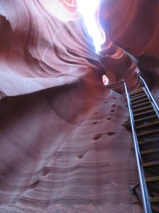
Antelope Canyon, with two slot canyons, upper and lower, sits within the LeChee Chapter of the Navajo Nation, just a few miles from Page, Arizona. A slot canyon is a long, narrow, deep water channel with sheer rock walls, in this case, eroded into sandstone. The Navajo names for Antelope Canyon are Tsé bighánílíní, (the water runs through it) for the upper canyon, and  Hazdistazí (spiral rock arches) for the lower canyon.

Although the Upper Antelope is more popular, we opted to tour Lower Antelope, which is narrower at the bottom and wider at the top than Upper is. It is also less accessible, as there are five ladders to climb through the tour. So far, the lower canyon is less crowded than the upper, but that is changing. We visited at a less crowded time, and were fortunate to be the only two people in our tour group. Our guide was able to take time to help us get some very good photos.

While waiting for the tour to begin, we were entertained by a Navajo Hoop Dancer.

When rain comes from the south, it floods the canyon, continuing the erosion that has created this underground treasure. It twists and turns through about 2,000 feet of length. Each turn brings a new opportunity to “ooh and ahh.”9E9643D1-A3C7-493A-9605-3BD498CA5151

Using a fairly steep ladder, we descended about 80 feet into the canyon. The maximum depth is about 120 feet. Before ladders were installed, hand and footholds were carved into the rock to allow access. In some places, you can still see these footholds next to the ladders.

Many of the formations have been given names, like The Chief, Fish, Rocky Mountain Sunrise, the Belly Button (where a large rock juts out of the side wall.)

This canyon cuts through layers of Navajo Sandstone, the largest layer of sandstone in the United States, covering parts of Arizona, Colorado, Nevada and Utah. It’s responsible for so many of the beautiful rock formations we see in those areas. Iron oxide creates the different colors, including black, brown, red, orange, pink, gold, and even white. We could see many of these colors in Antelope Canyon. Our visit was entirely too short.

Following our visit to Antelope Canyon, we drove to Marble Canyon, where we stopped by the Navajo Bridge to view the Colorado River flowing beneath us.

We drove alongside the Vermillion Cliffs, and came upon what appeared to be pueblo ruins on the side of the road. These “ruins” actually date back only about 100 years. Blanch and Bill Russell came to Arizona to treat Bill’s tuberculosis. While driving near Marble Canyon, their car broke down, so they camped among the rocks.  Upon waking up, they were so impressed with the beauty of the area that they purchased the land. They then constructed a stone house under a large boulder, using wood to frame doors and windows. The Russells built a trading post and restaurant nearby in the village of Cliff Dwellers, but left after about a decade.

This was a pretty clever way for the Russells to make the most use of their surroundings.

Posted in Arizona, USA Travel | Tagged , , , | Leave a comment

Horseshoe Bend, Page, AZ

December 9, 2019

The drive to Horseshoe Bend took us through Oak Creek Canyon this morning. As always, the 14 mile drive through the canyon is stunning, and today was no exception. It rained most of yesterday, so Oak Creek was flowing strong – we could hear it from several hundred feet above.

The first time we took this drive, about 7 years ago, we noticed what looked like a knot on the GPS. It was intimidating that first time, especially since it was close to sunset. After driving it a few times, though, we were handling it like the locals. The road has been freshly paved, so it’s a dream now.

It’s hard to take this drive without stopping a few times to enjoy the views. We also pull over to let followers pass so we can dawdle and gawk at will. Oak Creek Vista hosts a Native American vendor project, providing a welcome shopping opportunity.

As we drove north through the Colorado Plateau, east of the Grand Canyon, the shrubbery almost disappeared, replaced by colorful buttes and mesas, formed of Navajo Sandstone, the largest sandstone layer in the United States.

Horseshoe Bend is a 270° entrenched meander of the Colorado River as it flows through Glen Canyon and around a sandstone escarpment. Although this is off season, there were still quite a few people making the 1.5 mile round trip trek from the parking lot to the viewing area. We heard East Indian, Chinese, and Northern European languages, and even saw what appeared to be a Buddhist priest visiting the site.

We enjoyed the view from several hundred feet above (the canyon is about 1,000 feet deep). This was at mid-afternoon, it’s probably even more amazing when the sun is overhead.


Posted in Arizona, Red Rock, USA Travel | Tagged , , | Leave a comment

I Love a Parade!

December 7, 2019

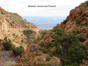
The city of Prescott, AZ holds an annual parade on the first Saturday of December, although we didn’t know that when we set out this morning. We drove from Sedona to Prescott via Cottonwood and Jerome so we could enjoy the scenery along the way. We reached an altitude of about 6,000 feet before descending again on the far side of Jerome.

E0B154D0-5C33-4E43-ADF9-C915022A190D

There’ve been several times in our travels when we’ve been surprised by parades. A St. Patrick’s Day parade in Biloxi, MS which provided us with several pounds of beads and goodies, including bananas; an Hispanic Day Parade in New York City where we enjoyed costumes an cultures of many Hispanic countries as well as an eyeful of a topless woman across the road; the Feast of Candelaria in Puno Peru, all of about three blocks long. It’s always a delightful surprise.

This year is the 37th year for the Prescott Annual Christmas Holiday Lights Parade. It  takes place in the early afternoon of the first Saturday in December. The Yavapai County Courthouse, which sits at the center of town, was lit up that night, but we didn’t stay long enough for that. The courthouse is over 100 years old and is on the National Register of Historic Places. Senator Barry Goldwater announced his candidacy for President from the courthouse steps in 1964. The building was closed today since it’s a Saturday, so we weren’t able to look inside.7C55E9AA-7F38-4922-96D0-5E54FE2D1638

We were early for the parade, so while waiting, we walked down Whiskey Row where we enjoyed some shopping and lunch. Lunch was at the historic Palace Bar. Opened in 1877, famous patrons include the Earp brothers and Doc Holliday. It’s been featured in a few movies such as “Billy Jack,” which I’ve seen, and “Junior Bonner,” which I haven’t. Bar personnel are dressed in period costume, causing me look for Marshall Dillon and Miss Kitty. The food was pretty darn good.

The parade was much like many small town parades, advertising local businesses, highlighting the firefighters, police departments, and other service organizations, plus several high school marching bands from around the area. We were even entertained by one band which performed in this year’s Macy’s Thanksgiving Day Parade – the Catalina Foothills High School Marching Band of Tucson, AZ.

I can’t forget the ubiquitous Shriners as well. All in all, it was a very pleasant afternoon.

This evening, we enjoyed an improv show by Zenprov Comedy at the Mary D. Fisher Theatre, home to the Sedona International Film Festival since 1995. Indie movies and other shows are shown here throughout the year.

Posted in Arizona, Prescott, Red Rock, Road Trip, USA Travel | Tagged , , | Leave a comment